We neighborhood kids used to call it the "Chalk Mine." To us, the abandoned quarry looked like something out of the Old West. We thought for sure it had been there since cowboy days; maybe even a hundred years! There were a bunch of other tall tales about the place, but it would be another half century before I finally uncovered its factual history. Much was surprising to me. For one thing, the rocks mined there weren't "chalk" at all...
"There was a large deposit of [diatomaceous] earth on Covina Hills Road that the Featherstone Company successfully mined and processed through the 1920s and early 1930s. The operation closed during the Depression. The property was part of the 2,100 acre Hill Ranch that Frank Marion Chapman and E. G. Shouse purchased from the Hollenbeck family of East Los Angeles." --Barbara Ann Hall, Ph.D.1
So, far from being there a hundred years, it turned out the quarry wasn't even as old as my parents. The diatomite itself, however, was actually formed about 7 million years ago, in the upper Miocene epoch.2
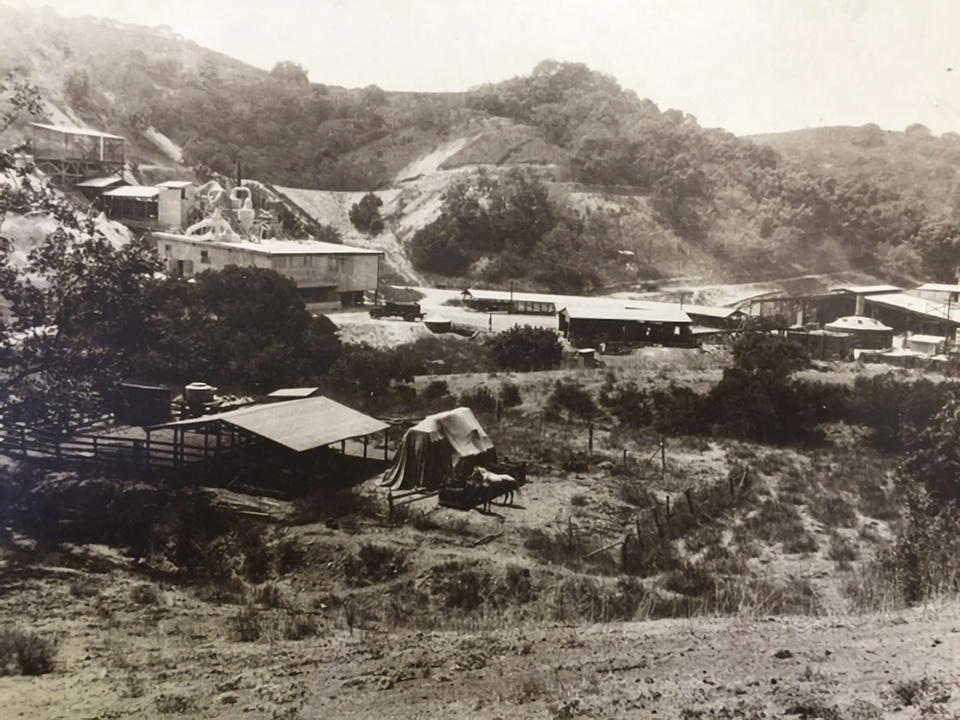
Featherstone Quarry, Covina Hills, 1929. The complex extended from today's Rancho La Floresta Drive at left to the main diatomite mine at right. I-10 now passes from left to right through the low white hill at center. 'Dick' Whittington Studio, photographer. Courtesy of The Huntington Library, San Marino, CA. Link to full-res image.
The processing plant over the hill on the Charter Oak side, mid-1920s. In this photo, we are standing on a spot a few yards down the hill from the end of today's Woodhurst Drive, facing southwest toward the intersection of Rancho Los Nogales Drive and Puente Street. Photo courtesy Covina Valley Historical Society.
The photos above are the only ones I know of that show the quarry when it was still in operation. The diatomaceous earth mined there was used primarily in the manufacturing of tile, pipes and conduits.2
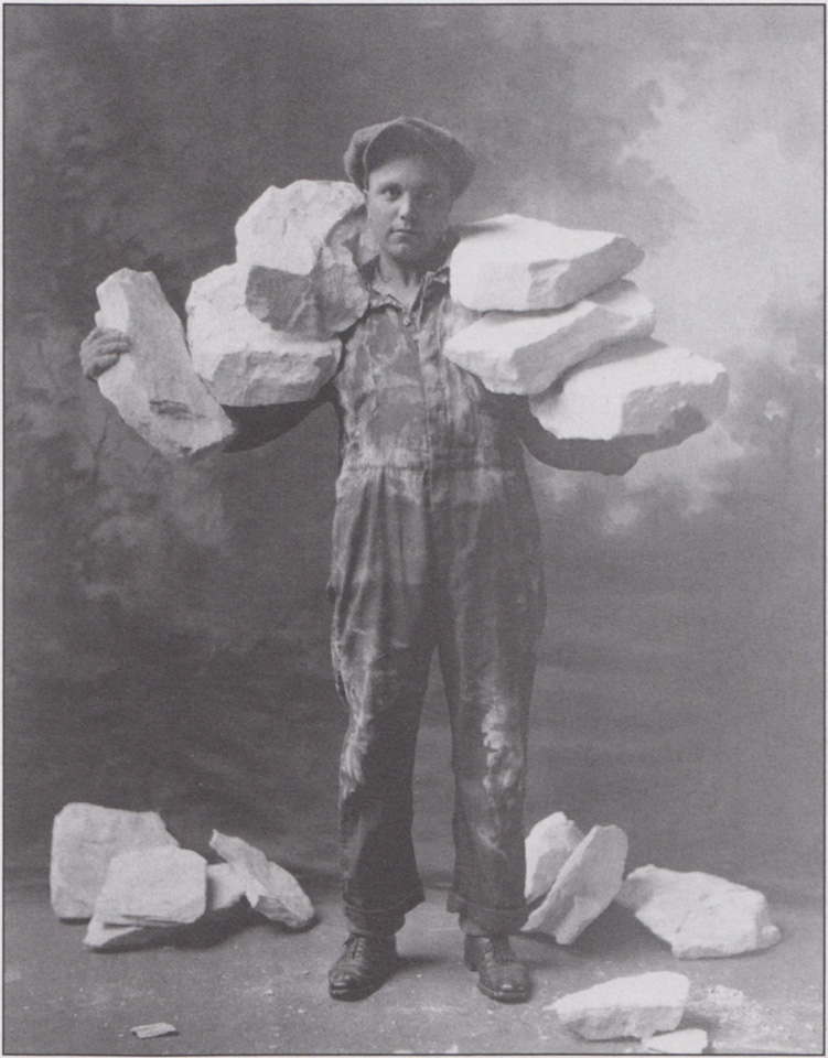
A worker showing why the mine was named Featherstone!1
Exactly when quarrying began at Featherstone is not known. Looking at old maps, it can be seen that roads associated with the mine were present in the 1910s, which would be earlier than other accounts. Exactly when quarrying stopped is also uncertain. A geology field report based upon data compiled in 1932 stated that operation of the mine "ceased several years ago,"2 so it may be that Featherstone Quarry did not survive into the 1930s, after all.
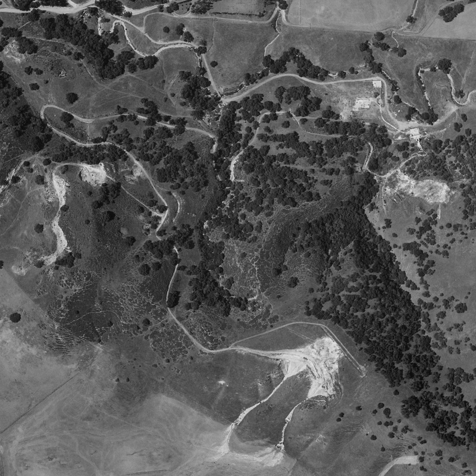
The main quarry (bottom) and its associated roads in 1934. The road at top approximately follows the alignment of today's Puente St.; the road over the hill from the quarry site, Jalapa Dr..
Fair use courtesy U.C. Santa Barbara Library, Special Research Collections.
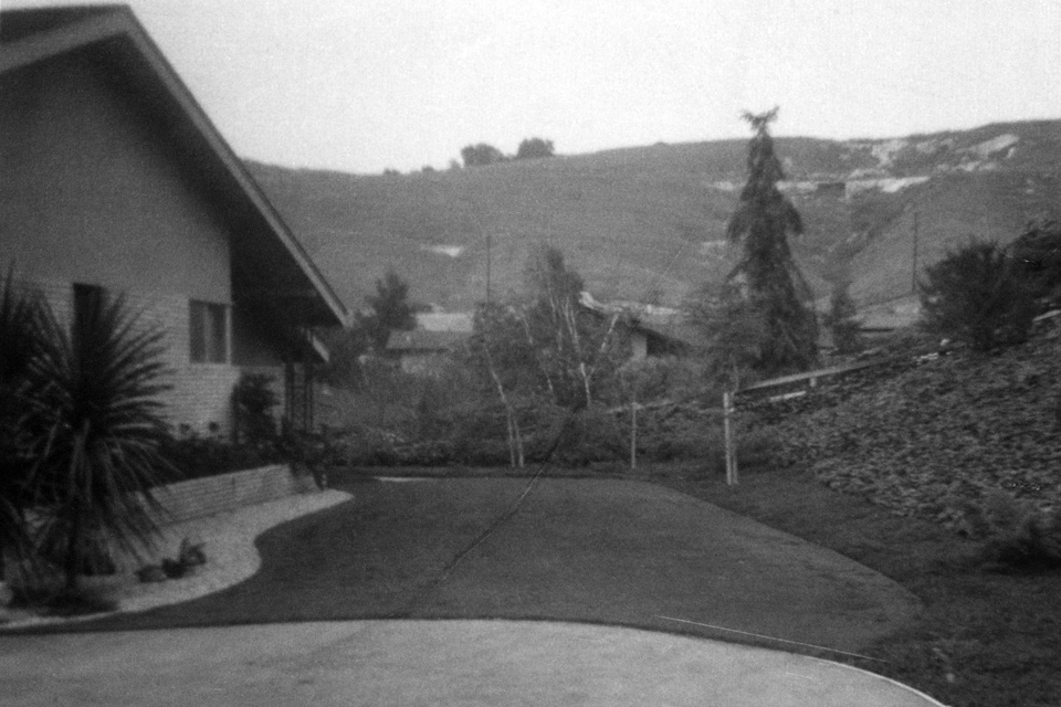
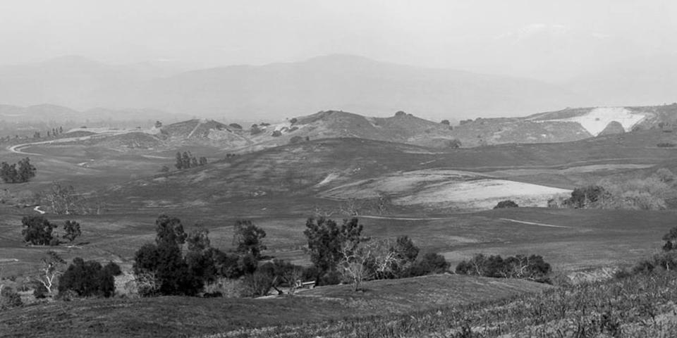
The "Chalk Mine" as seen from our house on Rancho El Encino, June, 1962.3
What we called the "Quartz Mine" can also be seen to the left of center. Inside that cleft was a thick outcropping of crystalline gypsum.
In 1965, all of the ancient hills north of our neighborhood were bulldozed to create the Covina Heights housing development.