Recently, I found this amazing panoramic photograph showing Covina and its environs in 1929.

'Dick' Whittington Studio, photographer. Courtesy of The Huntington Library, San Marino, CA. Link to full-res image.
I realize it doesn't look very amazing at this size, but below are some labeled enlargements which point out what is what in the photo.
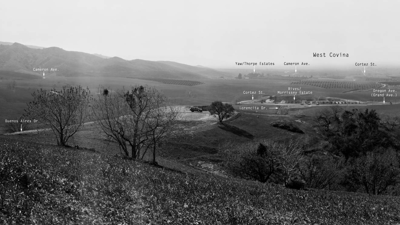
Looking west toward the San Jose Hills and West Covina. Today's Grand Avenue was originally called Oregon Avenue, and it ended at its intersection with Cameron Avenue on the south and on the north at Virginia Avenue. West Covina's section of Grand Avenue was not connected to Grand in Covina until 1964.

'Dick' Whittington Studio, photographer. Courtesy of The Huntington Library, San Marino, CA. Link to full-res image.
The "Yaw/Thorpe Estates" were the hilltop properties on Cameron Avenue east of Barranca Avenue that were purchased by popular concert singer ("Lark") Ellen Beach Yaw in 1914. The "Rives/Morrissey Estate" was a ranch compound built by Los Angeles businessman Judson Rives. In 1927, banker Thomas Morrissey bought the estate and the entire 421-acre Covina Highlands tract from Rives, intending to subdivide it into ranch-size lots for wealthy buyers. Had Morrissey's plans not been interrupted by a 10-year prison sentence for bank fraud, this area of West Covina might have ended up looking more like a rural version of Beverly Hills than the upper middle class suburb it eventually became.
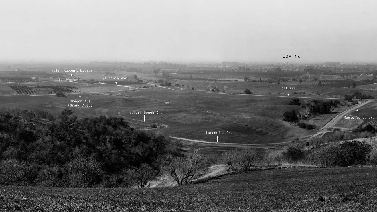
Looking northwest toward Covina. The property labeled "Nolan-Ruppert Estate" was originally owned by the aforementioned Thomas Morrissey, but the luxurious residence upon the knoll was sold before it was completed in 1928 to another Los Angeles banker, Edward J. Nolan. Nolan sold the house during the Great Depression, and around 1950, it was acquired by the Ruppert family for which the estate became best known.

'Dick' Whittington Studio, photographer. Courtesy of The Huntington Library, San Marino, CA. Link to full-res image.
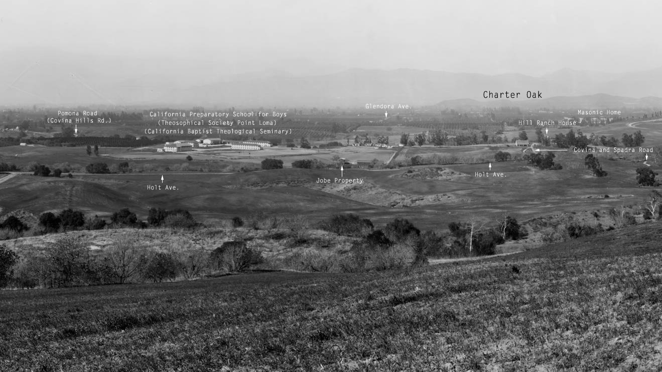
The California Preparatory School for Boys was built in 1925-26. In 1942, the Theosophical Society Point Loma acquired the property, and in 1951, the former prep school campus became the home of the California Baptist Theological Seminary. The moving story of the Jobe Property is the subject of my next blog post. The Covina and Spadra Road (right) was the original 1870s stagecoach route over the San Jose Hills to the Pomona Valley. Its northern terminus at this time was at the Hill Ranch house on the Pomona Road. Built in 1902, it is today the oldest extant structure in the Covina Hills.

'Dick' Whittington Studio, photographer. Courtesy of The Huntington Library, San Marino, CA. Link to full-res image.
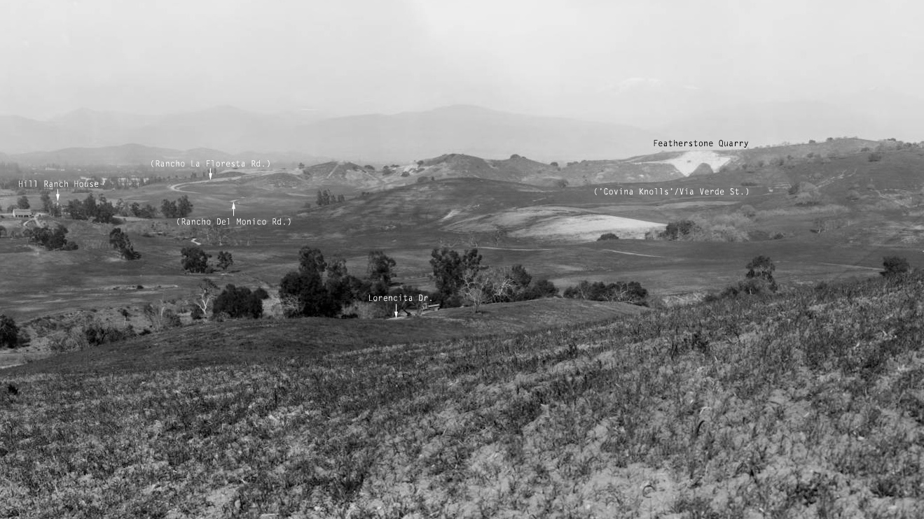
Today, Interstate 10 crosses directly across the middle of the following and previous photo.
I grew up in the little dale just below Featherstone Quarry. The kids in our neighborhood used to call it the "chalk mine," but it was actually a large natural deposit of diatomaceous earth. The quarry was still in operation at the time of this photo, but a worsening economy forced its closure only a few years later.

'Dick' Whittington Studio, photographer. Courtesy of The Huntington Library, San Marino, CA. Link to full-res image.
It's quite possible that there are people still alive today who remember when Covina looked like this! They'd be in their 90s now, but I would think there are still a few of them left. All that change in just one long human lifetime. Quite something to think about.
Grateful thanks to Randall Smith for his wonderfully-detailed information about the historical Yaw, Morrissey and Nolan properties, and for finally being able to pin down an exact date for the photographic subject of this post.
Footnote: If you have Google Earth installed on your computer, download this KMZ file, double-click on it, and it will take you to very near the spot where the photographer was standing back in 1929.
7 comments:
Wonderful photos. My folks bought a portion of the Jobe property this side of Holt where the Jobe Property label is in the photo and built a house where I grew up. Hiked to the Featherstone Mine many times!
Reed, is the Jobe property the same location as Jobe's Glen?
Yes. Jobe's Glen is part of Jobe's original property. He owned property on both sides of Holt Ave. He developed the glen on the north side in memory of his son. He referred to it as the Memorial Glen.
Reed, do you by any chance have any photos of Memorial Glen back when the Jobes lived there? I'm going to be writing a post about it for Memorial Day, and I'd really love to find some old pictures to go with it.
Glen Horner May 25, 2014
On the second panorama down, the one that shows Oregon Ave, Golden Bough and fronting along Lorencita with Holt in the background. That photo was taken very close to my folks place. This photo was taken before they built their house in 1932. The connecting road between Lorencita and Holt is Monta Verde Drive I believe. I was born in Covina in 1945 and went through High School there. My folks built their house on that hillside just above the little two track road taking off from Lorencita. In fact, my Dad had a greenhouse down by that two track road. These pictures are very interesting. Thanks.
J Scott, I believe I do have some photos but I'm not sure I can locate them in time for Memorial Day. I remember the glen very well and contacted the developer when the glen was undergoing a transition to offer some free consultation regarding restoration. I was not well received. I suppose they thought I would complicate the project. Which is probably true -- I'm not pleased with what was done to the glen. Another story. Will try to find photos, perhaps in time for next Memorial Day (?).
Fantastic photos. Thanks!
Post a Comment
To post a comment, you must login to this page with the Google Chrome web browser. That is the only way that works now.