Showing posts with label roads. Show all posts

Friday, August 14, 2026

The 39 Freeway

Among the material I collected at City Hall during my interview with Mayor Frank Haven in January, 1971, was a then-current Chamber of Commerce road map of Covina.1 Of particular interest to me was the vicinity map on the reverse which showed a proposed freeway passing through the city limits of both Covina and West Covina.


This map detail shows only one of several possible routings that were under consideration at the time.

Thursday, August 13, 2026

Covina Town Center, 1968-1972

Probably not many people now remember (or maybe never even knew) that in the late Sixties, the City of Covina proposed a major redevelopment project that would have essentially wiped out the old downtown as we know it.

It was called the Covina Town Center, and had it gone through as planned, almost everything lying in the area bounded by San Bernardino Road, Second, Fourth, and even areas south of Puente would have either been demolished and repurposed, or expanded in some way.

The Town Center plan also called for condemning whole neighborhoods of single-family homes to be replaced by high-density housing and offices, rerouting thru traffic away from Citrus Avenue over onto Second while turning the main street itself into a pedestrian-friendly shopping mall, and all of it crowned by a new administrative Civic Center complex with a concert hall-sized Civic Auditorium.1


Source: Covina Chamber of Commerce.1 Click on the image to view an enlargement.

Despite vocal opposition, the Town Center proposal actually passed a vote of the City Council and was set to break ground in February, 1971. The month previous to that, I wrote a 19-page report on the project for my high school civics class, the research for which included an in-person interview with Mayor Frank Haven (in office 1968-1972), who was basically the Town Center's principal proponent.2

I was away at college when the Town Center plan was finally scrapped, so I never heard why none of it ended up happening, but I'm sure glad now that it died on the vine. (If anyone can fill me in on the details of why the proposal ultimately failed, I would surely appreciate it.)

References:

1 "Covina's New Town Center," Covina Chamber of Commerce, 1970, 2pp.
2 "Should the City of Covina Have a New Civic Center?," A Civics Project by Scott Shannon & Terry Dunn, January 20, 1971, 19+2pp.


Friday, May 8, 2026

Compromise Line Road

I hope my dozen or so regular readers will pardon me if I write about someplace other than Covina just once. ;-)

Although I was born and raised in Covina, I lived my first five years on East Foothill Boulevard in Glendora, so consequently, the history of our neighbor to the north is a natural area of interest to me.

The subject is not far out of bounds geographically, either, as both Covina and Glendora share partial origins in a historical Mexican land grant called Rancho San José Adición (aka Rancho Addition to San Jose) which just happens to be the broader topic of this article. Most of Covina's Charter Oak neighborhood lies within Adición's borders, so I'm not really straying too far afield here.

Anyway, even as a child, I had a keen interest in roads and maps which really took off after I discovered my dad's Renie Atlas around age 12 (same time as my interest in Covina history, hmm!). Probably not long after that, the name of one street in particular from my Glendora years aroused my curiosity: "Compromise Line Road." Always wondered what that meant. Somewhere in my early readings of local history, I did learn that it involved a dispute over a northern boundary of Rancho Addition to San Jose, but I never could find out much more than that.


Compromise Line Road in Glendora. Source: Renie Atlas of Los Angeles City and County, 1965 edition.


Recently I was contacted by an old classmate who asked about Compromise Line, and desiring to know more than the basics I'd heard long ago, I decided to do a deep-dive into the subject. Obvious first stop reference-wise was Donald Pflueger's Glendora (1951), but unfortunately his mention of Compromise Line Road was so nonspecific as to be no help at all. Then I searched the newspaper archive, and that was a similar dead-end.

Friday, April 24, 2026

Covina in the Aughts

Citrus Avenue again, only this time about a half-century earlier. This photo was fairly easy to date, and very precisely, too.


Looking north on Citrus Avenue from Badillo Street, Covina, January, 1907. Clarence Tucker, photographer.
Click on the image to view an enlargement. Photo courtesy Covina Valley Historical Society and Powell Camera Shop (RIP).


Even before looking anything up, on the basis of a past search, I knew this picture had to be taken between 1903-1909 due to the presence of Franz Richter's bicycle repair shop in the far distance near Citrus's intersection with College. But, the obvious clincher was the banner hanging over the middle of the street. It reads:

Thursday, April 23, 2026

Citrus Avenue in the Fifties

Here we have two nice, detailed mid-century views of Covina's busy Citrus Avenue. The photos are undated, but examining certain clues, I think I can come up with some pretty good educated guesses as to when they were taken.

In this first one, the newest car I see is that 1952 Ford Convertible just left of center. That model was introduced in Fall, 1951. However, the photo has to have been taken later than September, 1952, because that's when Faye's Maternity Shop to the left of the Ford opened at 111 North Citrus,1 and that place does look essentially brand new here. So, 1952 seems like a safe bet for this view.


Looking north on Citrus Avenue from Badillo Street, Covina, 1952.
Click on the image to view an enlargement. Photo courtesy Covina Valley Historical Society and Powell Camera Shop (RIP).

(As an aside, I like how several kids evidently felt comfortable leaving their bikes parked on the street while they went to a show at the theater.)

Saturday, March 7, 2026

The Hollenbeck Palms

Recently, I added this very early C. W. Tucker photo postcard to my Covina ephemera collection.


Click on the image above to view a clean enlargement.

Although the view looks very different today, and the palms are way taller now, I doubt someone who grew up in Covina would have too much difficulty recognizing where this picture was taken.

But, just in case not, we are looking north on Hollenbeck Avenue from only a few feet north of its intersection with Badillo Street.

And the year? Well, let's play history detective and see what we can come up with!

Tuesday, January 13, 2026

Italia

You're about to make the acquaintance of a remarkable woman who, as you'll see, merits a far more prominent place in Covina history than the mere footnotes she's been relegated to in the past...

As has often been the case, my initial inspiration for an article was a postcard. This particular specimen first attracted my interest because of the handwritten inscription indicating the house owned by Mr. Clapp, the druggist, from whose store came this antique medicine bottle: the subject of one of my earliest posts here.


View looking southwest along the west side of the 200 block of North Second Street, Covina, c.1908. "Rose" mailed this hand-colored M. Rieder postcard from Lordsburg (La Verne) on January 2, 1908. Click image to view an enlargement.


The Clapps were an important family in early Covina, and I'll have more to say about them later, but the actual main character in my present story is Mrs. Clapp's mother—Mrs. Italia Cook—who lived in the big house at far right.

The published histories barely mention Italia, but she was easily the most propertied and most philanthropic woman in Covina at the turn of the last century, and now here, at long last, this pioneer-era force of nature is going to get the full recognition she's due.

Saturday, August 24, 2024

Citrus Avenue, 1938

Looking north on Citrus Avenue...

...from Workman Avenue:


...from Badillo Street:


...and from College Street:


The 200 block of North Citrus was the grocery and retail center of Covina in 1938, with Safeway, Alpha Beta and Cornet on the west side and J. J. Newberry adjoining Bank of America across the street.


But when?

Saturday, May 25, 2024

Second Street Park

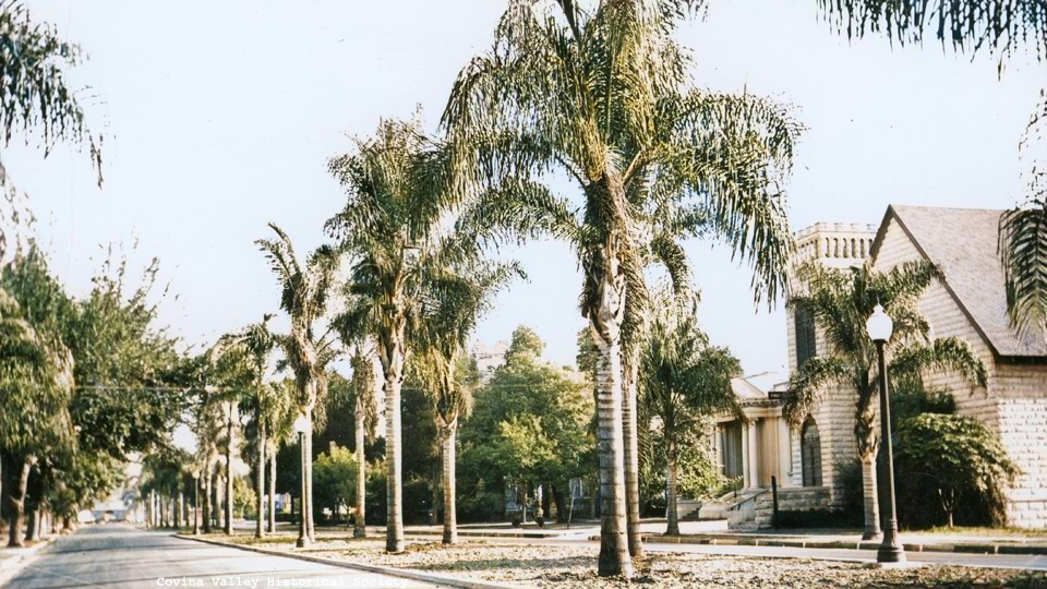
For the past eight decades, Covina's Second Street has been a rather bleak expanse of asphalt, but look how pretty it used to be! From 1923-1949, Second had a 16-foot-wide median strip1,2 running from San Bernardino Road south to Badillo that was graced by 48 Queen palms (Syagrus romanzoffiana). They called it "Second Street Park."3


Looking north on Second Street from College Street, c.1940. Photo courtesy Covina Valley Historical Society c/o Powell Camera Shop.

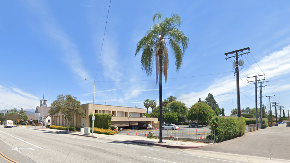
So why was this visually-appealing landscaping done away with? You guessed it: parking.2 Initially, the palms were replanted along the sidewalks and elsewhere,3 but eventually all but one of them were removed. This single, solitary palm at the northeast corner of the Badillo alley is now all that remains of old Second Street Park.


Source: Google Street View.

Kind of sad, isn't it? Wouldn't it be nice if Covina were to re-beautify Second in the 21st century? I can hardly think of another major street in town that is more in need of aesthetic improvement.

References:

1 Covina Argus, July 28, 1922, p.1.
2 Covina Argus-Citizen, April 4, 1947, p.8.
3 Covina Argus-Citizen, June 18, 1948, p.1.


Saturday, May 4, 2024

Covina's Old Neighbors

The localities described below would have been household names to Covinans during the the town's first half-century, but most are unfamiliar today.


USGS map from 1908 showing Covina and environs in the early 20th century. (Note the original alignments of roads in the area of present-day West Covina.)
Click on the image for an enlargement.

Wednesday, March 20, 2024

The Arrow Highway

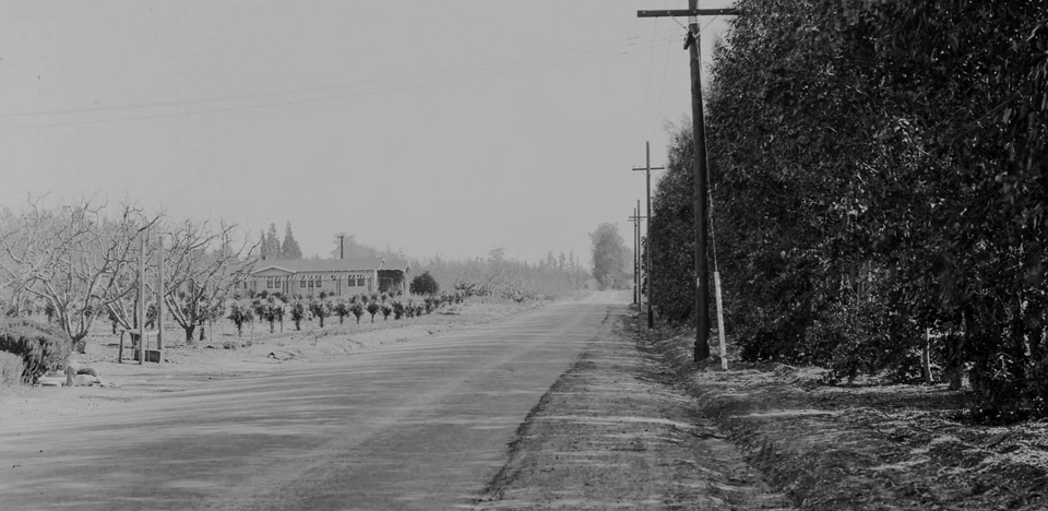
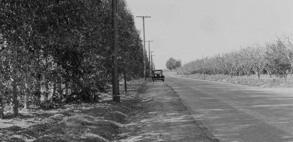
One-hundred years ago today–March 20, 1924–the "Arrow Route Association" was formed at the Sycamore Inn in Upland1,2 to promote the development of a modern 80-foot-wide2 interurban highway from San Bernardino to Los Angeles. It was proposed to relieve traffic on Foothill Boulevard while also linking the business districts of Rialto, Fontana, Cucamonga, Upland, Claremont, La Verne and San Dimas.1,2 The ambitious initial plans even called for the new thoroughfare to extend beyond Los Angeles to Santa Monica.3


A pleasant rural stretch of the early Arrow Route in Cucamonga, San Bernardino County, 1933. (The approximate location today.)
Photos courtesy Darin Kuna and Huntington Digital Library.


In Covina at that time, the existing main boulevards to Los Angeles–Foothill and Valley–were 3 and 7 miles away from town respectively; not exactly convenient. The Arrow Highway, however, was to pass only a mile north of Covina, so community leaders were very much for the idea right from the start. Accordingly, on November 6, 1924, Covina's own J. L. Matthews was appointed chairman of a committee to oversee Arrow's completion west from La Verne to El Monte, where it was to intersect Valley Boulevard.4

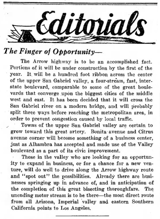
Matthews, significantly, was also the publisher of the city's most influential newspaper, which he used as a platform to actively booster the plan. In this editorial, it's clear he could hardly contain his enthusiasm.


Covina Argus, September 30, 1927.5

Ironically, it would be landowners in the Covina area who would erect most of the procedural roadblocks that impeded Arrow Highway's eventual completion.

Tuesday, November 2, 2021

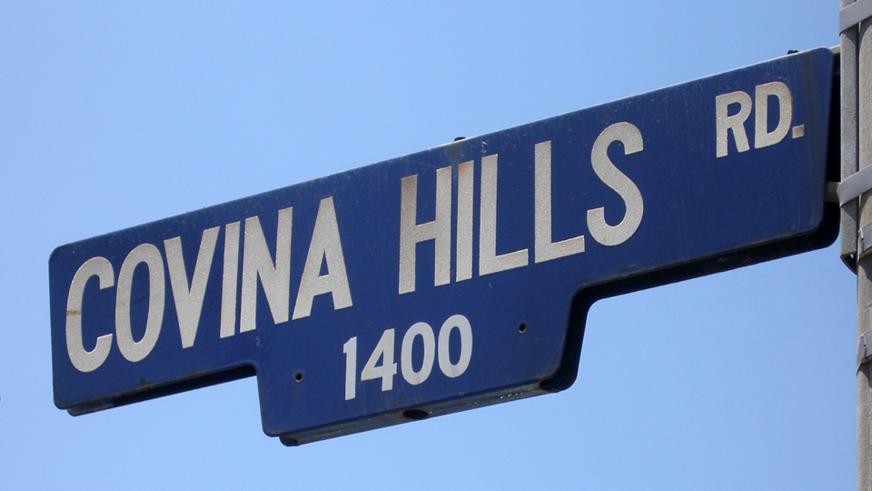
Covina Hills Road

Looking back, I realize that Covina Hills Road was the likely origin of my fascination with olden times. We moved to the Ranchos when I was 5, and even at that young age, I noticed that, taking Rowland towards home, the instant we passed Grand onto Covina Hills Road, the scene changed from modern suburbia to cowboy days. Along almost its whole length were sights to behold that looked frankly ancient to me. Maybe this had been a stagecoach road, or an old indian trail, but no matter who I asked or what library books I read, no one could ever tell me anything about Covina Hills Road that came even close to answering all the questions I had about it. A lifetime would pass before I was able to discover the road's forgotten story myself...


Corner of CHR and Via Verde, San Dimas, June 26, 2010. Photo © J Scott Shannon.

Known by a variety of names over the years, today's Covina Hills Road began its existence in early 1895 as a mile-long access road to the headquarter buildings of the McCarthy Company's Hollenbeck Ranch partition southeast of town.1


Survey map from August, 1895,1 showing the new Hollenbeck Ranch road (yellow) as an extension of Rowland Avenue in the Phillips Tract.
Courtesy Los Angeles Dept. of Public Works.


The year previous, however, a committee of the Pomona Board of Trade together with officials and supervisors of Los Angeles County had already recommended creation of a road extending all the way over the San Jose Hills to give Pomona a more direct route to the San Gabriel Valley and points west.2 At the time, travelers from Pomona wanting to go to Covina had to divert around the hills: either north via Lordsburg (La Verne) and San Dimas, or west via the Old Spanish Trail (today's Valley Blvd.) then north on Pass and Covina Road. If they could cross directly over the hills, though, it would take at least five miles off the trip,3 which in the days before automobiles could mean an hour of time saved.

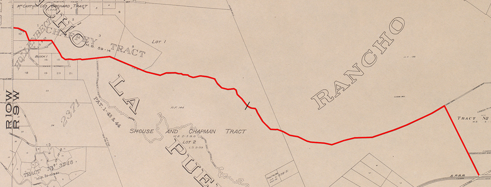
The route as surveyed in the summer of 1895 passed through the Phillips Ranch4 on the east over what we now call Kellogg Hill, then through Hollenbeck Ranch lands on the Covina side.3 After the rights-of-way were obtained and obstacles to construction overcome, work on the Pomona County Road was completed in four months in early 1896 for a total cost of $1,100.5


The original as-built alignment of the Pomona Road (red). Since 1933, the road has ended at the point indicated by the black slash.


Saturday, September 25, 2021

Covina 1907

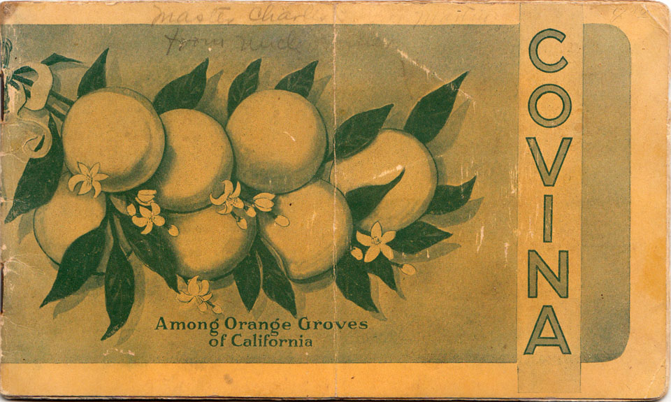
This promotional booklet was put out by the Covina Valley Farmers' Club in March, 1907.1 Some of these images (all by Tucker Studios) are quite rare; a few likely never published elsewhere before or since. Its 12 photos are presented here in the same order they appear in the booklet. (Click on any of the black-and-white pictures to view an enlargement.)


I believe the faded pencil inscription reads "Master Charles ... Martin / from Uncle Archie"


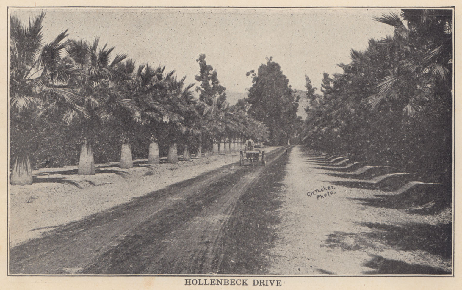
I've always liked this picture of Hollenbeck back when the palms were young. Donald Pflueger says this is Hamilton Temple driving his 1901 Oldsmobile;2 one of the first automobiles in Covina.


Saturday, August 14, 2021

Before Glendora Avenue

When I was a kid starting to get curious about local history, the story I heard about West Covina's Glendora Avenue was that it was called that because in olden days it went to Glendora. It did seem to point in that general direction, so I always assumed the tale was true.

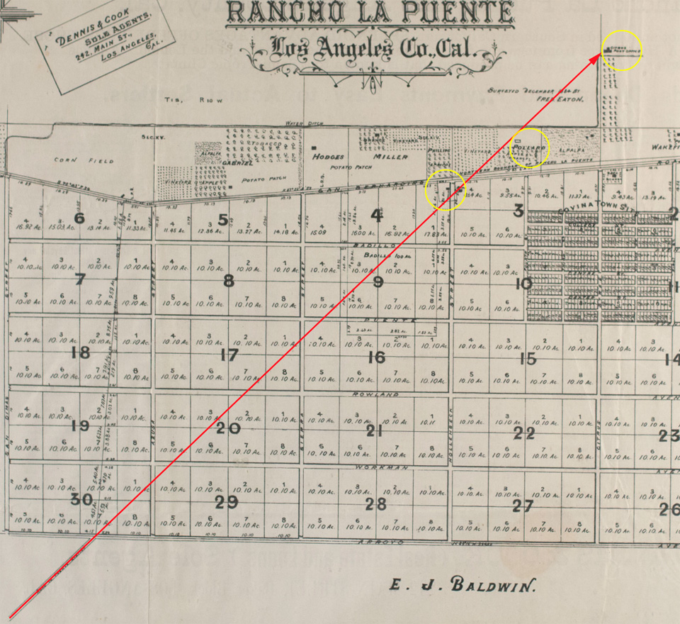
But where did Glendora Avenue actually go in historical times? I didn't think to figure that out until just the other day. Turns out if I take the original 1885 survey map of Covina and precisely extend the line of today's Glendora Avenue, it very conveniently connects three important historical sites: the Julian Badilla home (1876), Eugene Griswold's 1877 Citrus Post Office and general store, and the homestead of Robert J. Pollard, who I have recently come to believe may have been the Covina area's first settler of European descent.


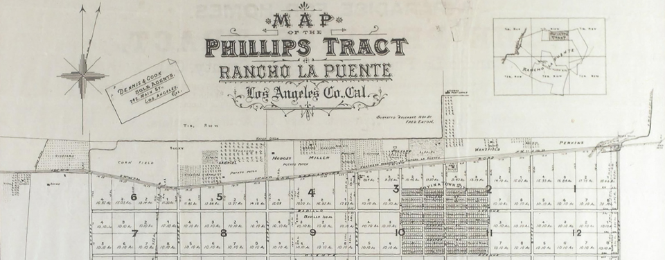
Detail of Phillips Tract map (1885) showing a proposed historical northward extension of Glendora Avenue/Puente Depot Road (red arrow).
Yellow circles indicate the Badilla, Pollard and Griswold properties respectively. Map courtesy Covina Valley Historical Society.


No maps from the 1870s show that such a road existed through the future Covina area, but it would make sense that one did, because if you were Mr. Pollard or Mr. Griswold or the Sres. Badilla, you would need a wagon road in that exact location and orientation to get you to Puente, which was not only the headquarters town of Rancho La Puente, it was also the location of the then-new Southern Pacific Railroad depot, which at the time would have been your main transportation link to the greater world beyond.

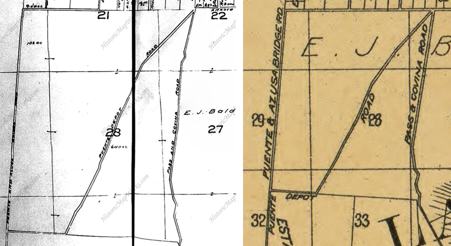
But there are maps from turn of the 20th century that do show a "Puente Depot Road" roughly tracing the path of today's Glendora Avenue. To realize my scenario, we need only imagine that the depot road went further north before the grid of streets for Covina was laid out in 1883-1884.


Maps from c.1900 showing "Puente Depot Road." Courtesy HistoricMapWorks.com and Library of Congress.


I don't think the diagonal Glendora Avenue we know today necessarily followed that same alignment all the way north, though. All it had to do was go as far as Citrus Avenue–a main thoroughfare named "Azusa Road #2" in the 1870s–and from there, you could have taken it up to Azusa or the foothills, where it ended at Fairmount Cemetery. In any case, Glendora wasn't founded until 1886, so the road we now call Glendora Avenue never went to such a place to begin with. The story behind the name turns out to be only the stuff of legend, after all.

One more thing: let's say the depot road did extend north to Citrus Avenue, that would finally answer a nagging question I've had for a long time, which was, why did the Badillas choose to build their HQ exactly where they did? That particular spot always seemed less than ideal to me. However, if we assume that in 1876, it was the intersection of the most crucial local roads at the time: San Bernardino Road (the most direct route to Los Angeles), the Puente Depot Road, and from there, the road north to Azusa, then the Badillas' chosen location makes perfect logistical sense.

This makes me think that the depot road existed before the Badillas arrived. So who first blazed the old wagon track to Puente? No way of knowing for certain at this point, but my guess would be R. J. Pollard, who may have been there before anybody else, but that I have yet to establish.

Much speculation here, I acknowledge, but a lot of history is informed speculation based on previously-known facts. And it's fun stuff to think about, anyway! I mean a historian's gotta have fun once in a while, right? Right!

Grateful thanks to Michael Schoenholtz and Randall Smith for research and discussion.


Tuesday, April 2, 2019

The San Bernardino Road

San Bernardino Road is one of Los Angeles County's oldest historical highways. An important transportation link in pioneer times, today's city of Covina would not have come into existence without it.

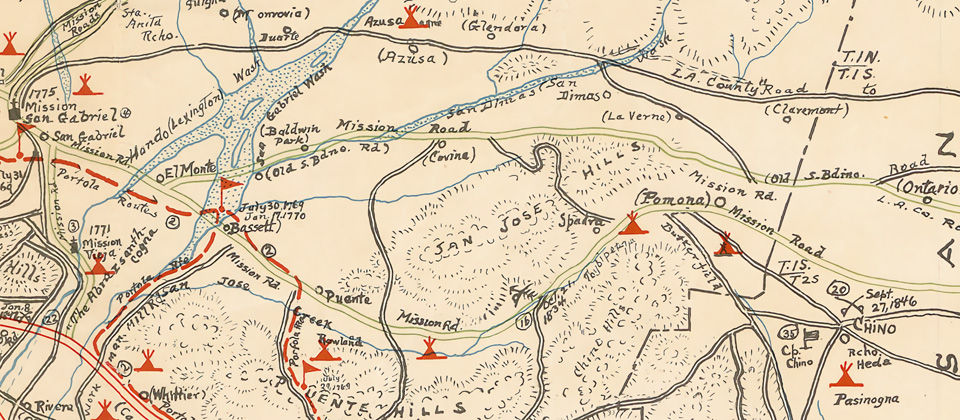
In 1810, when California was still part of the Spanish Empire, the friars of Mission San Gabriel built a chapel and supply station 45 miles to the east. The chapel was dedicated to San Bernardino de Siena, which, in the decades to come, would lend its name to a new city, and to the mission trail that originally connected the inland estancia to the mother church and to Los Angeles beyond.


Detail from the Kirkman Map (1937) of historical sites in Los Angeles County, showing the future location of Covina (center) on the "Old S.Bdino. Rd."


It seems likely, however, that the trace which became known as the San Bernardino Road existed even before Mission San Gabriel was founded. The Gabrielinos which populated the valley prior to European settlement were said to have used it to transport logs from the San Bernardino Mountains to build the mission. The Anza expedition is known to have traversed the trail in 1774, as did Jedediah Smith and his party in 1826 and 1827.1

By 1842, when the San Bernardino Road was established as the northern boundary of Rancho La Puente,2 it was already the main east-west travel and freighting route between Los Angeles and what was then called the Azusa Valley.1 The old thoroughfare was upgraded to a county road in 1879,3 when it was widened and straightened to its current alignment.

In 1882, recognizing it as an ideal location for a townsite, Joseph S. Phillips bought 2,000 acres of land on the south side of the stage road and founded Covina there three years later.2,4

Many early "firsts" in the Covina area took place along the much-traveled track.2

  • The first general store: Goldsmith's "Four Corners" mercantile, just west of today's Orange Avenue, 1865.
  • The first community center and church: Grange Hall, on the south side, 500 feet west of today's Vincent Avenue, 1870s.
  • Covina's first schoolhouse, corner of Citrus Avenue, 1883.
  • First irrigation reservoir–foundational to Covina's citrus industry–west of Grand Avenue, 1886.
  • The city's first high school (pictured below): on San Bernardino Road behind the grammar school, 1903.


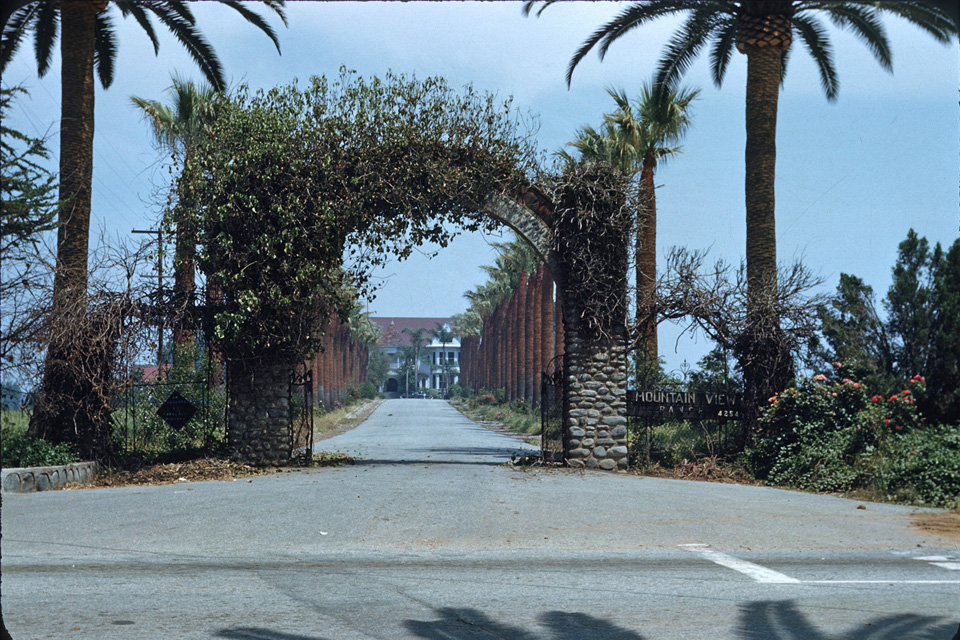
Some of the earliest houses in the lower Azusa Valley were built along San Bernardino Road. The most historically notable were the two homes built by the Badilla brothers in 1876,5 just west of today's Hollenbeck Avenue, and Thomas S. Ruddock's Mountain View (1891) at San Bernardino Road's intersection with Grand Avenue.4


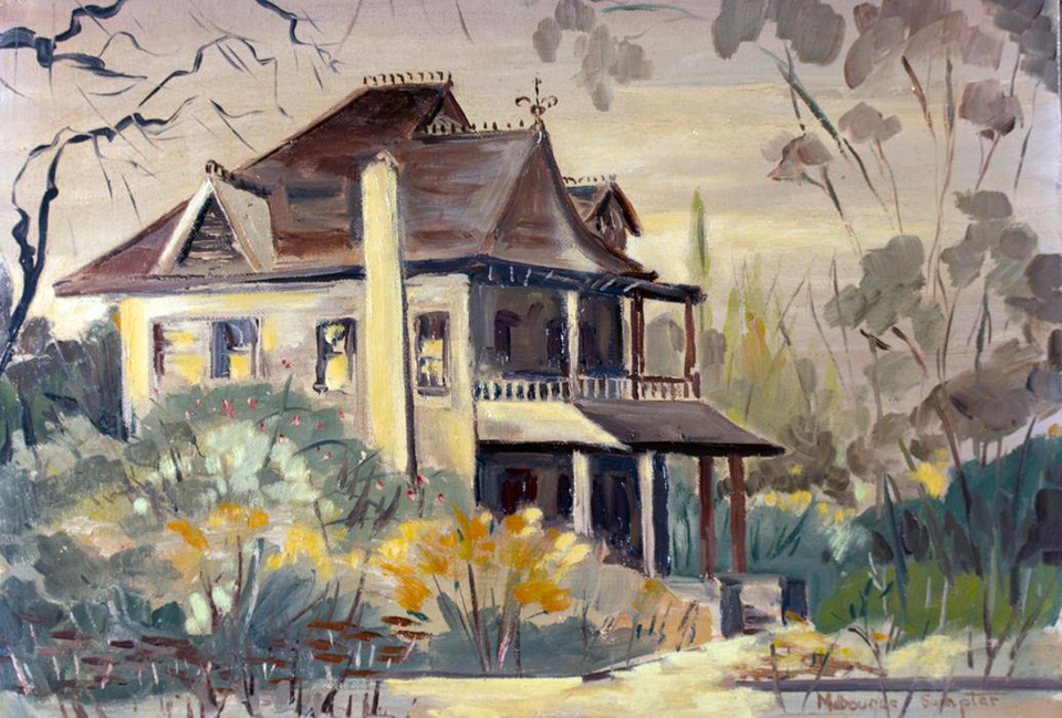
Covina's founder–J. S. Phillips–lived in this Queen Anne manse on the southwest corner of San Bernadino Road and Hollenbeck.
Painting by Melbourne Sumpter, image courtesy Glenn Reed/Covina Valley Historical Society.


The entrance to Mountain View at the eastern end of San Bernardino Road, 1952. This driveway is now the palm-lined stretch of Wingate Street in Charter Oak.
Photo by Bruce Ward Macy, courtesy Marilee Johnson.


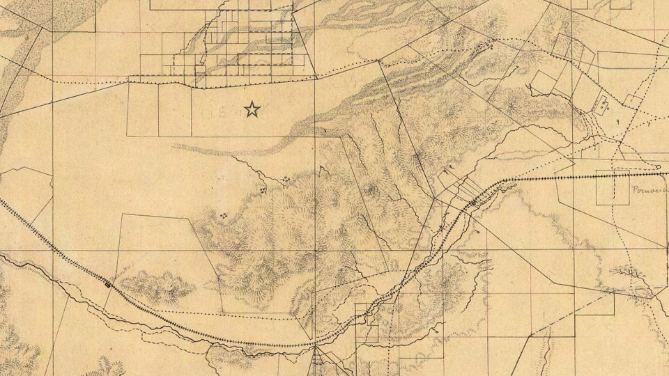
Before the establishment of Mountain View, the San Bernardino Road continued east in a meandering diagonal line up to Mud Springs south of San Dimas, then down past the Casa Primera de Rancho San José in Pomona on its way to its namesake destination.


This topographical map from 1880 shows the original track of old San Bernardino Road (upper dotted line). The star shows the future location of Covina.
The dotted line to the south is another mission road, later to become Valley Blvd. Source: David Rumsey Map Collection.


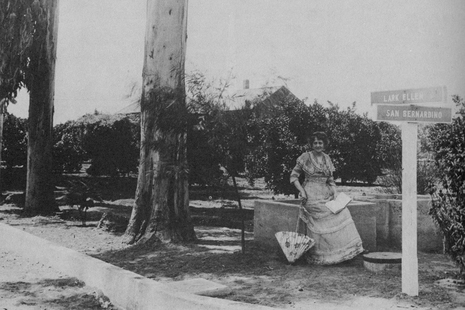
Opera singer "Lark Ellen" Beach Yaw also lived on San Bernardino Road, at the intersection of the street that still bears her name.
Image source: Covina, by Donald Pflueger, 1964.


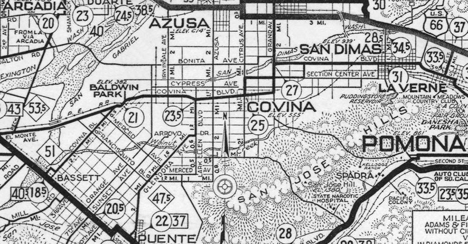
From 1911-1933, San Bernardino Road was part of a 14-mile-long thoroughfare called Covina Boulevard which ran from Bassett to San Dimas,
as shown on this AAA strip map from 1931. (Today's Covina Blvd. was called Section Center Ave. during this period.)


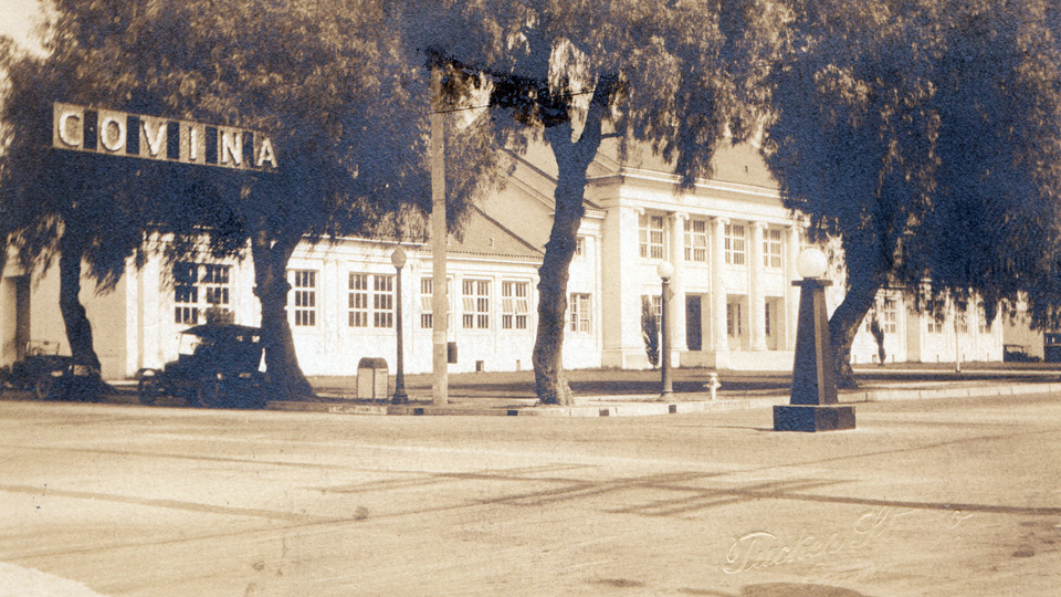
The Covina Grammar School at the southeast corner of San Bernardino Road (then named Covina Boulevard) and Citrus Avenue, mid-1920s. Tucker Studio photo.


Now well over 200 years old, almost all traces of the original San Bernardino Road have been erased, however the portion of it that passes through Covina today is one of the few remaining stretches that preserves the 1879 alignment of the historic Spanish mission trail.


The familiar odd angles of old San Bernardino Road are easily recognized in this detail of the first map of Covina, 1885.
Courtesy Glenn Reed/Covina Valley Historical Society.

References:

1 Head, Harriett R., San Bernardino Road Linked with Southern California History. Covina Argus, January 31, 1930, p.2.
2 Pflueger, D. H. 1964. Covina: Sunflowers, Citrus, Subdivisions. Castle Press, Pasadena, California, 372pp.
3 Los Angeles Herald, June 4, 1879.
4 Hall, B. A. 2007. Images of America – Covina. Arcadia Publishing, San Francisco, California, 127pp.
5 _______. 2012. Covina History Changes. The Citrus Peal, Covina Valley Historical Society, p.9.


Tuesday, November 20, 2018

Badillo – Badilla – or Eaton

...by guest author Glenn Reed
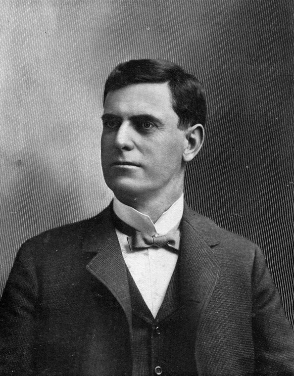

Frederick Eaton (1856-1934), surveyor of the Phillips Tract and the townsite of Covina.
Source: Wikimedia Commons.

A couple of years ago we, of the Historical Society, were surprised and honored by a visit from some of the descendants of the Badilla brothers. As most of you know the Badilla brothers were Costa Rican coffee growers who came to California about 1875 and, with the intention of raising coffee, bought the land where Covina is now not knowing that this area was far too arid for the cultivation of that crop. In 1882, Joseph Swift Phillips purchased most of that land, decided to subdivide it, and established the town of Covina near its center. He hired Fred Eaton to survey the land and lay out the town site. This was completed, the site map was filed, and maps published in 1885. The map had street names written on it, including "Dexter," the name of Phillips's newborn son, and to honor the previous owners, "Badillo" street. But on the map the Costa Ricans' name was spelled Badillo, with a terminal "o" rather than "Badilla" the the last letter "a" as the brothers' name was spelled.
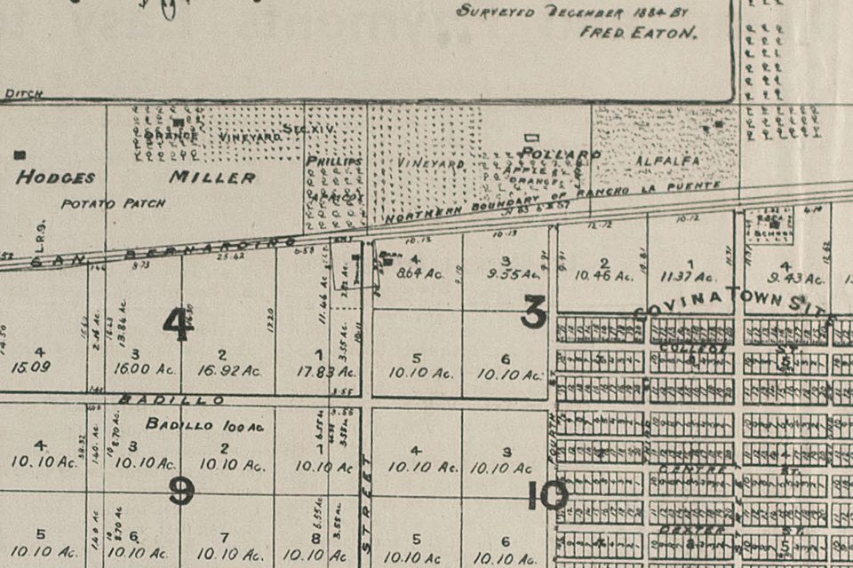

Detail of Eaton's map of the Phillips Tract, showing his spelling of "Badillo" Street alongside a label marking Antonio Badilla's 100-acre plot.
Courtesy Glenn Reed and the Covina Valley Historical Society.

The Badilla descendants pointed the error out, much to our chagrin. Some time later, I noticed an item on Facebook where one of the Badilla descendants suggested that the error was caused by the historical society. This was impossible, of course, as the error occurred in 1885 and the Society was not founded until 1969. But who was responsible for the misspelling? Mr. Phillips? Looking at his cash ledger from 1885-1886, I found more than twenty places where he entered the name Raphael or Vincent Badilla for work they performed on the water ditch from the San Gabriel River. Raphael and Vincent were two of the thirteen children of Antonio Badilla, one of the Costa Rican brothers. There entries were in Joseph Phillips's own hand and the name "Badilla" was written clearly with the "a" as the last letter. So apparently it was not Mr. Phillips as he used the proper spelling. It must have been Fred Eaton or someone in his office. In any event Fred Eaton must bear the responsibility.

Incidentally, Mr. Phillips's Cash Ledger for 1885-1886 is one of the prize treasures of our historical society's collection.

Mr. Fred Eaton made a couple of other mistakes in his lifetime and is remembered more for those than for his many accomplishments. He was born in 1855 in Los Angeles. He became superintendent of the Los Angeles Water Company when he was only 19 years old. Of course his uncle owned the company. Eaton hired William Mulholland as a zanjero and quickly moved him up in the company. Eaton opened his own engineering office in 1881 and did the survey of Covina in 1884-1885. He was appointed city surveyor and then elected city engineer of Los Angeles in 1887 (he was the only candidate).

Eaton designed 6th Street Park (now knwon as Pershing Square), Elysian Park, Westlake Park (now named MacArthur Park), Eastlake Park (now known as Lincoln Park), and the Plaza. His major achievement was the design of a new sewer system for the city of Los Angeles with an outfall to the ocean.

In 1898, he was elected mayor of Los Angeles for a two year term. While mayor he ensured strict enforcement of civil service laws in the city, desegregated the fire department (it was segregated again under the next mayor), created the Los Angeles Water Department, and announced his plan to appoint William Mulholland as superintendent. It was he who convinced William Mulholland that the need for water in Los Angeles could best be satisfied by an aqueduct from the Owens Valley to Los Angeles. For these accomplishments, and many more, he deserves much credit.

But later, acting on behalf of the City of Los Angeles, Eaton bought water rights from Owens Valley land owners while letting them believe that he was an agent for the federal government's reclamation program that was for the farmers' benefit. When it was discovered that he was acting for Los Angeles he was considered a villain and is still remembered for the deception.

Fred Eaton also bought, for his own account, an area called Round Valley near the Owens River. Some years later, after the aqueduct from Owens Valley to Los Angeles had been completed, William Mulholland felt it would be necessary to build a storage reservoir in Round Valley and asked Eaton to sell it to the city. Eaton asked for an amount that Mulholland felt was exorbitant. Their disagreement destroyed a close friendship of 35 years. Mulholland chose instead to build a reservoir on the Santa Clara River behind a new dam – the Saint Francis Dam.

References:
1885 Covina Townsite map
Joseph Swift Phillips's 1885-1886 Cash Ledger
"Fred Eaton, a Second Look," by Anna Sklar
"In Memoriam; Fredrick Eaton," Ramona Parlor
Fred Eaton, Wikipedia
Conversation with Barbara Ann Hall, Ph.D.

This article was originally published in the October, 2016 issue of "The Covina Citrus Peal," the official newsletter of the Covina Valley Historical Society, and is reproduced here with the permission of the author, Covina historian Glenn Reed.

Tuesday, October 23, 2018

Covina On the Rails

Long before Metrolink, rail transportation played a vital role in Covina's history. In 1876, the Southern Pacific Railroad became the first to connect Los Angeles to a transcontinental rail system, but the line passed through Spadra and Puente to the south. The Atchison, Topeka & Santa Fe Railway arrived in L.A. in 1887, but it, too, bypassed Covina: this time to the north, via Alosta, Glendora and Azusa. It wasn't until September, 1895, that the Southern Pacific opened a spur through Covina (today's Metrolink San Bernardino Line), offering service to Los Angeles and points beyond.

The S.P.'s primary purpose was transporting freight, however, so consequently, people who wished to travel by rail had very limited choices in terms of departure and arrival times. Conveniently-scheduled passenger service wouldn't be available to Covinans for another dozen years, when Henry Huntington's Pacific Electric Railway Company came to town.

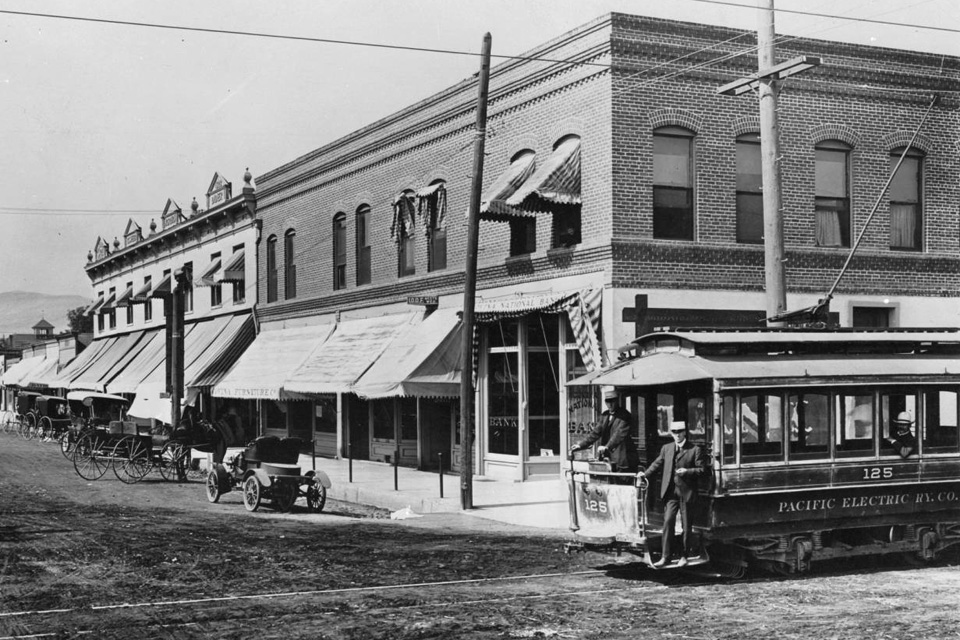
The first spike was driven for the P.E. tracks on Badillo Street on November 5, 1903, but the little trolley shown below only ran between Hollenbeck and Barranca Streets. The Covina segment was opened to the rest of the Pacific Electric system on June 5, 1907.


Intersection of Citrus and Badillo, circa 1905. Courtesy USC Digital Library.

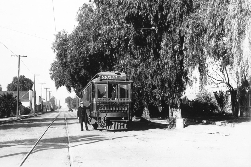
An early interurban Pacific Electric train bound for Covina (below), circa 1910. The original round-trip fare to Los Angeles was 90¢. (Sounds like a bargain, but that's about $25 in today's money.) Ticket in hand, then, a one-way trip to the big city took just under an hour.


Courtesy USC Digital Library.

Pacific Electric's Covina station, circa 1937. It was located on the north side of East Badillo Street a short distance east of Second Avenue. It was Covina's commuter connection to the P.E. network from 1915 until 1945 when the line was rerouted to the Southern Pacific tracks north of downtown. All passenger rail service to Covina was discontinued in 1947.


Courtesy Los Angeles Public Library.

Saturday, September 29, 2018

Covina, 1895

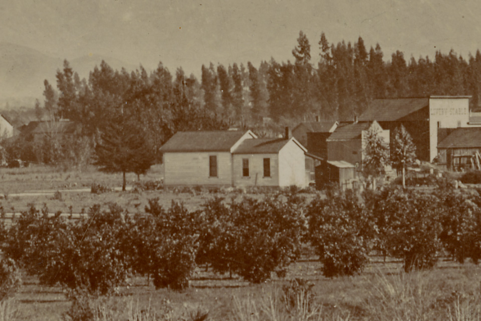
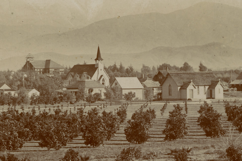
This is the oldest-known photograph of Covina. It was taken in winter, 1894, when the town was only 9 years old. The vantage point is the roof of the home of Mr. Lambert L. Ratekin at 237 South Fourth Avenue. The view is to the northeast, showing Fourth Avenue and the alley between Center and Dexter Streets in the foreground, and in the middle distance, Badillo Street passes from left to right just past the young orange groves.


Courtesy California State Library. Click on image for enlargement.

The photo is also noteworthy for depicting the very first house ever built in Covina.


The Samuel Allison residence (1885), at 160 West Badillo Street.

The image can be dated precisely because the school that we know was built in 1894 (at left, below) can be seen here currently under construction.


Historically-important buildings from l. to r.: the Covina Public School (1894), the Methodist Church (1888) on College Street, and the Episcopal Church (1893) at Badillo and Third.

What the school looked like upon completion:

Monday, September 24, 2018

Earliest Views of Citrus Avenue

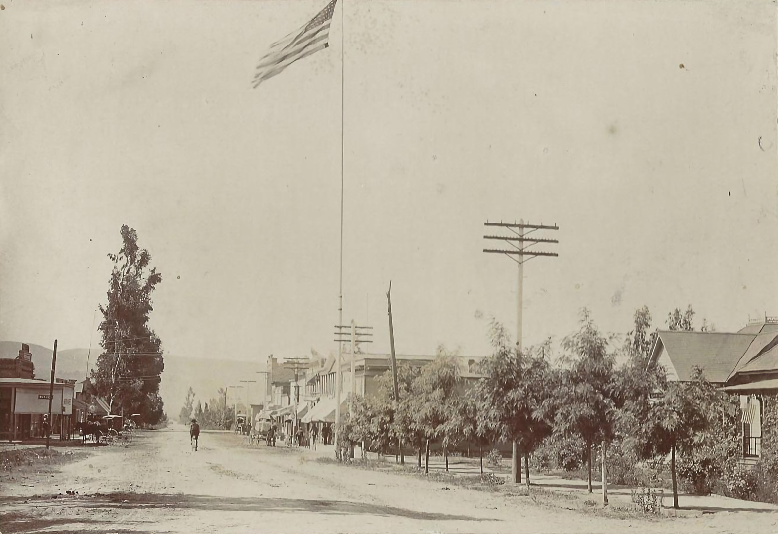
Some time ago, Covina historian Glenn Reed sent me this old photograph of Citrus Avenue, looking south from a vantage point near Italia Street.


Photo courtesy Glenn Reed. Click image for enlargement.
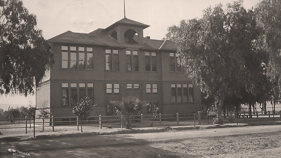
Although the photo bears no date, it can be said with certainty that it was taken in 1898. It can't be any later, because the First National Bank of Covina was built on the northwest corner of Citrus and College (where the flag pole stands) in 1899, but it can't be earlier because I can just barely see the T. E. Finch Block a few doors down, and that was erected in 1898.

Then, only a few days ago, reader Brian Solar sent me this illustrated newspaper article from 1897 that features an even earlier view of Citrus Avenue. Although a simple drawing in its details, I have confidence in its historical accuracy. Look at the eucalyptus tree at right. It's a close mirror image of the same tree in the 1898 photo above.


From the article "Azusa, Covina, Glendora" in the the Sunday, December 5, 1897 edition of the Los Angeles Herald. Source: Newspapers.com, courtesy Brian Solar. Click image for enlargement.
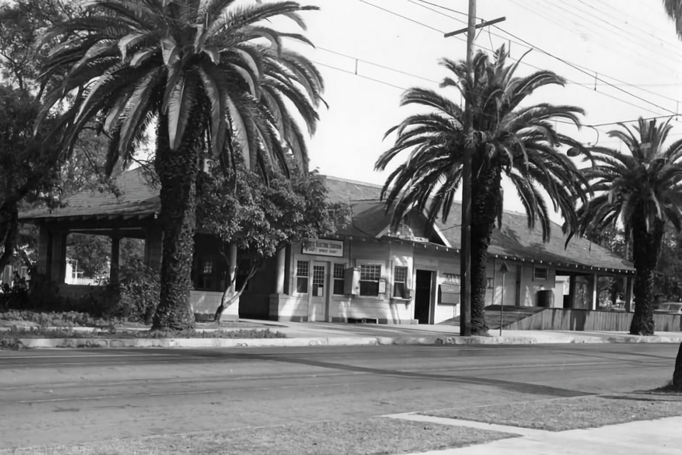
Interesting to note that the flag pole is not depicted in the 1897 illustration, so that must have gone up the following year, too. At left is the then-brand-new Chapman-Workmen Building (1897), still standing today at the northwest corner of Citrus and Badillo. Across the street, however, the lot appears vacant. The Reed Block (and what later generations would know as the Covina Theater) would be built on that site in 1900.


The complete newspaper page:

Monday, May 1, 2017

The Adams Ranch

...by guest author Glenn Reed

James H. Adams was the owner of a ranch in Covina that he named El Dorado. Most of it was located between San Bernardino Road to the north, Badillo Street to the south, Fourth Street on the east, and Hollenbeck on the west. The land had been planted to oranges in 1886 by the previous owner Joseph S. Phillips. Mr. Phillips had previously raised raisin grapes but felt that grapes did not bring a large enough profit. The grove was protected on the east and north by a tall hedge of eucalyptus and cypress trees, outside of which were planted alternately pepper trees and palms. The ranch is described in the 1896 and 1898 holiday supplements of the Covina Argus newspaper which is clearly intended as a promotional pamphlet for the town and its real estate. The editor, Louie Matthews, suggests that the locals send copies to their friends and relatives in the east to encourage them to move to California. It is interesting that while the supplement describes the beauty and elegance of many of the Covina ranch homes, such as Antone Kerckhoff's "Francisquita" and C.H. Ruddock's "Mountain View," when it describes the Adams ranch it says, "All the buildings on this property are neat and modern structures, conspicuous among them being the barn and coach-house, which...is one of the handsomest and best-appointed structures of its kind in the county of Los Angeles." High praise for a barn. The outstanding feature of the Adams barn is a cupola on posts above the center of the roof that resembles one of the domes of Saint Basil's Cathedral in Moscow. The barn also had windows, a rarity in barns. The Covina Argus describes the ranch as "One of the finest ranches of this justly-celebrated citrus-fruit-growing locality, both for beauty of situation, fertility of soil and high state of cultivation in which it is maintained, and the number of ornamental trees surrounding it, is the forty-five-acre ranch of Mr. J.H. Adams."


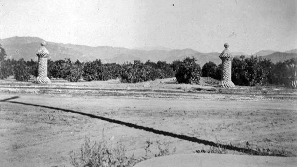
Two of the Adams stone pillars on Badillo Street in the 19-aughts. The east curb of Fifth Street can be seen in the foreground.
Photo courtesy Covina Public Library.

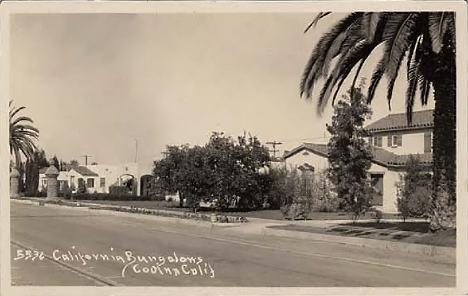
Today, perhaps the only remaining physical feature of the Adams Ranch is the pair of stone pillars on the east side of Hollenbeck about 125 feet south of San Bernardino Road. These were built at the entrance to the ranch house and barn by Jack Nelson, the caretaker. Originally there were at least eight other identical pillars on the perimeter of the ranch. There were single pillars at the diagonally opposite corners, one at Hollenbeck and Badillo and one at San Bernardino and Fourth Street. There was a pair on the north side of Badillo about 60 feet apart in front of the former Pitzer residence. There were two pair on the east side of Fourth Street, one pair flanking Orange Street, and the other pair on each side of Cottage Street. They were about 45 feet apart. The single pillar at San Bernardino and Fourth was also on the east side of Fourth. Apparently Mr. Adams felt that the land comprising Fourth Street belonged to him. Even with that land, his pillars enclosed slightly less than 40 acres. The Argus said that this ranch included 40 acres of oranges planted in 1886 and five acres of lemons. That five acres was most likely south of Badillo.


Postcard from the 1930s showing the same two Adams stone pillars on Badillo Street (far left). Several of these houses still stand today.

In 1921, the easterly ten acres of the ranch was sold to the City of Covina for $2,000 an acre, and became the City Park. At that time the Covina Union High School had a single classroom building located on the west side of South Citrus Avenue between Dexter and Puente and felt the need for more room. The trustees were ready to buy the remaining 30 acres of the Adams Ranch between Badillo and San Bernardino at the same price but found that the seller wanted $2,500 per acre for the remainder. The school district appointed a committee to study the matter and they decided instead of buying the land, to build an additional building on the existing campus next to Puente Avenue. It was called the Science Building.

The westerly 30 acres was sold to be subdivided in 1924. I am pleased that my parents Tom and Edith Reed were among the early purchasers of a lot in the subdivision in 1924. They chose a lot just east of the location of the old Adams barn. I still live there. Mr. Raymond Finch bought the lot next door that must have been at least partially under the barn.

Two lots of the Adams Park subdivision were not purchased for residential purposes but instead were developed as a miniature golf course. These were the two lots on San Bernardino Road next to Valencia Street directly across the street from the city park. Unfortunately the Great Depression occurred and made such entertainment as miniature golf unprofitable. The golf course was abandoned and became overgrown with shrubs, trees, and weeds. That made it an almost perfect playground for all the kids in the area. It was a wonderful place to play "Hide and Seek" or "Indians."

As El Dorado, the Adams Ranch was as the Argus stated, "a model place, one which is the pride of its owner and the neighborhood, and the admiration of visitors." Now the City Park and Adams Park are the pride of their owners and of the neighborhood.

Sources:
     Covina Argus Holiday Supplements 1896 and 1898
     Covina Argus February 1921
     "Covina" by Pflueger
     "Images of America–Covina" by Barbara Ann Hall Ph.D.
     1932 Spence Air Photo
     Conversations with my father, Thomas B. Reed
     Conversation with Jack Milliken
     Conversation with my nephew, Dr. Thomas Armbruster
     Powell Camera and Marty Getz

This article was originally published in the April, 2017 issue of "The Covina Citrus Peal," the official newsletter of the Covina Valley Historical Society, and is reproduced here with the permission of the author, Covina historian Glenn Reed.