Showing posts with label covina hills. Show all posts

Saturday, May 4, 2024

Covina's Old Neighbors

The localities described below would have been household names to Covinans during the the town's first half-century, but most are unfamiliar today.


USGS map from 1908 showing Covina and environs in the early 20th century. (Note the original alignments of roads in the area of present-day West Covina.)
Click on the image for an enlargement.

Tuesday, November 2, 2021

Covina Hills Road

Looking back, I realize that Covina Hills Road was the likely origin of my fascination with olden times. We moved to the Ranchos when I was 5, and even at that young age, I noticed that, taking Rowland towards home, the instant we passed Grand onto Covina Hills Road, the scene changed from modern suburbia to cowboy days. Along almost its whole length were sights to behold that looked frankly ancient to me. Maybe this had been a stagecoach road, or an old indian trail, but no matter who I asked or what library books I read, no one could ever tell me anything about Covina Hills Road that came even close to answering all the questions I had about it. A lifetime would pass before I was able to discover the road's forgotten story myself...


Corner of CHR and Via Verde, San Dimas, June 26, 2010. Photo © J Scott Shannon.

Known by a variety of names over the years, today's Covina Hills Road began its existence in early 1895 as a mile-long access road to the headquarter buildings of the McCarthy Company's Hollenbeck Ranch partition southeast of town.1


Survey map from August, 1895,1 showing the new Hollenbeck Ranch road (yellow) as an extension of Rowland Avenue in the Phillips Tract.
Courtesy Los Angeles Dept. of Public Works.


The year previous, however, a committee of the Pomona Board of Trade together with officials and supervisors of Los Angeles County had already recommended creation of a road extending all the way over the San Jose Hills to give Pomona a more direct route to the San Gabriel Valley and points west.2 At the time, travelers from Pomona wanting to go to Covina had to divert around the hills: either north via Lordsburg (La Verne) and San Dimas, or west via the Old Spanish Trail (today's Valley Blvd.) then north on Pass and Covina Road. If they could cross directly over the hills, though, it would take at least five miles off the trip,3 which in the days before automobiles could mean an hour of time saved.

The route as surveyed in the summer of 1895 passed through the Phillips Ranch4 on the east over what we now call Kellogg Hill, then through Hollenbeck Ranch lands on the Covina side.3 After the rights-of-way were obtained and obstacles to construction overcome, work on the Pomona County Road was completed in four months in early 1896 for a total cost of $1,100.5


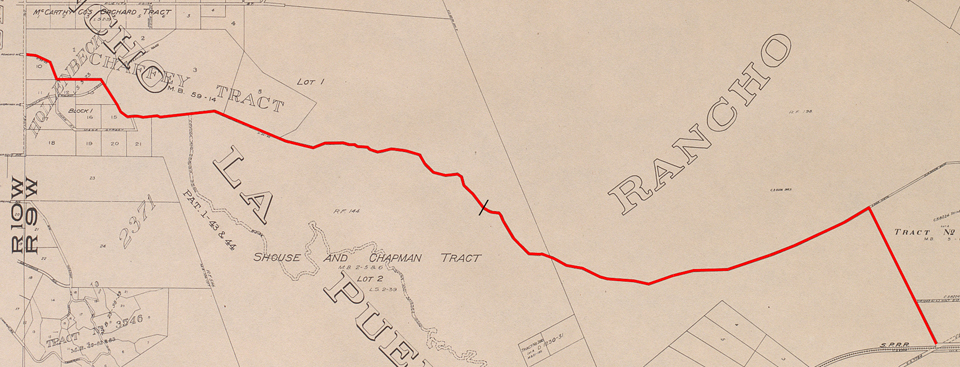
The original as-built alignment of the Pomona Road (red). Since 1933, the road has ended at the point indicated by the black slash.


Monday, July 17, 2017

Wally Moon's Baseball Camp

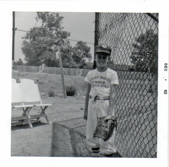
In the early Sixties, Los Angeles Dodgers outfielder Wally Moon started a baseball summer camp at the Baptist Seminary in the Covina Hills, only about a mile from our house. Since we were a big "baseball family," it was natural that I attend.


That mitt's bigger than my whole chest!

Recently, I had some old home movies converted into DVDs, and was delighted to discover footage of me playing my first game at Wally Moon's in the summer of '62, when I was 7 going on 8. I have a ton of fond memories about the camp, but it was great to actually see the place again. It reminded me of just how much fun I really had there.

Anyway, my play here is pretty terrible, but don't watch me, watch the surroundings! If you attended Wally Moon's Summer Baseball Camp back then, I'm sure this will bring back great memories for you, too. :-)

Also in those home movies was a clip of me pitching little league at Barranca Park in 1964. Not at the main ballfield, though; it was on the minors' diamond on the grounds of Barranca School. I was a lot better pitcher than I was a batter, but that's not saying much. I did have a pretty good wind-up and delivery, though...

Saturday, June 13, 2015

Featherstone Quarry

We neighborhood kids used to call it the "Chalk Mine." To us, the abandoned quarry looked like something out of the Old West. We thought for sure it had been there since cowboy days; maybe even a hundred years! There were a bunch of other tall tales about the place, but it would be another half century before I finally uncovered its factual history.

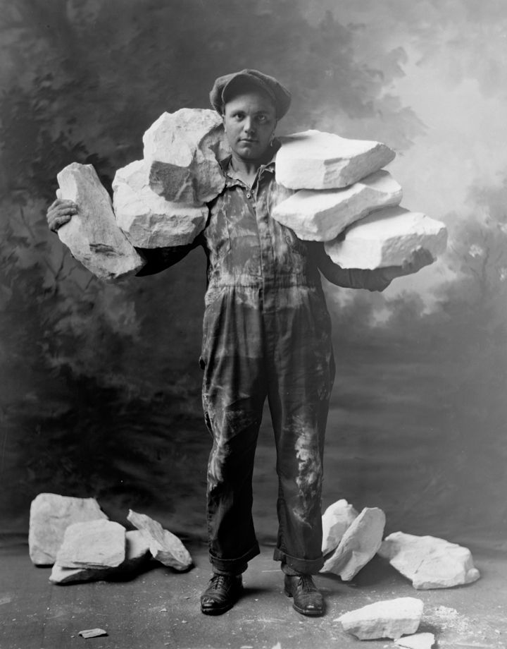
Featherstone Quarry was the entrepreneurial brainchild of one David Forbes Meiklejohn (1876-1937):1 a Stanford-educated mining engineer2 who, around 1920, stumbled somewhat serendipitously upon a large deposit of almost pure diatomaceous earth on Chaffee lands in the hills southeast of Covina, and subsequently invested a quarter-million dollars to exploit what he perceived as its "vast wealth."

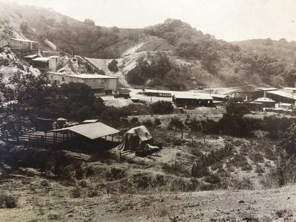
Extraction of the resource began in late 1920-early 1921, when roads to the site were graded and a processing plant constructed.3 The diatomite was used primarily in the manufacture of insulation,3 tile, pipes and conduits.4 Exactly why and when quarrying ended, however, is uncertain. A geology field report based upon data compiled in 1932 stated that operation of the mine "ceased several years ago,"4 so it may be that Featherstone Quarry did not survive as a going concern past 1930.


Featherstone Quarry, Covina Hills, 1929. The complex extended from today's Rancho La Floresta Drive at left to the main diatomite mine at right. I-10 now passes from left to right through the low white hill at center. 'Dick' Whittington Studio, photographer. Courtesy of The Huntington Library, San Marino, CA. Link to full-res image.


The processing plant over the hill on the Charter Oak side, mid-1920s. In this photo, we are standing on a spot a few yards down the hill from the end of today's Woodhurst Drive, facing southwest toward the intersection of Rancho Los Nogales Drive and Puente Street. Photo courtesy Covina Valley Historical Society.


A worker showing why the mine was named Featherstone! The diatomite formed in the Miocene epoch approximately 7 million years ago.4
Image courtesy Covina Valley Historical Society c/o Powell Camera Shop.


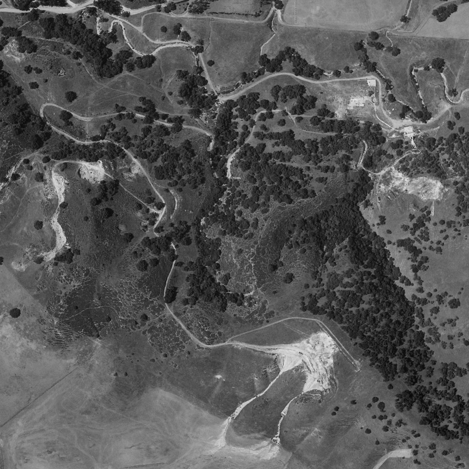
The main quarry (bottom) and its associated roads in 1934. The road at top approximately follows the alignment of today's Puente St.; the road over the hill from the quarry site, Jalapa Drive. Fair use courtesy U.C. Santa Barbara Digital Library, Special Research Collections.


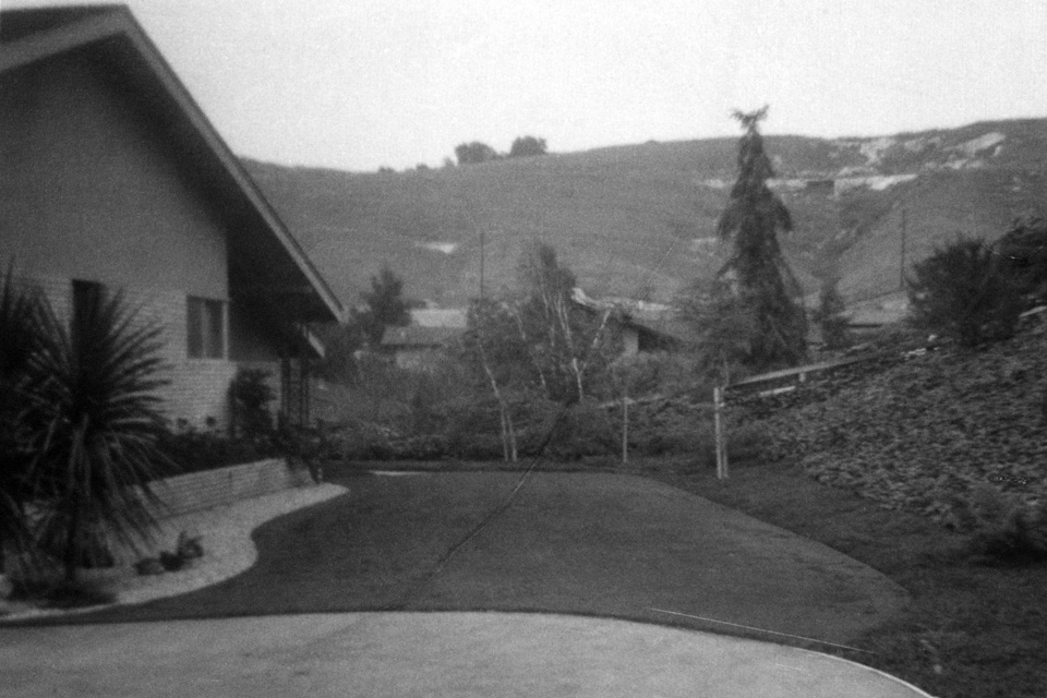
The "Chalk Mine" as seen from our house on Rancho El Encino, June, 1962. What we called the "Quartz Mine" can also be seen to the left of center. Inside that cleft was a thick outcropping of crystalline gypsum.


In 1965, all of the ancient hills north of our neighborhood were bulldozed to create the Covina Heights housing development.

Thursday, June 11, 2015

Casa Mirasol

Local history has changed a little! Likely unbeknown to almost everyone, it turns out one of the buildings of the old Baptist Seminary in the Covina Hills still stands today.

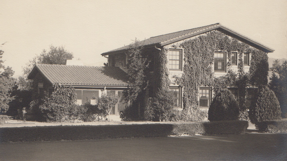
Now a private home, this lone survivor was originally the residence of the Headmaster of the California Preparatory School for Boys.

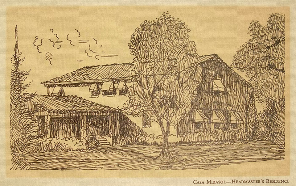
As this student-made drawing from 1936 indicates, the house in its Cal Prep days was known as "Casa Mirasol." According to Assessor's Office records, it was built in 1929.

In 1942, Dr. Gottfried de Purucker moved his branch of the Theosophical Society to the Covina Hills campus, and Casa Mirasol became his home. After the California Baptist Theological Seminary acquired the property in 1951, it was used as the Dean's residence.


Casa Mirasol in 1942

The old school campus was important in Covina's history, and part of my own history, as well. One can only speculate why this building alone was spared demolition, but I'm happy to know it's still with us.


Monday, May 26, 2014

Memorial Glen

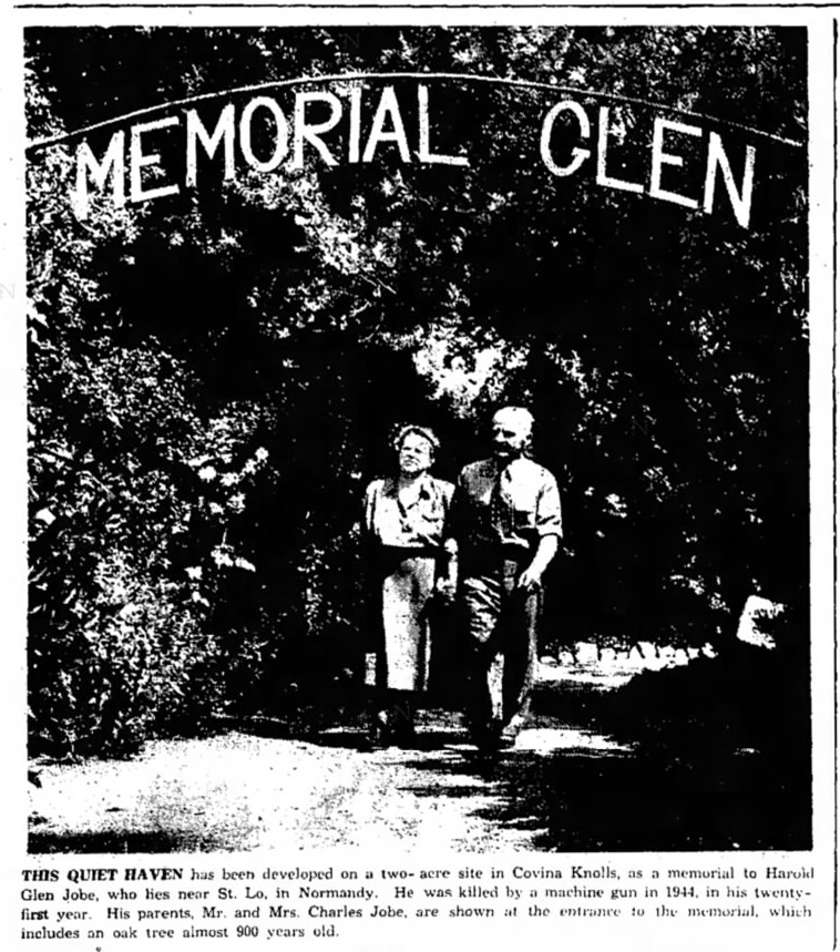
In the closing months of World War II, a grieving father resolved to create a place of peaceful repose dedicated to the memory of his son who had died defending freedom in Europe.


Covina Argus-Citizen, August 15, 1952.


Charles Jobe and his wife Betty were citrus growers in the hills east of Covina. They were the proud parents of two sons: Harold Glen (left, b.1922) and Claude (b.1929), and it was Harold who lost his life at Saint-Lô, France, during the last days of the Battle of Normandy ("Operation Overlord") in August, 1944.


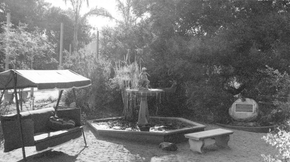
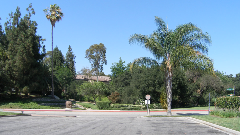
A small, wooded creek ran through the Jobes's land on Holt Avenue, and it was in this mixed stand of live oaks and orange trees that Charles Jobe created "Memorial Glen." Near the center of the grove, in the shade of a magnificent 900-year-old live oak, Mr. Jobe set up a stone monument with a bronze plaque dedicating the park to his fallen son and to the other servicemen from Covina who had sacrificed their lives in World War II.


Over the next two decades, the Jobes hosted multitudes of visitors to Memorial Glen. Sadly, after Charles Jobe died in 1967, and his widow had to relocate elsewhere, the park became the haunt of youths who used the secluded spot for, well, let's just say less-than-reverential purposes. During this period of neglect, almost all of Mr. Jobe's labors were trashed by disrespectful vandals.

To make matters worse, when Interstate 10 was widened in the early 1970s, the adjacent service road was realigned to the east, and all of the trees in the western third of the former Jobe property were taken out. The removal of this protective canopy exposed the trunk and limbs of the ancient live oak to the sun's direct rays, and this resulted in the slow death of the veteran giant. Arborists tried their best to save it, but finally, in the early 1980s, what remained of the great tree had to be removed.

By this time, the City of Covina had acquired the land, and its Parks & Recreation Department created Jalapa Park, named after Covina's sister-city in Mexico.


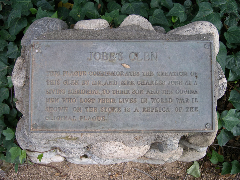
In 1998, part of the park was turned into a formal Veterans Memorial. This interpretive monument was erected on the site...

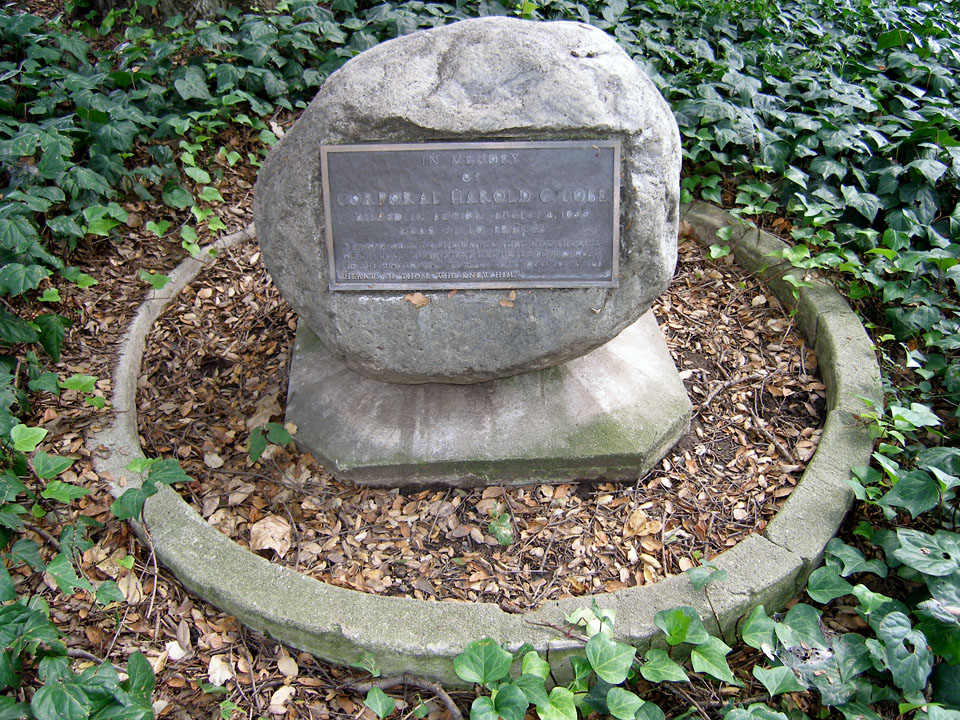
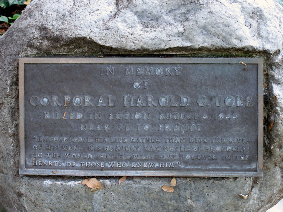
  ...and a new commemorative plaque was installed to replace the long-vanished original.

IN MEMORY
OF
CORPORAL HAROLD G. JOBE
KILLED IN ACTION AUGUST 4, 1944
NEAR ST. LO FRANCE
"HAROLD GAVE HIS LIFE RATHER THAN RISK THE LIVES
OF HIS MEN. HIS BRAVERY MAY NEVER BE BROADCAST
TO THE WORLD, BUT HE WILL LIVE FOREVER IN THE
HEARTS OF THOSE WHO KNEW HIM."


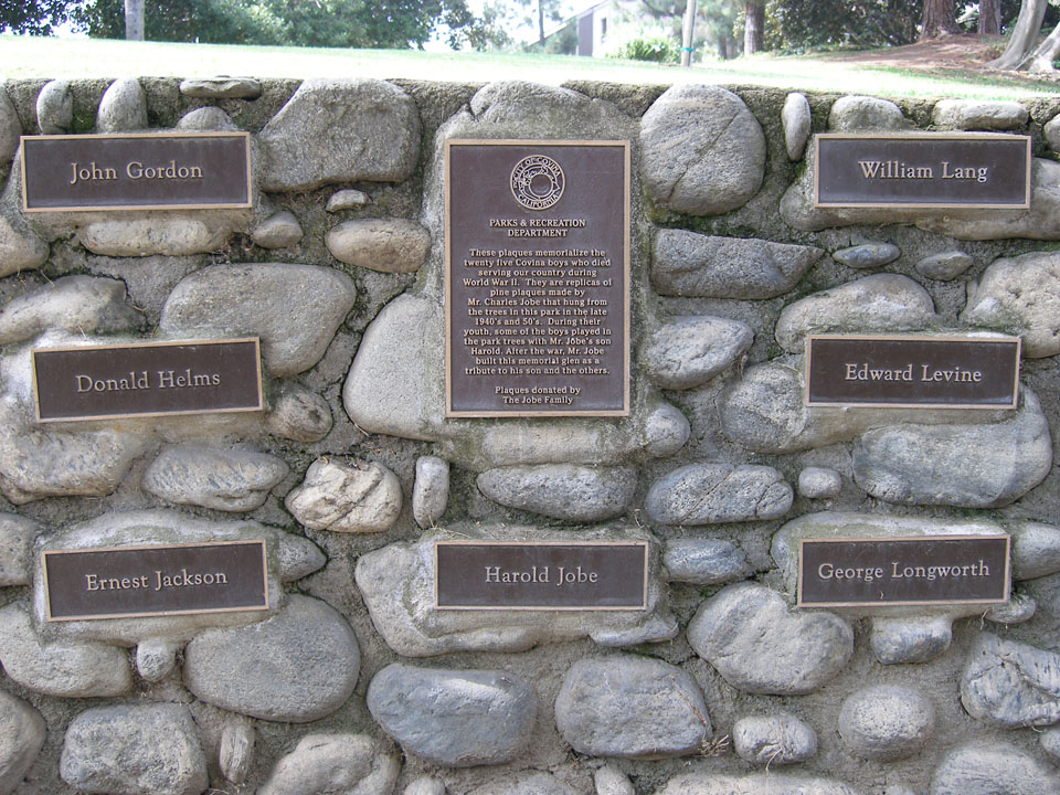
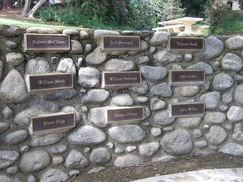
More recently, the family of nephew Jere A. Jobe donated these new bronze plaques to the park.


As someone who grew up only a mile from Memorial Glen during the 1960s, and who personally witnessed its decline in the following decade, I am truly grateful to the City of Covina for restoring and preserving this unique historical site for future generations.


Color photos © J Scott Shannon. Special acknowledgment and thanks to fellow local historian J. David Rogers for the black-and-white photographs, the biographical details of the Jobe Family, and the history of Memorial Glen.


Wednesday, May 21, 2014

Covina Valley Panorama, 1930

Recently, I found this amazing panoramic photograph showing Covina and its environs prior to development.


'Dick' Whittington Studio, photographer. Courtesy of The Huntington Library, San Marino, CA. Link to full-res image.

I realize it doesn't look very amazing at this size, but below are some labeled enlargements which point out what is what in the photo.


Monday, August 26, 2013

75 Years Ago Tonight

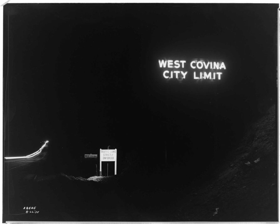
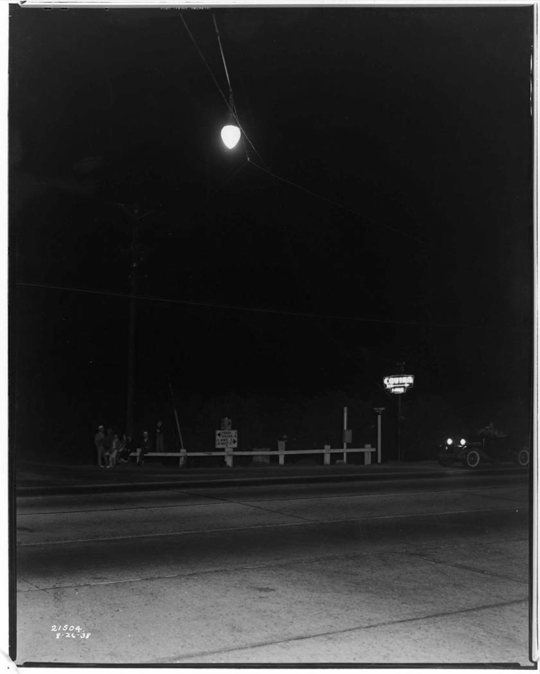
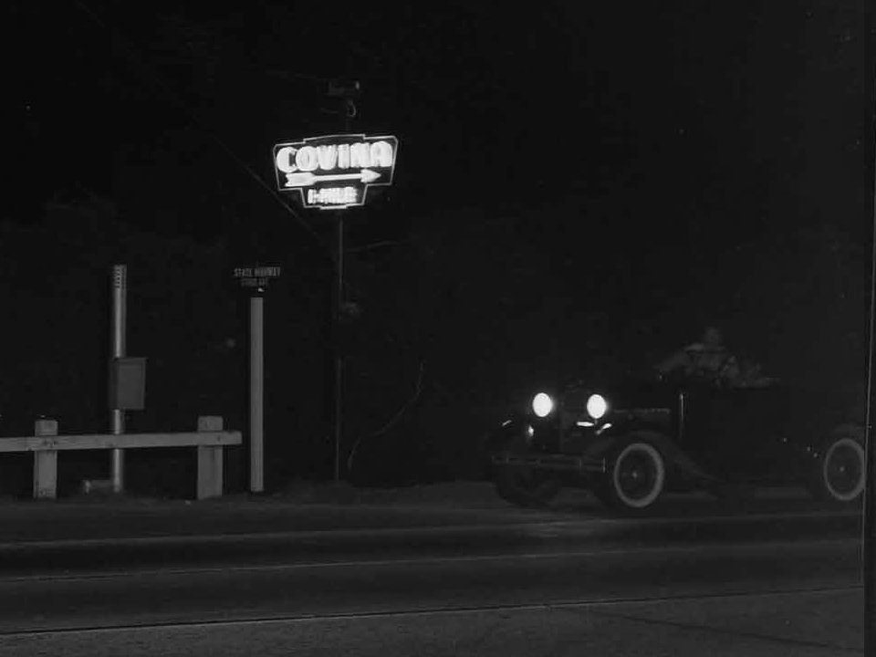
These photos were taken 75 years ago tonight along Garvey Boulevard (today's I-10) on the stretch that passed through the Covina area. They are from the archives of the Southern California Edison Company, and were evidently taken to document street lighting along the roadway.

The first one shows the signage at the eastern boundary of West Covina–the city limits of which, at that time, extended all the way east to Range Avenue (today's Grand Avenue). The slope of the pavement down the grade to the Walnut Creek arroyo is recognizable even today.

The neon sign fascinates me because I never knew it existed. The smaller sign illuminated by incandescent light warns motorists about the speed trap that West Covina had become notorious for since the opening of Garvey Boulevard. (My father used to tell tales about the WCPD cops and their famously predatory traffic law enforcement.) It's pretty obvious from this very prominent signage that they meant business. "You have been warned!"


G. Haven Bishop, photographer. From the Edison Archive. Courtesy of The Huntington Library, San Marino, CA. Link to full-size image.

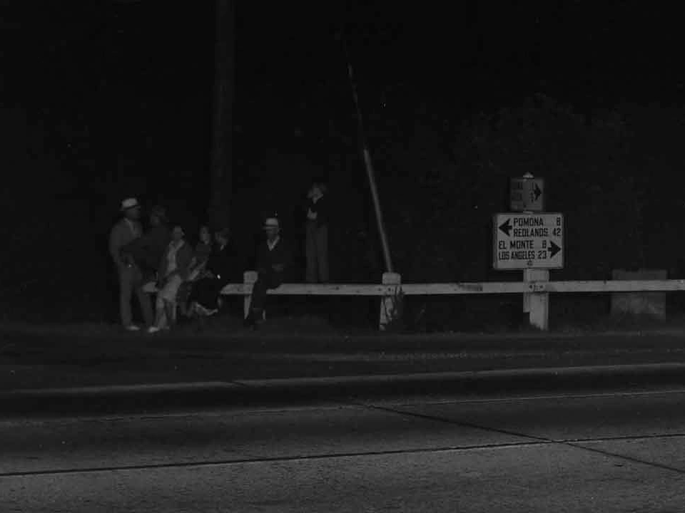
Here is another neon sign that I didn't know about before, either. It reads, "COVINA 1-MILE." Looking at the street signs in extreme closeup, I can see this is the intersection of "State Highway" and "Citrus Ave." The mileage sign points east to "Pomona 8" and "Redlands 42," and "El Monte 8" and "Los Angeles 23" to the west. The shaded mileage sign pointing north appears to say "Covina 1" and "Glendora [illegible]."


G. Haven Bishop, photographer. From the Edison Archive. Courtesy of The Huntington Library, San Marino, CA. Link to full-size image.


One might wonder what these people were doing hanging out down on the main drag through town at what must have been close to 10PM. Turns out they were assembling for a dedication ceremony for the new overhead street light (the neon "Covina" sign had been put in place three years previously).

Saturday, March 24, 2012

Oak Canyon Road

Probably not a lot people from Covina ever heard of Oak Canyon Road, but growing up in the hills east of town, I became aware of it at a very early age. Whenever we'd drive past Oak Canyon, its picturesque colonnade of old palm trees would catch my eye, and I'd wonder how they got there. Seven decades would pass before I finally found answers to all of the questions I had about this pioneer-era byway.


Detail of Joseph M. Bloom map showing Oak Canyon Road (green), Covina Hills Road (yellow) and surrounding streets in 1963.

First called Park Street, the now-secluded track southeast of Covina was laid out by the McCarthy Company in 1895: the same year as the westernmost mile of today's Covina Hills Road.1


Tract map from 1895 showing Park Street (green) and the new County Road (yellow) in the McCarthy subdivision of Block 1 of the Hollenbeck Ranch.
Courtesy Los Angeles Dept. of Public Works.

In 1902, Col. Frank Marion Chapman acquired 1,470 acres south of the Pomona-Covina Road,2 and Park Street became the palm-lined carriageway entrance to his Chapman Heights Ranch.

Following the Colonel's death in 1909, pioneer scion Harvey M. Houser bought the northernmost 100-acre portion of the former Chapman ranch.3 In March, 1925, Houser then sold the property to Mr. and Mrs. John H. Henry,4 and the following year, a renamed Palm Drive became the picturesque gateway to the Henrys' new California Preparatory School for Boys located atop the mesa overlooking Walnut Creek.


Aerial view of the new Cal Prep campus and what is now Oak Canyon Road at left, 1927. Courtesy U.C. Santa Barbara Geospatial Collection.

The palms lining the school's entrance road were evidently a kind of mascot to Cal Prep's academic community. Their emblem prominently featured the tropical tree, and they even named their yearbook "The Palm."


Frontispiece of the 1928 Cal Prep annual.5
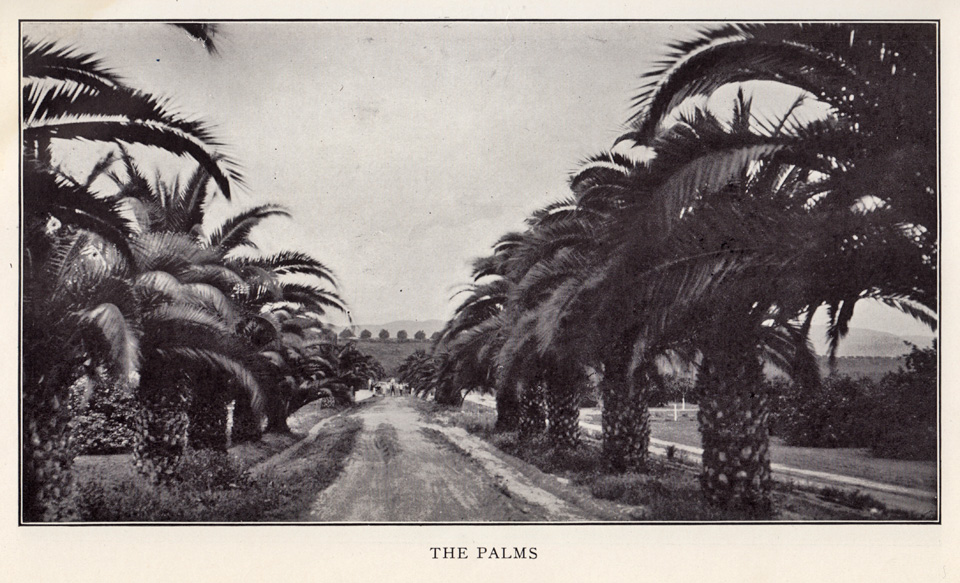

Looking south on Cal Prep's Palm Drive, 1928.5

After the California Preparatory School moved to Ojai in 1942, the campus was taken over by the Theosopical Society Point Loma,6 and it was in 1945 that the first mentions of Oak Canyon Road began appearing in the local newspaper.

The campus changed hands yet again in 1951, then becoming the new home of the California Baptist Theological Seminary.7 This was how I knew the place when our family moved to the Covina Hills in 1959, and I first saw the palms.

As curious as I was back then about Oak Canyon Road, I strictly avoided that area when I was younger, as it had a rather notorious local reputation. Invading swarms of "bad" teenagers took advantage of the secluded road to party and make out. The L. A. County Sheriffs patrolled that road constantly, and in my day it was mostly known as a really good place to go to get busted. The delinquency problem was solved once and for all, though, when Oak Canyon Road was finally closed to all vehicle traffic in the late 1970s when the seminary property was acquired by redevelopers.

The cars and juvies went away, but the palms endured as always—or at least some of them did. The trees used to extend in a uniform line all the way from the base of the bluff to the intersection with Covina Hills Road. I wish I had taken a picture of the palm drive as it looked before a suburban housing development destroyed the trees north of Walnut Creek in 1977 and obscured the view of those that remained. That vista that so inspired me in my childhood only survives in memory now, alas.

Fortunately, though, the southern half of the palms live on, and the old road itself today serves as the gateway to the 82.8-mile-long Schabarum-Skyline Equestrian Trail. I'm very pleased that at least one section of this pioneer-era relic will now be preserved for future generations.

This is my favorite picture from my visit last year to this quiet refugium. It was so amazing to finally walk among these palms and contemplate just how ancient they are. Planted 110 years ago, they are older than almost every man-made structure in the eastern San Gabriel Valley. Living history, hidden in plain sight, yet now no longer the mystery lost to the passage of time that they once were.


Photo ©2011 by J Scott Shannon.

(N.b., The foregoing is a complete rewrite of the original article which, over time, I discovered contained multiple factual errors. This revised version also includes a lot of new information and illustrations that were not available to me 14 years ago. I think you'll agree, this is a much more satisfactory and worthwhile read! —JSS, May 1, 2026.)

References:

1 Map of the McCarthy subdivision of Block 1 of the Hollenbeck Tract, surveyed August, 1895.
2 Covina Argus, May 31, 1902, p.1.
3 Covina Argus, May 14, 1910, p.2.
4 Covina Argus, March 6, 1925, p.1.
5 The Palm, 1928, Annual of the California Preparatory School for Boys, Covina, California, 84pp.
6 Los Angeles Times, May 22, 1942, p.30.
7 Covina Argus-Citizen, January 26, 1951, p.1.


The Baptist Seminary

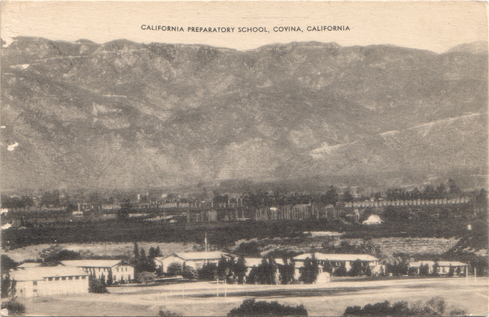
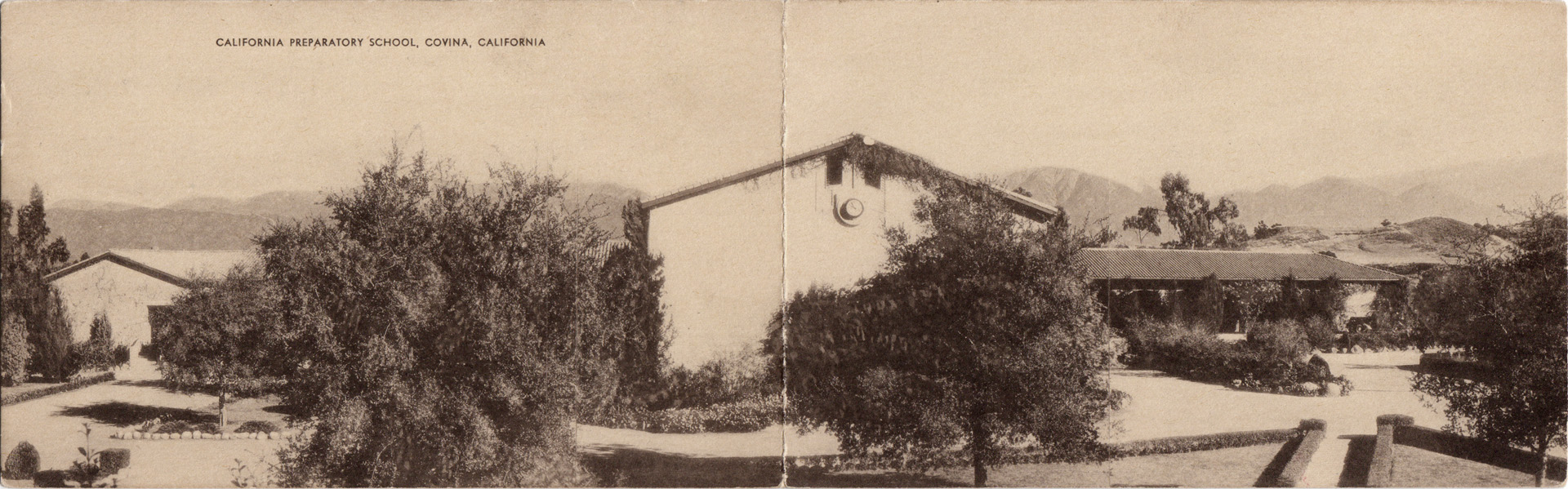
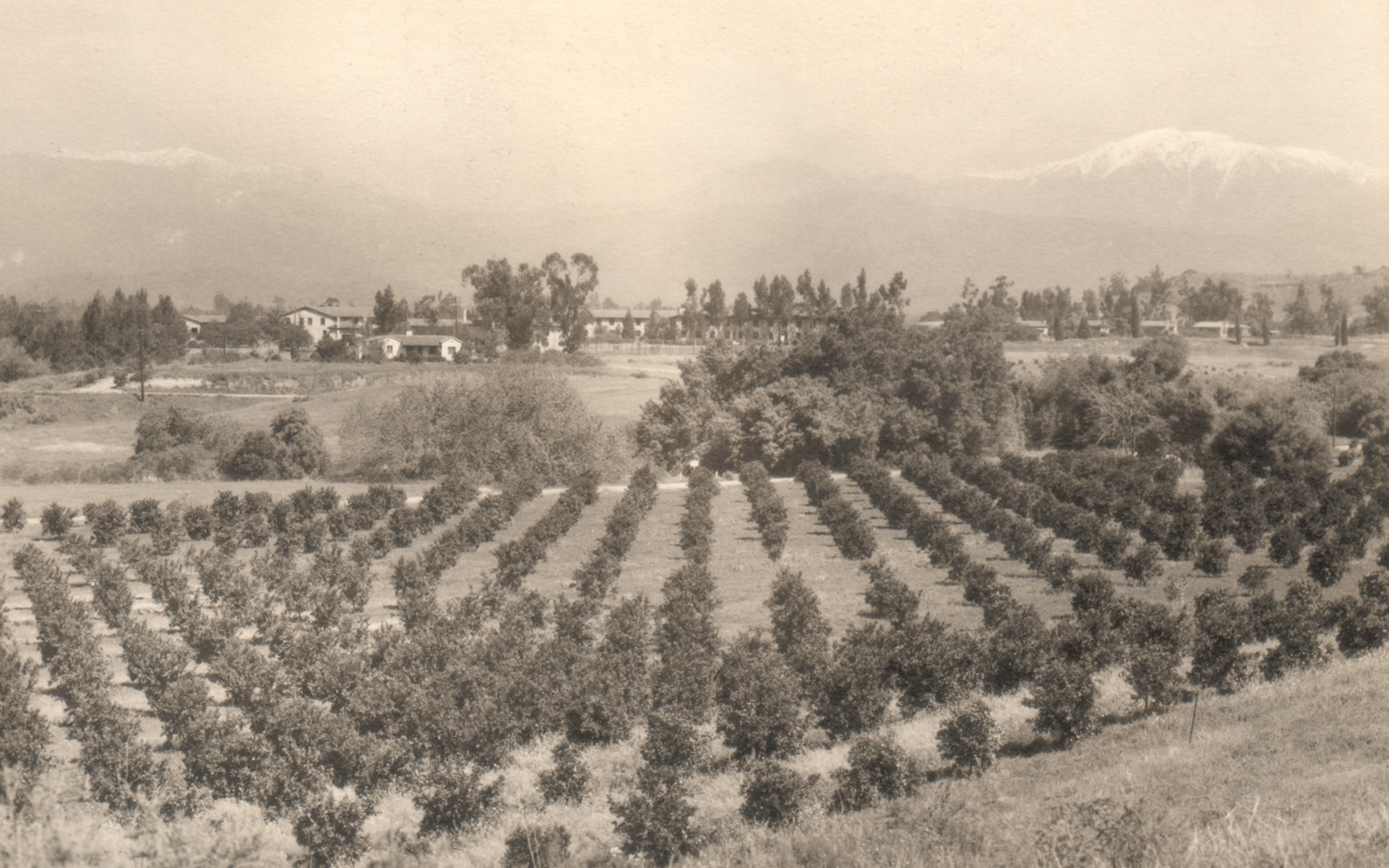
In 1926, the California Preparatory School for Boys (shown below c.1938) was built on the 100-acre H. M. Houser ranch on former Hollenbeck lands southeast of Covina.


Click any image on this page for an enlargement.

The prep school did well until the onset of WWII, when the ownership, fearing enemy attack (not joking!), moved the entire school to the mountains in Ojai. Consequently, in 1942, the Covina property was sold to the Theosophical Society Point Loma. The south-to-north view below shows the campus in the mid-Forties.


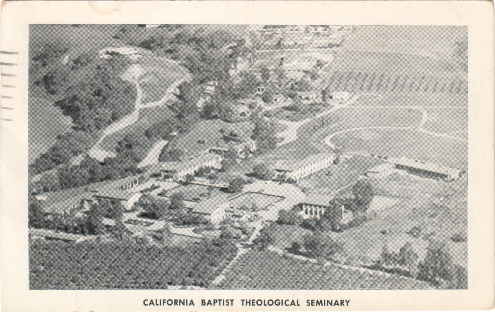
In 1951, the property changed hands again and became the California Baptist Theological Seminary. In this aerial view from c.1955 (below), we're looking generally eastward here; the road to the immediate left of the campus is Covina Hills Road.

Seminary classrooms (left) and one of the dormitories (right). In the early 1960s, that dormitory was also the headquarters of Wally Moon's Baseball Summer Camp. It was the first place I can ever remember sleeping overnight away from home.

The Baptist Seminary conferred its last ministry degrees at Covina in 1974 and moved its central campus to Berkeley. Starting in 1979, the grounds were redeveloped for housing and offices, and almost all of the old buildings were demolished. The gymnasium was initially spared and turned into a racquetball and workout facility, but it was finally torn down in 2005. Today, the only campus structure that remains is the Headmaster's house – Casa Mirasol.


Saturday, September 24, 2011

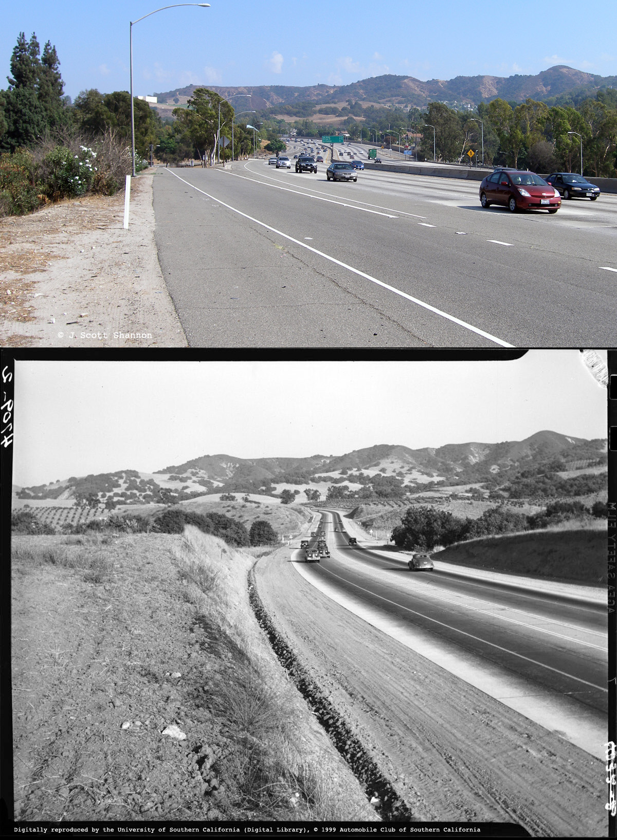
I-10 at Holt, 2011 & 1938


Click on image for an enlargement.

The first highway between the east San Gabriel Valley and the Pomona Valley was built in 1933. It was called Arroyo Avenue, and was designated as part of U.S. Highway 99. In 1957, US-99 was widened and became the San Bernardino Freeway, and when it was added to the Interstate Highway System in the early 1960s, it became what we know today as Interstate 10 (I-10).

In these views, we are looking east toward Pomona just west of the highway's intersection with Holt Ave., east of Covina. The top photo was taken in the present day; the bottom one in 1938.

Top photo © 2011 J Scott Shannon, bottom photo © 1999 USC Digital Library/Automobile Club of Southern California.


Sunday, March 28, 2010

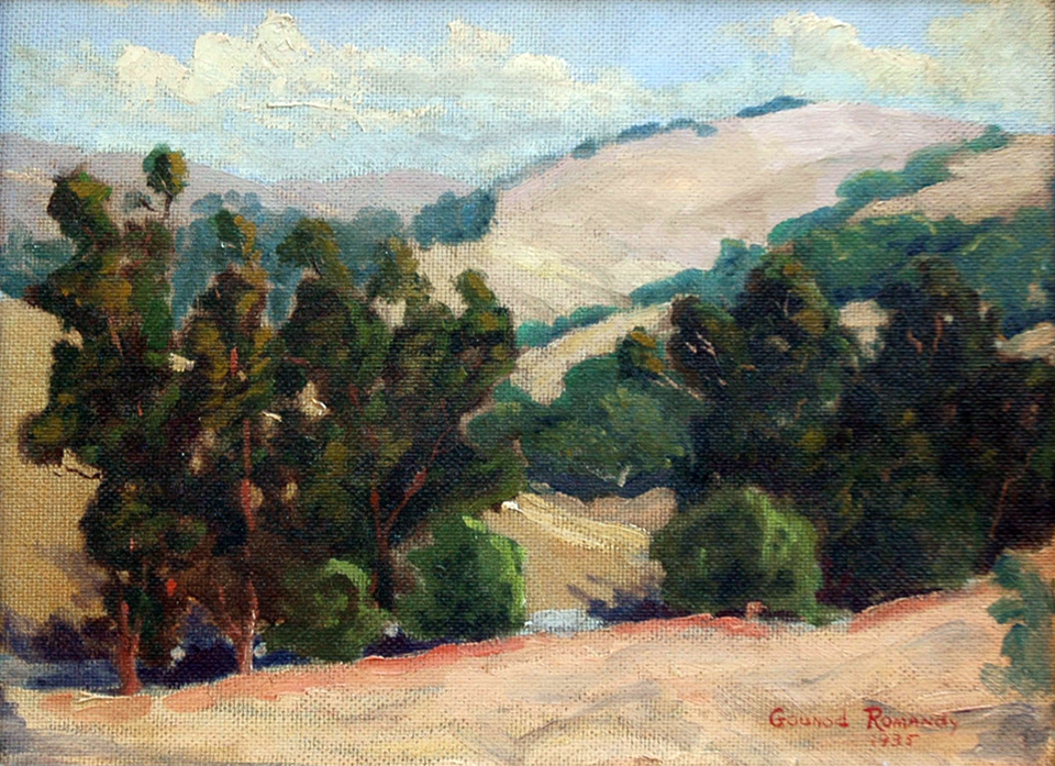
Gounod Romandy's "Hills of Covina, California" (1935)

I found this painting on eBay recently. It's entitled "Hills of Covina, California," and it was painted by noted California impressionist artist Gounod Romandy (1893-1942) in 1935.

It's only about a mile from our old Covina home. The painting was actually done about 25 years before we lived there, but the vista remained relatively unchanged until the 1970s, when this little dale began to be developed. Back when me and my buddies had those hills all to ourselves, they were alive with coyotes, jackrabbits, pheasants, tarantulas, even the occasional rattlesnake. Today, the hills are completely covered with houses.

How amazing to see an impressionist interpretation of our hills in their natural state. I can even recollect what the place would have smelled like on a beautiful summer's day like this, and call to mind the sound of a gentle breeze blowing through those tall grasses and trees. It truly was a wonderful place to grow up.


Friday, November 9, 2007

My Hills, Then & Now

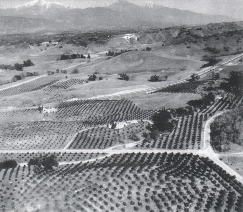
Last week, quite unexpectedly, a lifetime's dream of mine came true. I've finally been able to see what the Covina hills I lived in as a child originally looked like before they became part of Los Angeles's spreading metastasis.

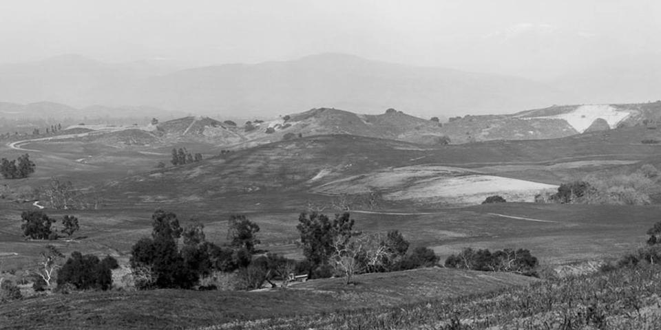
See that outcrop of white limestone on the hill in the background? That's what we kids called the "Chalk Mine." Down and to the right from the chalk mine can be seen a much smaller patch of white. In 1959, my family's house would be built just to the left of that. So these were my hills, circa 1935, about 20 years before I was born.

I'm just totally blown away by this image. The whole little valley I lived in–and everything around it–was entirely undeveloped, open rangeland. Nothing but wild grasses, chaparral, live oaks, walnuts and orange groves.

It is a vision of Heaven to me... a true Paradise Lost.

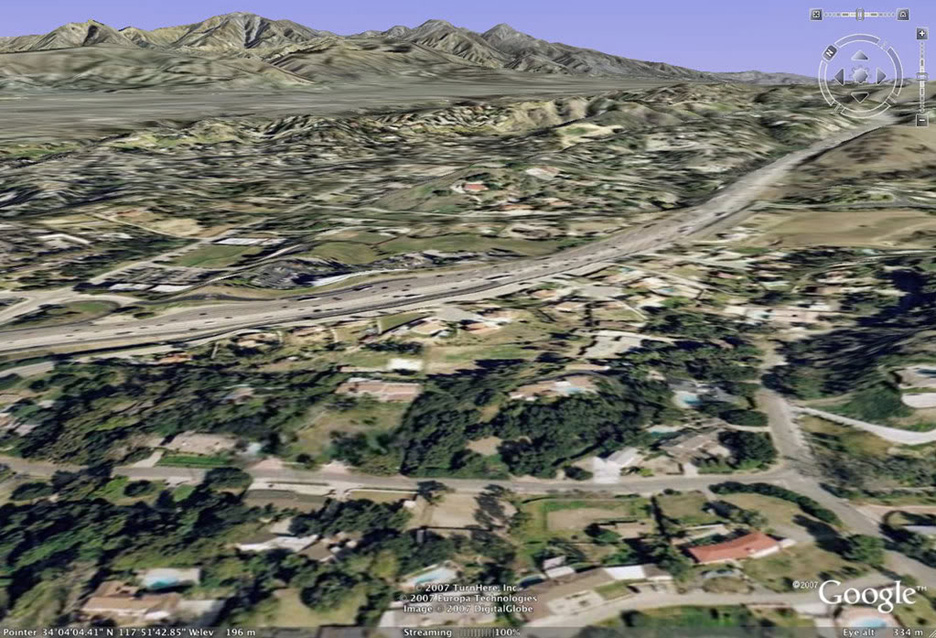
And here is the same scene today, courtesy of Google Earth. The then-newly-constructed Arroyo Avenue (U.S. Hwy. 99) in the old photo is now Interstate 10, and virtually all the formerly open spaces are now occupied by homes and businesses. It's become just another faceless L.A. suburb.

I'm grateful that I lived long enough to be able to see my hills the way they originally were. The chalk mine is long gone, but there's still a small refugium of undeveloped hills just past where my house was. Bulldozers may not have claimed it yet, but no coyotes howl, no jackrabbits scurry, no pheasants fly, no tarantulas crawl there anymore, like they did when I was little. It's all dead land now, fit only for humans.