Probably not a lot people from Covina ever heard of Oak Canyon Road, but growing up in the hills east of town, I became aware of it at a very early age. Whenever we'd drive past Oak Canyon, its picturesque colonnade of old palm trees would catch my eye, and I'd wonder how they got there. Seven decades would pass before I finally found answers to all of the questions I had about this pioneer-era byway.

Detail of Joseph M. Bloom map showing Oak Canyon Road (green), Covina Hills Road (yellow) and surrounding streets in 1963.
First called Park Street, the now-secluded track southeast of Covina was laid out by the McCarthy Company in 1895: the same year as the westernmost mile of today's Covina Hills Road.1

Tract map from 1895 showing Park Street (green) and the new County Road (yellow) in the McCarthy subdivision of Block 1 of the Hollenbeck Ranch.
Courtesy Los Angeles Dept. of Public Works.
In 1902, Col. Frank Marion Chapman acquired 1,470 acres south of the Pomona-Covina Road,2 and Park Street became the palm-lined carriageway entrance to his Chapman Heights Ranch.
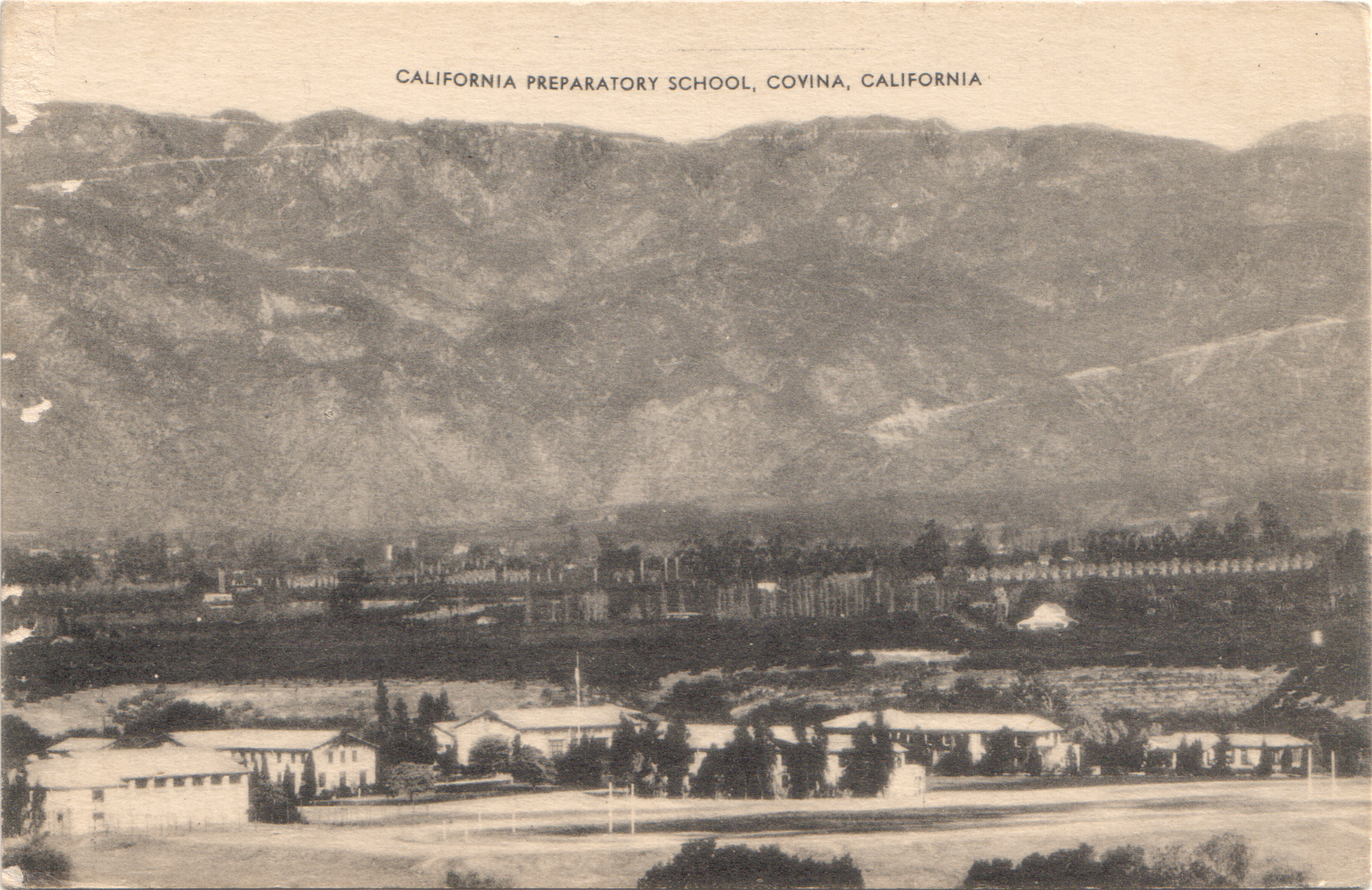
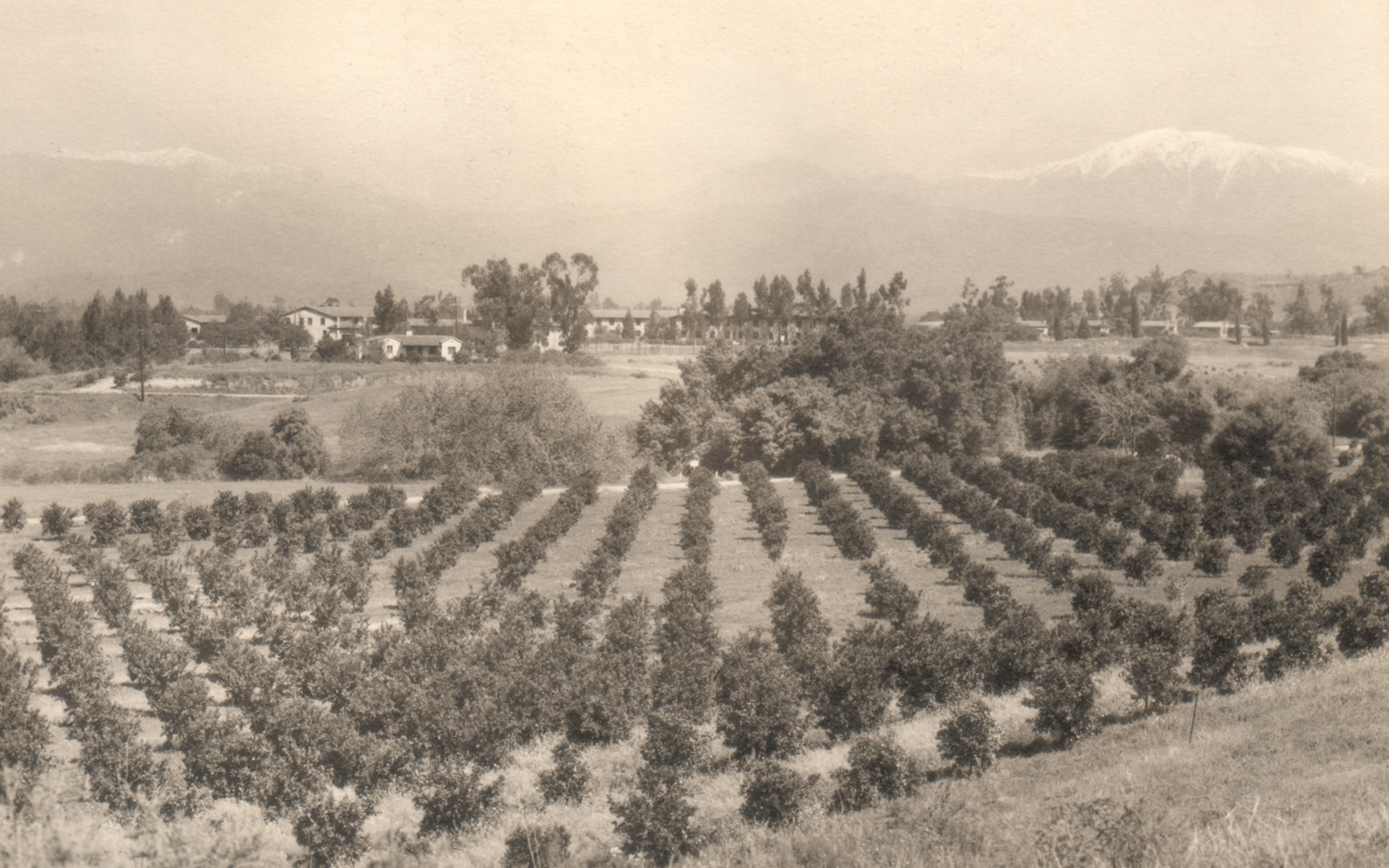
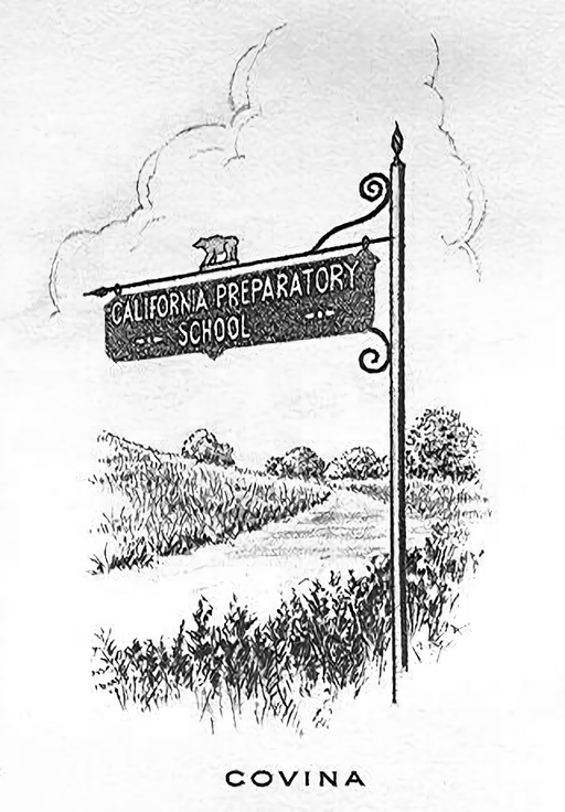
Following the Colonel's death in 1909, pioneer scion Harvey M. Houser bought the northernmost 100-acre portion of the former Chapman ranch.3 In March, 1925, Houser then sold the property to Mr. and Mrs. John H. Henry,4 and the following year, a renamed Palm Drive became the picturesque gateway to the Henrys' new California Preparatory School for Boys located atop the mesa overlooking Walnut Creek.

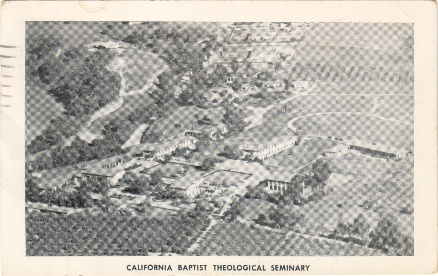
Aerial view of the new Cal Prep campus and what is now Oak Canyon Road at left, 1927. Courtesy U.C. Santa Barbara Geospatial Collection.
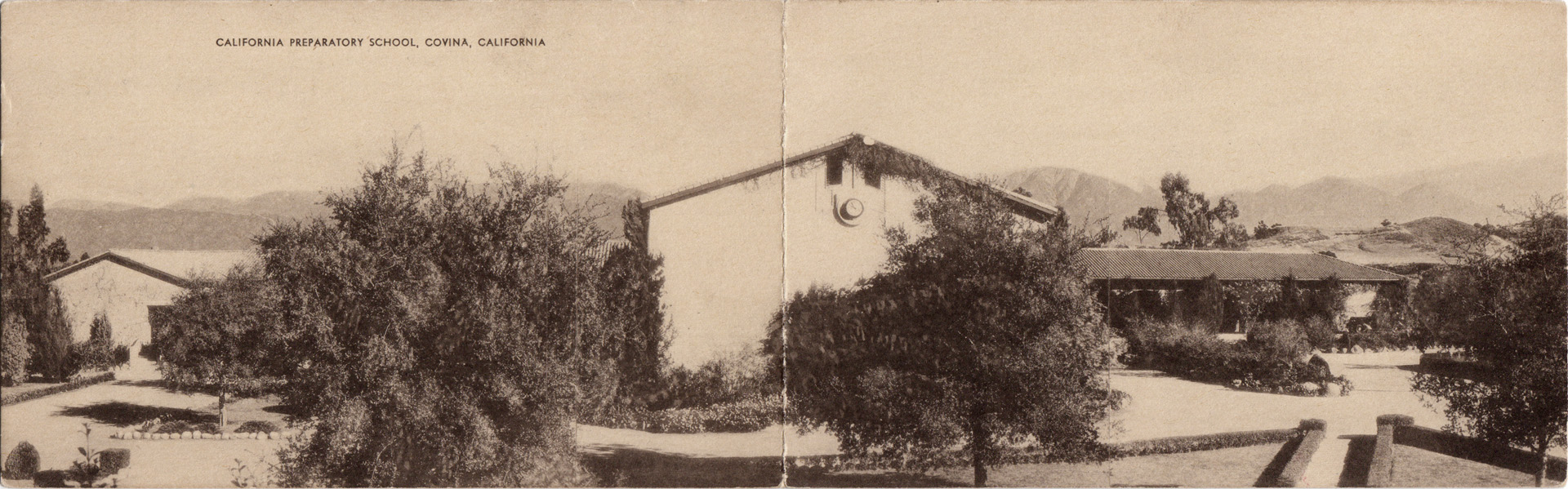
The palms lining the school's entrance road were evidently a kind of mascot to Cal Prep's academic community. Their emblem prominently featured the tropical tree, and they even named their yearbook "The Palm."

Frontispiece of the 1928 Cal Prep annual.5
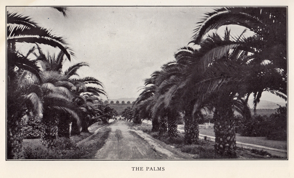
Looking south on Cal Prep's Palm Drive, 1928.5
After the California Preparatory School moved to Ojai in 1942, the campus was taken over by the Theosopical Society Point Loma,6 and it was in 1945 that the first mentions of Oak Canyon Road began appearing in the local newspaper.
The campus changed hands yet again in 1951, then becoming the new home of the California Baptist Theological Seminary.7 This was how I knew the place when our family moved to the Covina Hills in 1959, and I first saw the palms.

As curious as I was back then about Oak Canyon Road, I strictly avoided that area when I was younger, as it had a rather notorious local reputation. Invading swarms of "bad" teenagers took advantage of the secluded road to party and make out. The L. A. County Sheriffs patrolled that road constantly, and in my day it was mostly known as a really good place to go to get busted. The delinquency problem was solved once and for all, though, when Oak Canyon Road was finally closed to all vehicle traffic in the late 1970s when the seminary property was acquired by redevelopers.
The cars and juvies went away, but the palms endured as always—or at least some of them did. The trees used to extend in a uniform line all the way from the base of the bluff to the intersection with Covina Hills Road. I wish I had taken a picture of the palm drive as it looked before a suburban housing development destroyed the trees north of Walnut Creek in 1977 and obscured the view of those that remained. That vista that so inspired me in my childhood only survives in memory now, alas.
Fortunately, though, the southern half of the palms live on, and the old road itself today serves as the gateway to the 82.8-mile-long Schabarum-Skyline Equestrian Trail. I'm very pleased that at least one section of this pioneer-era relic will now be preserved for future generations.
This is my favorite picture from my visit last year to this quiet refugium. It was so amazing to finally walk among these palms and contemplate just how ancient they are. Planted 110 years ago, they are older than almost every man-made structure in the eastern San Gabriel Valley. Living history, hidden in plain sight, yet now no longer the mystery lost to the passage of time that they once were.

Photo ©2011 by J Scott Shannon.
(N.b., The foregoing is a complete rewrite of the original article which, over time, I discovered contained multiple factual errors. This revised version also includes a lot of new information and illustrations that were not available to me 14 years ago. I think you'll agree, this is a much more satisfactory and worthwhile read! —JSS, May 1, 2026.)
References:
1 Map of the McCarthy subdivision of Block 1 of the Hollenbeck Tract, surveyed August, 1895.
2 Covina Argus, May 31, 1902, p.1.
3 Covina Argus, May 14, 1910, p.2.
4 Covina Argus, March 6, 1925, p.1.
5 The Palm, 1928, Annual of the California Preparatory School for Boys, Covina, California, 84pp.
6 Los Angeles Times, May 22, 1942, p.30.
7 Covina Argus-Citizen, January 26, 1951, p.1.