San Bernardino Road is one of Los Angeles County's oldest historical highways. An important transportation link in pioneer times, today's city of Covina would not have come into existence without it.
In 1810, when California was still part of the Spanish Empire, the friars of Mission San Gabriel built a chapel and supply station 45 miles to the east. The chapel was dedicated to San Bernardino de Siena, which, in the decades to come, would lend its name to a new city, and to the mission trail that originally connected the inland estancia to the mother church and to Los Angeles beyond.
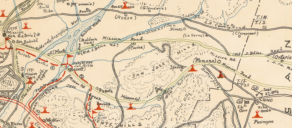
Detail from the Kirkman Map (1937) of historical sites in Los Angeles County, showing the future location of Covina (center) on the "Old S.Bdino. Rd."
It seems likely, however, that the trace which became known as the San Bernardino Road existed even before Mission San Gabriel was founded. The Gabrielinos which populated the valley prior to European settlement were said to have used it to transport logs from the San Bernardino Mountains to build the mission. The Anza expedition is known to have traversed the trail in 1774, as did Jedediah Smith and his party in 1826 and 1827.1
By 1842, when the San Bernardino Road was established as the northern boundary of Rancho La Puente,2 it was already the main east-west travel and freighting route between Los Angeles and what was then called the Azusa Valley.1 The old thoroughfare was upgraded to a county road in 1879,3 when it was widened and straightened to its current alignment.
In 1882, recognizing it as an ideal location for a townsite, Joseph S. Phillips bought 2,000 acres of land on the south side of the stage road and founded Covina there three years later.2,4
Many early "firsts" in the Covina area took place along the much-traveled track.2
- The first general store: Goldsmith's "Four Corners" mercantile, just west of today's Orange Avenue, 1865.
- The first community center and church: Grange Hall, on the south side, 500 feet west of today's Vincent Avenue, 1870s.
- Covina's first schoolhouse, corner of Citrus Avenue, 1883.
- First irrigation reservoir–foundational to Covina's citrus industry–west of Grand Avenue, 1886.
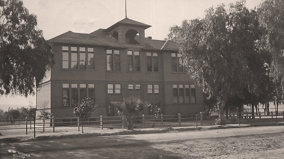
- The city's first high school (pictured below): on San Bernardino Road behind the grammar school, 1903.
Some of the earliest houses in the lower Azusa Valley were built along San Bernardino Road. The most historically notable were the two homes built by the Badilla brothers in 1876,5 just west of today's Hollenbeck Avenue, and Thomas S. Ruddock's Mountain View (1891) at San Bernardino Road's intersection with Grand Avenue.4
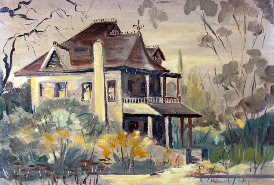
Covina's founder–J. S. Phillips–lived in this Queen Anne manse on the southwest corner of San Bernadino Road and Hollenbeck.
Painting by Melbourne Sumpter, image courtesy Glenn Reed/Covina Valley Historical Society.
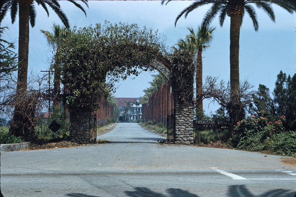
The entrance to Mountain View at the eastern end of San Bernardino Road, 1952. This driveway is now the palm-lined stretch of Wingate Street in Charter Oak.
Photo by Bruce Ward Macy, courtesy Marilee Johnson.
Before the establishment of Mountain View, the San Bernardino Road continued east in a meandering diagonal line up to Mud Springs south of San Dimas, then down past the Casa Primera de Rancho San José in Pomona on its way to its namesake destination.
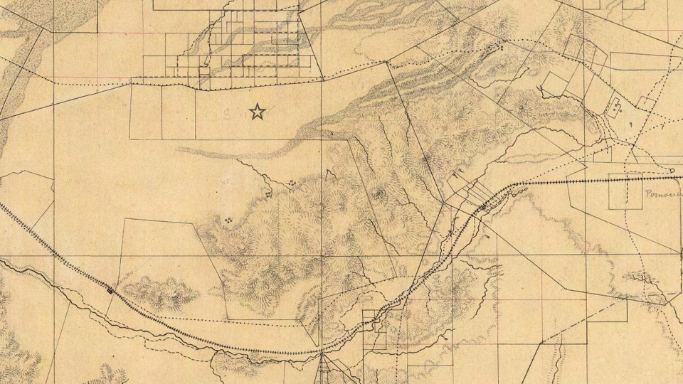
This topographical map from 1880 shows the original track of old San Bernardino Road (upper dotted line). The star shows the future location of Covina.
The dotted line to the south is another mission road, later to become Valley Blvd. Source: David Rumsey Map Collection.
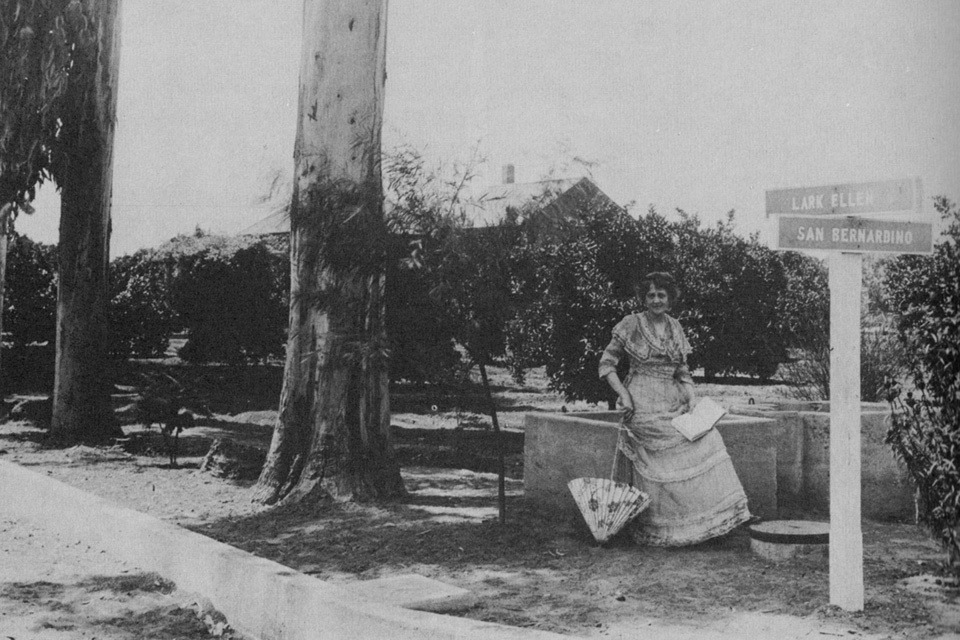
Opera singer "Lark Ellen" Beach Yaw also lived on San Bernardino Road, at the intersection of the street that still bears her name.
Image source: Covina, by Donald Pflueger, 1964.
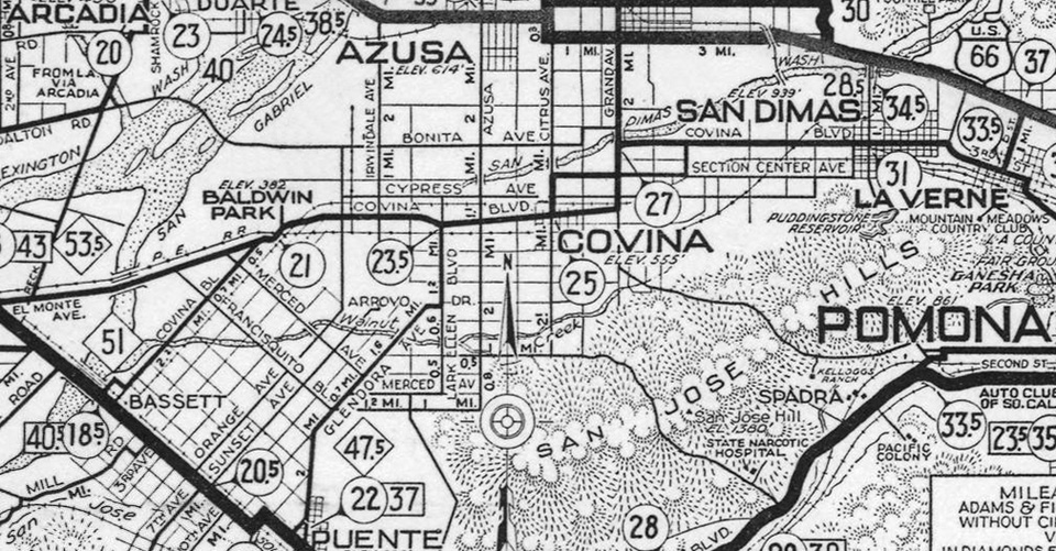
From 1911-1933, San Bernardino Road was part of a 14-mile-long thoroughfare called Covina Boulevard which ran from Bassett to San Dimas,
as shown on this AAA strip map from 1931. (Today's Covina Blvd. was called Section Center Ave. during this period.)
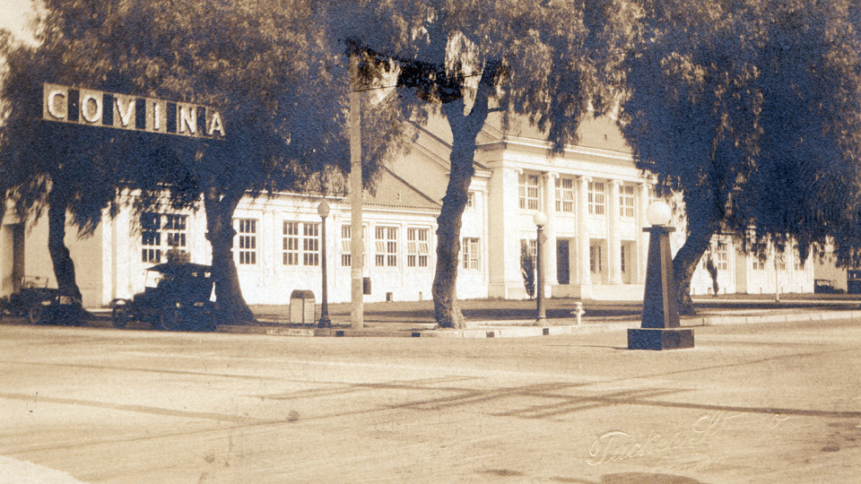
The Covina Grammar School at the southeast corner of San Bernardino Road (then named Covina Boulevard) and Citrus Avenue, mid-1920s. Tucker Studio photo.
Now well over 200 years old, almost all traces of the original San Bernardino Road have been erased, however the portion of it that passes through Covina today is one of the few remaining stretches that preserves the 1879 alignment of the historic Spanish mission trail.
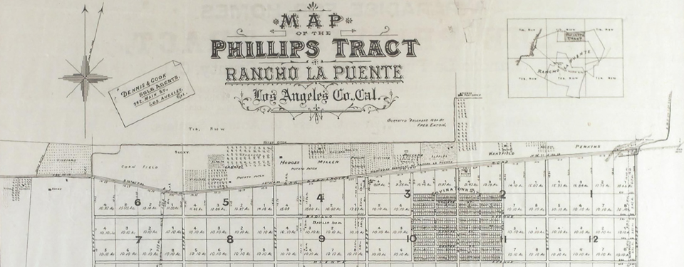
The familiar odd angles of old San Bernardino Road are easily recognized in this detail of the first map of Covina, 1885.
Courtesy Glenn Reed/Covina Valley Historical Society.

References:
1 Head, Harriett R., San Bernardino Road Linked with Southern California History. Covina Argus, January 31, 1930, p.2.
2 Pflueger, D. H. 1964. Covina: Sunflowers, Citrus, Subdivisions. Castle Press, Pasadena, California, 372pp.
3 Los Angeles Herald, June 4, 1879.
4 Hall, B. A. 2007. Images of America – Covina. Arcadia Publishing, San Francisco, California, 127pp.
5 _______. 2012. Covina History Changes. The Citrus Peal, Covina Valley Historical Society, p.9.