Showing posts with label then & now. Show all posts

Saturday, August 24, 2024

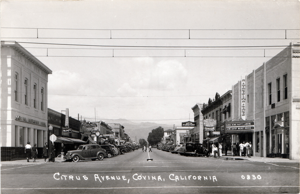
Citrus Avenue, 1938

Looking north on Citrus Avenue...

...from Workman Avenue:


...from Badillo Street:


...and from College Street:


The 200 block of North Citrus was the grocery and retail center of Covina in 1938, with Safeway, Alpha Beta and Cornet on the west side and J. J. Newberry adjoining Bank of America across the street.


But when?

Saturday, May 25, 2024

Second Street Park

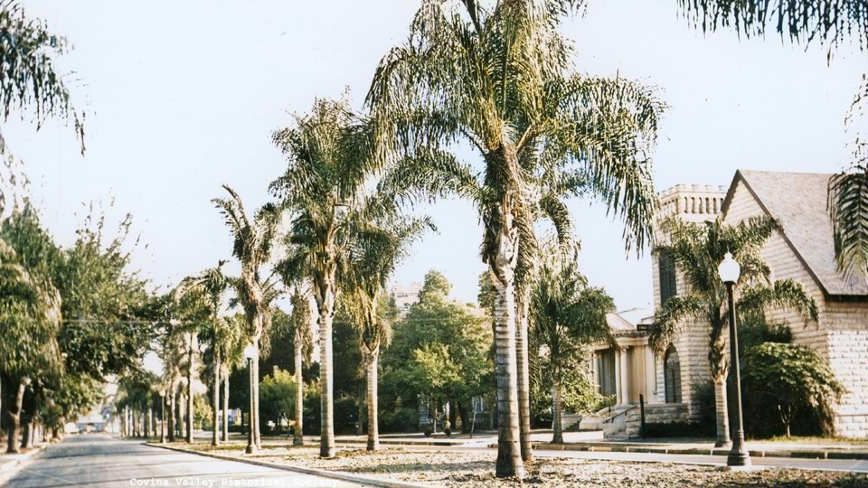
For the past eight decades, Covina's Second Street has been a rather bleak expanse of asphalt, but look how pretty it used to be! From 1923-1949, Second had a 16-foot-wide median strip1,2 running from San Bernardino Road south to Badillo that was graced by 48 Queen palms (Syagrus romanzoffiana). They called it "Second Street Park."3


Looking north on Second Street from College Street, c.1940. Photo courtesy Covina Valley Historical Society c/o Powell Camera Shop.

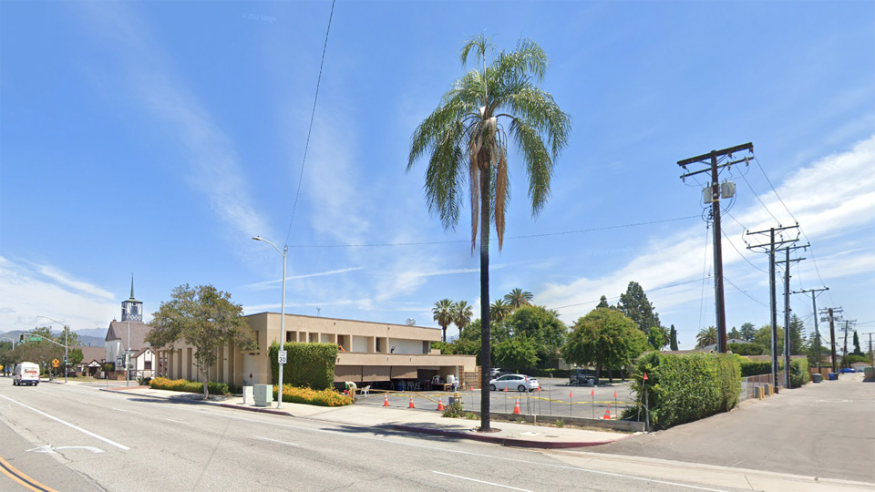
So why was this visually-appealing landscaping done away with? You guessed it: parking.2 Initially, the palms were replanted along the sidewalks and elsewhere,3 but eventually all but one of them were removed. This single, solitary palm at the northeast corner of the Badillo alley is now all that remains of old Second Street Park.


Source: Google Street View.

Kind of sad, isn't it? Wouldn't it be nice if Covina were to re-beautify Second in the 21st century? I can hardly think of another major street in town that is more in need of aesthetic improvement.

References:

1 Covina Argus, July 28, 1922, p.1.
2 Covina Argus-Citizen, April 4, 1947, p.8.
3 Covina Argus-Citizen, June 18, 1948, p.1.


Thursday, December 7, 2023

Photo Sleuthing

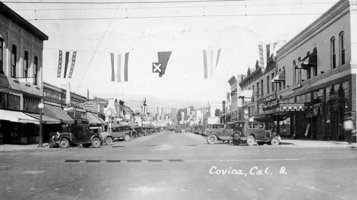
Whenever I find a picture of old Covina that I've never seen before–like this one from a postcard–I enjoy trying to figure out exactly when it was taken.
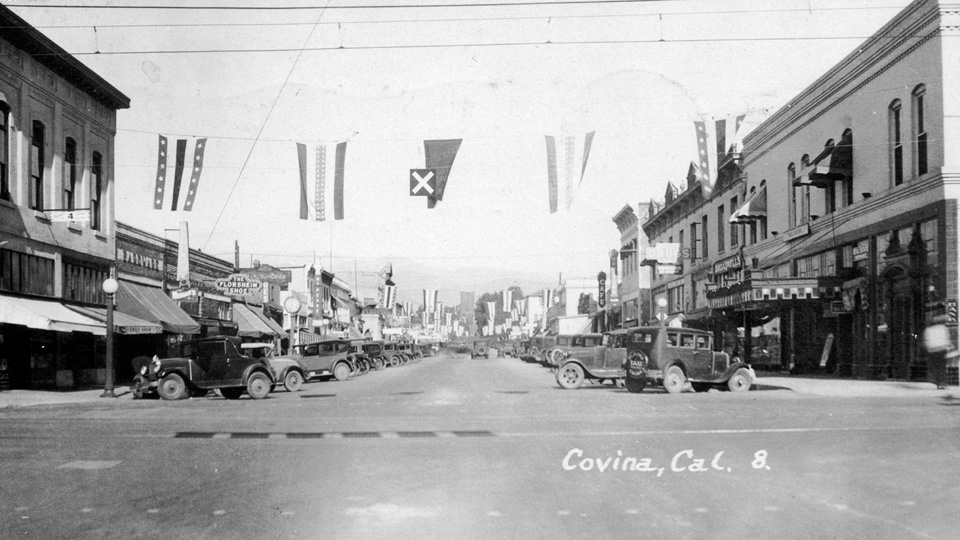

Looking north on Citrus Avenue from its intersection with Badillo Street. The original canopy of the Covina Theatre can be seen at right.
Click on image for a larger view.


Just eyeballing the cars and the star-spangled bunting hanging over Citrus, my first thought was the photo might be from a 4th of July in the late 1920s. The postcard was mailed April 28, 1930, so obviously the photo couldn't have been taken any later than that.

I also recognized signage seen in this earlier post showing Citrus Avenue in the mid-Twenties (below)–in particular the McPeake cigar sign at 125 N Citrus–so I knew I had to be looking at sometime between 1925-1929.
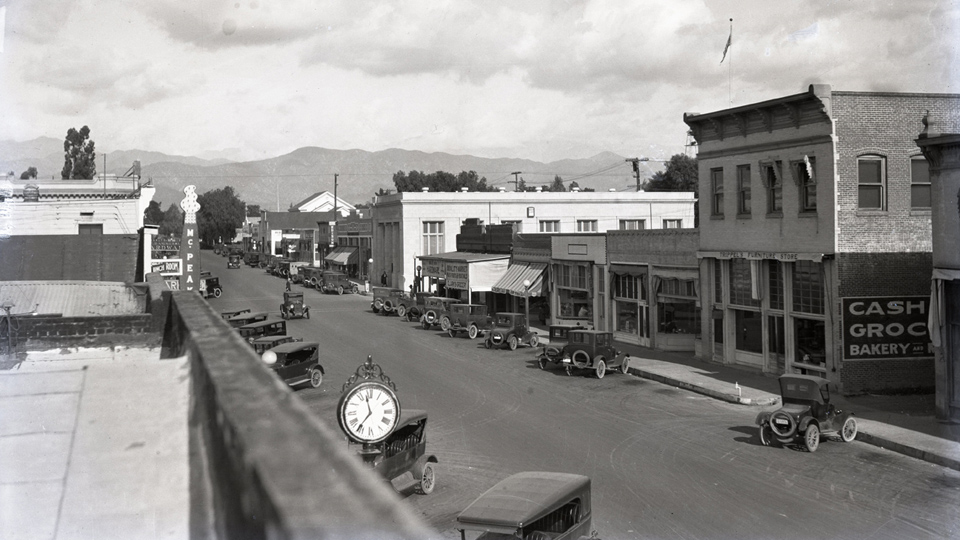

North Citrus Avenue in 1925.


Looking more closely, I noticed a distinctive roof line, just barely visible in the distance. Known as the Logan-Stead Building in my day, this was the earliest view of Citrus I could remember seeing it there.
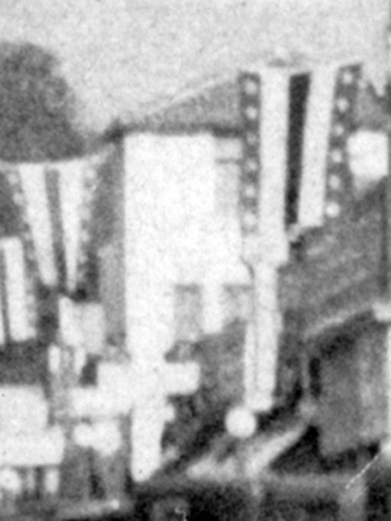


So when was it built? Searching the online archives of the Covina Argus, I found out that site-clearing for what was originally known as the Oddfellows Building had commenced in July, 1929,1 so that ruled out Independence Day of that year. Then I thought it might be Armistice Day–what we now call Veterans Day–but that didn't become a national holiday until 1938. So if it wasn't July 4th or Armistice Day, why all the patriotic decorations?

This called for a much closer look. Examining my 1200dpi scan, I could make out some diagonal LETTERS near the top of the center banner:
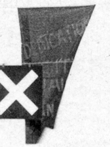

A-ha! Seeing "DEDICATION" there brought to mind one of the first photos of old Covina that I ever added to my digital collection, also of that same building:
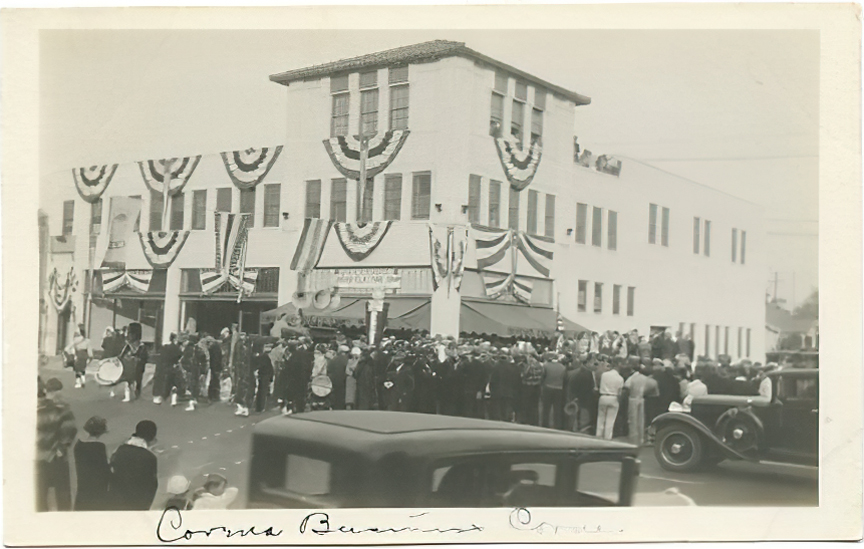

No date on it, but it clearly shows the dedication ceremony of the new Oddfellows Building, and there, strung across Citrus, can be seen banners identical to those in the original postcard photo!

So now I feel virtually certain that my mystery picture was taken during the first week of December, 1929, immediately prior to the official opening of the Oddfellows Building on December 7:2 94 years ago today.
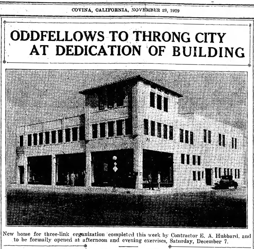

Covina Argus, November 29, 1929.


Some additional history on this once-important downtown edifice.

The Oddfellows Building was purchased by Thomas P. Logan and Sam Stead in 1941.3 For many years thereafter, it housed Logan Hardware and several other retail businesses, and was a meeting place for a number of fraternal organizations and service clubs.
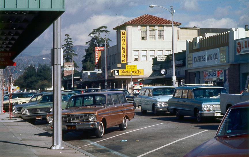

The Logan-Stead Building in the mid-Sixties. Source: Facebook, I Grew Up In Covina; photographer unknown.


In its final years, the structure fell into disrepair and was ultimately abandoned. It was destroyed by arson and the site cleared in the early Nineties.4

The northeast corner of Citrus and Italia today:
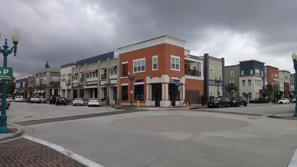

Photo by J Scott Shannon, March 20, 2023.


I really must apologize for the long hiatus. There were so many things I had in mind to write about Covina history this year, but the business of life has kept me almost continuously occupied. I hope to do better in 2024.

References:

1 Covina Argus, July 12, 1929, p.1.
2 Covina Argus, November 29, 1929, p.1.
3 Covina Argus-Citizen, November 29, 1946, p.1.
4 Bob Findley on the "I Grew Up In Covina" Facebook group.
Newspaper clipping courtesy Newspapers.com.
 

Saturday, September 24, 2011

I-10 at Holt, 2011 & 1938


Click on image for an enlargement.

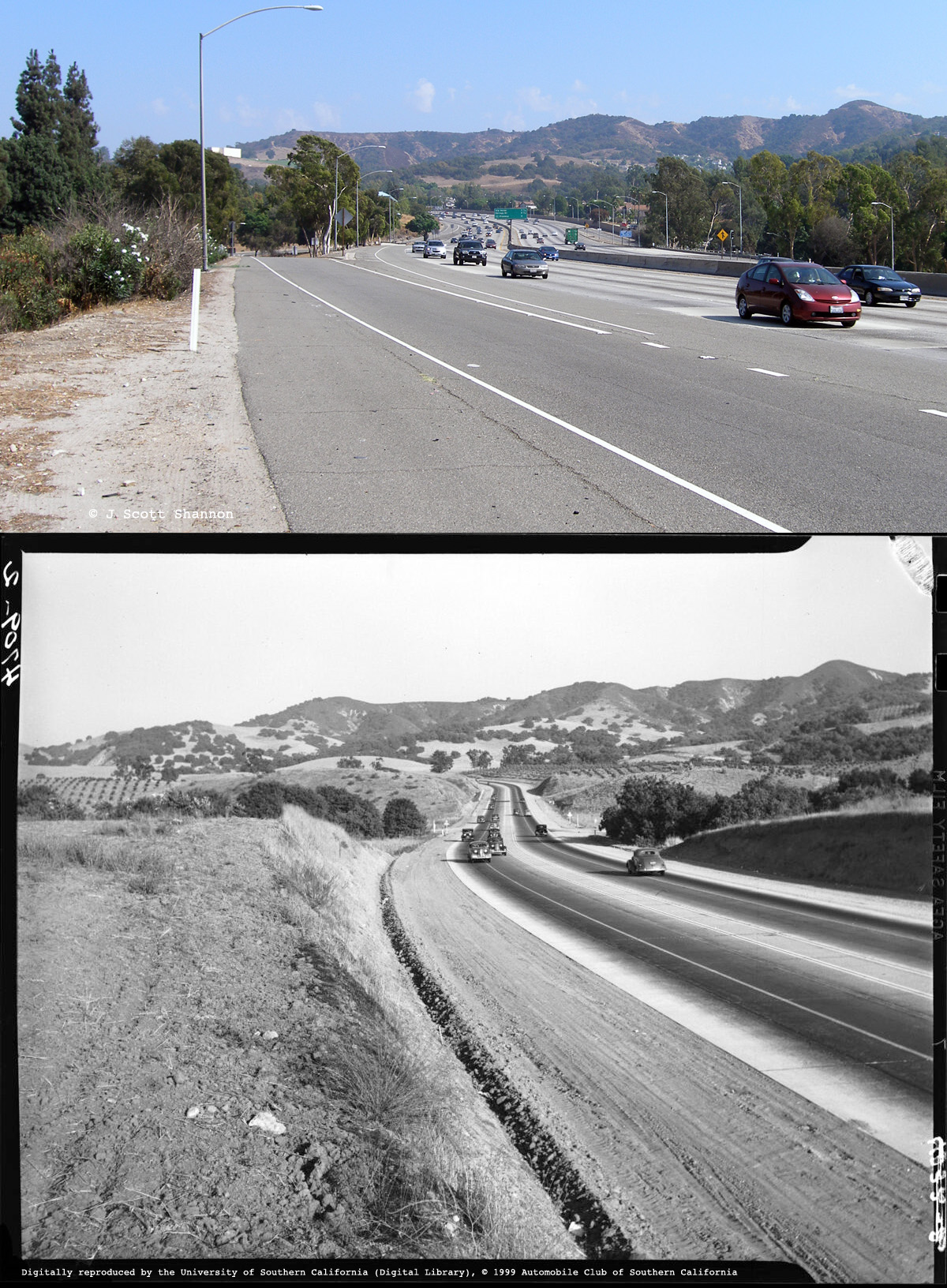
The first highway between the east San Gabriel Valley and the Pomona Valley was built in 1933. It was called Arroyo Avenue, and was designated as part of U.S. Highway 99. In 1957, US-99 was widened and became the San Bernardino Freeway, and when it was added to the Interstate Highway System in the early 1960s, it became what we know today as Interstate 10 (I-10).

In these views, we are looking east toward Pomona just west of the highway's intersection with Holt Ave., east of Covina. The top photo was taken in the present day; the bottom one in 1938.

Top photo © 2011 J Scott Shannon, bottom photo © 1999 USC Digital Library/Automobile Club of Southern California.


Friday, November 9, 2007

My Hills, Then & Now

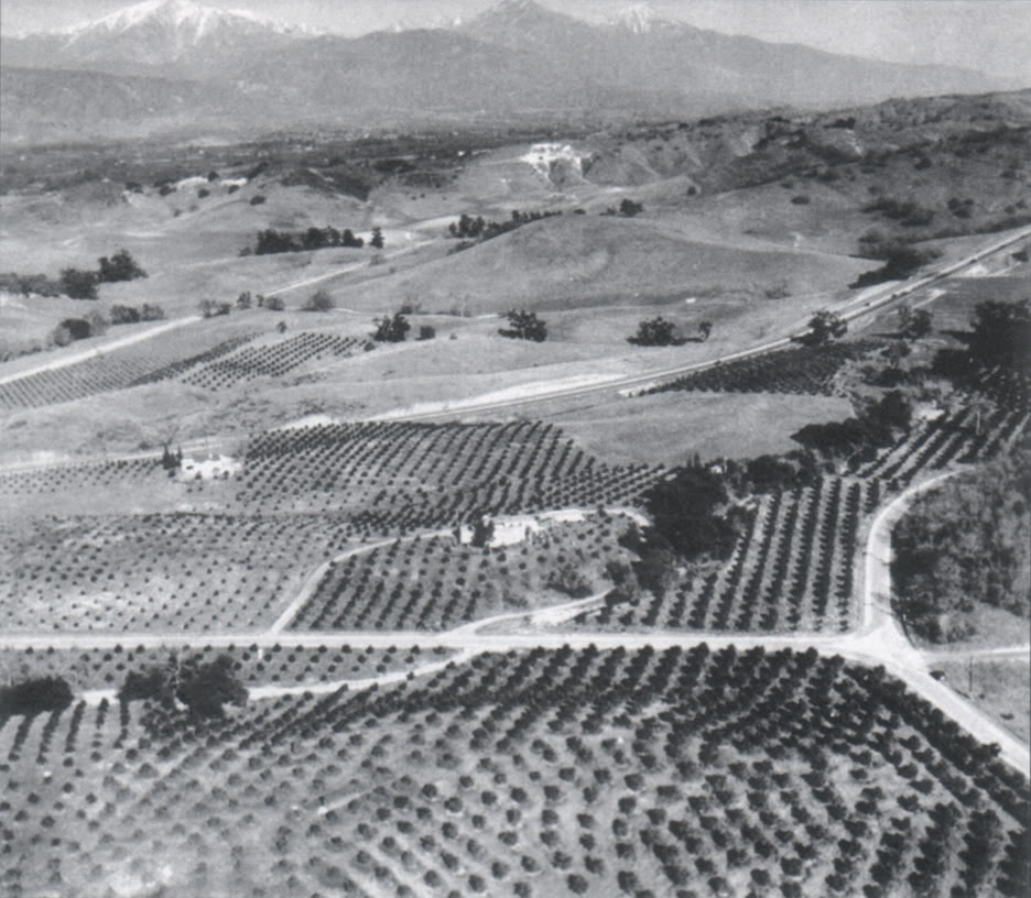
Last week, quite unexpectedly, a lifetime's dream of mine came true. I've finally been able to see what the Covina hills I lived in as a child originally looked like before they became part of Los Angeles's spreading metastasis.

See that outcrop of white limestone on the hill in the background? That's what we kids called the "Chalk Mine." Down and to the right from the chalk mine can be seen a much smaller patch of white. In 1959, my family's house would be built just to the left of that. So these were my hills, circa 1935, about 20 years before I was born.

I'm just totally blown away by this image. The whole little valley I lived in–and everything around it–was entirely undeveloped, open rangeland. Nothing but wild grasses, chaparral, live oaks, walnuts and orange groves.

It is a vision of Heaven to me... a true Paradise Lost.

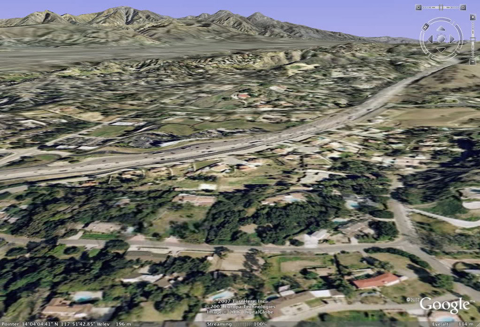
And here is the same scene today, courtesy of Google Earth. The then-newly-constructed Arroyo Avenue (U.S. Hwy. 99) in the old photo is now Interstate 10, and virtually all the formerly open spaces are now occupied by homes and businesses. It's become just another faceless L.A. suburb.

I'm grateful that I lived long enough to be able to see my hills the way they originally were. The chalk mine is long gone, but there's still a small refugium of undeveloped hills just past where my house was. Bulldozers may not have claimed it yet, but no coyotes howl, no jackrabbits scurry, no pheasants fly, no tarantulas crawl there anymore, like they did when I was little. It's all dead land now, fit only for humans.