Showing posts with label aerial photos. Show all posts

Monday, June 22, 2026

Citizen Casad

If you've followed my blog for any significant length of time, you know I enjoy collecting old Covina postcards and learning about the people who wrote/received them. Well, this may not be a postcard, but in terms of discovering someone, I really hit the jackpot here!


To see the Hollywood received postmark on the verso, click here.

The first thing I noticed about this old envelope was its fine-grade Irwindale postmark. (Irwindale in this case being the original Irwindale, i.e. turn-of-the-last-century West Covina, not the modern-day incorporated city to our northwest.) Then I pondered the fancy cursive that closely resembled my grandmother's, and deciphered the addressee's last name as "Casad." Ahh, that's a street in Covina/WC! Could this maybe be the person it's named after? Then, only minutes later, a quick newspaper search introduced me to Mr R. C. Casad, who has turned out to be one of the more remarkable historical Covina personages I've ever had the pleasure to meet.

In our Civics class at South Hills, I remember Mr. Douglas telling us that the framers of the Constitution intended that Congress be comprised of regular citizens elected by the community who would then come to the nation's capital for a two-year term and represent their constituents. Sounded great on paper, but of course, the system we ended up with was career politicians representing their party and themselves over and above anything else. Not so great...

Covina's Roland C. Casad, however, was a throwback to the Founders' ideal, and much more—a common man who sought not only to stand for his district, but who sincerely desired to improve the lives of all the people and bring prosperity to the entire country. To that end, he tirelessly ran for national elected office 11 times from 1932-1948, including 4 times for president.

Saturday, March 7, 2026

The Hollenbeck Palms

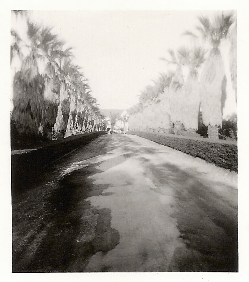
Recently, I added this very early C. W. Tucker photo postcard to my Covina ephemera collection.


Click on the image above to view a clean enlargement.

Although the view looks very different today, and the palms are way taller now, I doubt someone who grew up in Covina would have too much difficulty recognizing where this picture was taken.

But, just in case not, we are looking north on Hollenbeck Avenue from only a few feet north of its intersection with Badillo Street.

And the year? Well, let's play history detective and see what we can come up with!

Tuesday, November 18, 2025

Plaza Progress

Something more recent for a change!

The regional indoor shopping mall known today as Plaza West Covina is a half-century old this year. Originally called West Covina Fashion Plaza, its grand opening took place September 25, 1975.1

A couple weeks ago, I discovered a newly-available series of aerial photos on the UCSB Geospatial Collection website which appears to have been taken to document the yearly progress of the BKK landfill in the San Jose Hills. Far up near the top edges of these photos, however, were glimpses of the main West Covina shopping center which is the subject of this article, and they visually document in detail how the Plaza under its various names has evolved over time.


All photos courtesy of UCSB Geospatial Collection; captions and credits below. Click on the image above to view an enlargement.

1973: The last year of the original West Covina Plaza shopping center, which first opened in October, 1956.2

1974: Construction of the new indoor mall.3

1975: The completed West Covina Fashion Plaza.4 The west wing of the old Plaza was demolished, temporarily sparing the building formerly occupied by J. C. Penney.

1977, 1992: The east wing of the old Plaza was kept open for business until its demolition commenced in Fall, 1991.5,6

1995: This configuration has remained relatively unchanged to the present day,7 except that the building formerly occupied by Tower Records and Desmond's before that was demolished in 2009.

More dates, photos and factoids below!

Sunday, October 6, 2024

The Founder's House

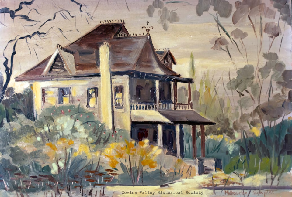
In the early 20th century, the citizens of Covina all recognized this ornate manse formerly standing at the southwest corner of San Bernardino Road and Hollenbeck Street as the house of the city's founder: Joseph S. Phillips (1840-1905). Despite its past status as a local landmark, over time its origins became obscured, and confusion has arisen in recent years about exactly whose house this was.


Painting by Melbourne Sumpter, image courtesy Glenn Reed/Covina Valley Historical Society.


Two specific facts about the place are undisputed:

• The first house on that site was built by pioneer José Julian Badilla after he and his elder brother Pedro bought the land in 1876.1,2,3

• In 1882, after Joseph Phillips agreed to buy 2,000 acres of then ex-Badilla land from J. Edward Hollenbeck (1829-1885), Phillips moved into Julian Badilla's former home.1,3,4

Most latter-day historians have also presumed that this two-storey Queen Anne Victorian is the same house built by Julian Badilla.1,4 However, could it be that Phillips replaced the original structure with a home of his own? Fact is, we don't know for certain one way or another, because there is no surviving record of who actually built the old landmark, or when.

In this article, I will attempt to answer the "who and when" with information that is now available, specifically maps that were published in the 1870s and 1880s, modern-day photographic and descriptive evidence, logical deduction and parsimony.

Saturday, May 23, 2020

Covina On the Cusp

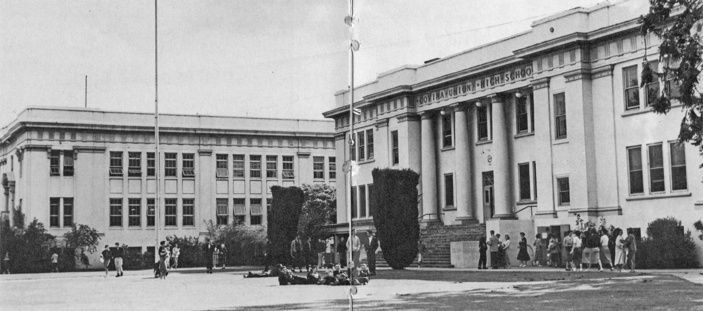
Title page of the CHS Cardinal yearbook from 1954: the year I was born in Covina. It shows my home town on the cusp of its transition from citrus-growing capital to suburban residential community.


Click for full-res image.

Still more groves than subdivisions at this point, but that wouldn't be the case for much longer.

The old high school would soon be no more, as well. CHS began transitioning to a new location on Puente at Hollenbeck starting in Fall, 1956. That same year, students from West Covina attended classes at the old campus until their own new high school would be ready in 1957. In 1958-1959, it became an all-freshman high school, where students from all over the area waited for Northview, Charter Oak, and Edgewood to be completed. After closing completely in 1961, the main building was repeatedly vandalized, and in June, 1962, the gymnasium was destroyed by arson. The entire complex was subsequently demolished.


Covina High quad, 1954. Science Hall annex at left. Click for full-res image.


Wednesday, March 7, 2018

The Ruddock Mansion

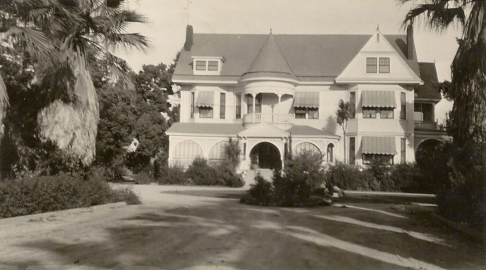
"Mountain View" was the winter home of Chicago lumberman Charles Homer Ruddock (1848-1929) and family.1,2 In March, 1888, Charles's father, Thomas Sanderson Ruddock, had purchased 204.6 acres of Hollenbeck Ranch land from Moye Langley Wicks:3 a huge parcel which lay east of Grand Avenue and the new town of Covina. However, the elder Ruddock died suddenly in Los Angeles on January 17, 1890,4 so he didn't live to see the grand estate that his son built and completed there in 1891.5

In pioneer times, the extravagant 3-story Queen Anne-style mansion1 was the showpiece of the entire Azusa Valley (as the Eastern San Gabriel Valley was called back then).6 According to Covina historian Barbara Ann Hall, Mountain View...

...had 11 7 bedrooms, 5 4 bathrooms, and 7 8 fireplaces of Belgian tile and rosewood. A stained-glass window looked down upon the staircase. There were stained-glass chandeliers in the ballroom. Surrounding the mansion were stables, a carriage house, a bunkhouse, servants' quarters, and a caretaker's cottage. The 800-foot 650-foot drive was lined with palm trees and roses.1

In 1910, Mountain View was sold to Conrad C. Kohlmeier,7 and through his son, William, portions of the former Ruddock lands stayed in the Kohlmeier family into the 1940s.

Ironically, for all its local fame in bygone days, few photographic images of Mountain View were known to have survived. Recently, however, I made the acquaintance of Mary Elarton Kidd–whose great aunt was one of the last residents of Mountain View–and she has shared with me many photos of the ranch which have never before been seen by the public.

To the best of my knowledge, this is the most detailed picture in existence of Covina's lost Victorian treasure. It shows Mountain View not long after John and Mary Chrastka bought the 27-acre mansion property in 1927.8


The Ruddock Mansion, 1891-1956. Photo courtesy Mary Kidd. Click image to enlarge.

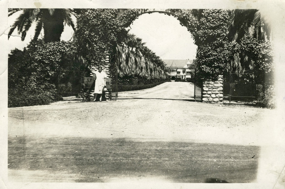
The entrance to Mountain View, formerly located at 522 North Grand Avenue9 at the eastern end of San Bernardino Road. The mansion itself was located immediately east of the intersection of today's East Wingate Street and South Westridge Avenue.


Photo courtesy Mary Kidd.

Planted over 130 years ago, the Washingtonia filifera fan palms that still stand today along East Wingate Street are among the oldest trees in Covina (together with the palms that line Hollenbeck Street). Here they are in the 1940s, when they were already six decades old.


Photo courtesy Mary Kidd.

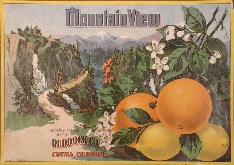
A Ruddock Company citrus crate label:


Image courtesy Calisphere.

Continuing on:

Saturday, June 13, 2015

Featherstone Quarry

We neighborhood kids used to call it the "Chalk Mine." To us, the abandoned quarry looked like something out of the Old West. We thought for sure it had been there since cowboy days; maybe even a hundred years! There were a bunch of other tall tales about the place, but it would be another half century before I finally uncovered its factual history.

Featherstone Quarry was the entrepreneurial brainchild of one David Forbes Meiklejohn (1876-1937):1 a Stanford-educated mining engineer2 who, around 1920, stumbled somewhat serendipitously upon a large deposit of almost pure diatomaceous earth on Chaffee lands in the hills southeast of Covina, and subsequently invested a quarter-million dollars to exploit what he perceived as its "vast wealth."

Extraction of the resource began in late 1920-early 1921, when roads to the site were graded and a processing plant constructed.3 The diatomite was used primarily in the manufacture of insulation,3 tile, pipes and conduits.4 Exactly why and when quarrying ended, however, is uncertain. A geology field report based upon data compiled in 1932 stated that operation of the mine "ceased several years ago,"4 so it may be that Featherstone Quarry did not survive as a going concern past 1930.


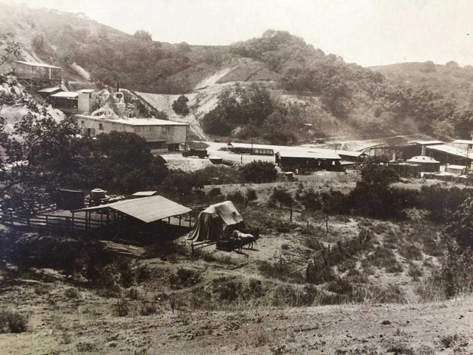
Featherstone Quarry, Covina Hills, 1929. The complex extended from today's Rancho La Floresta Drive at left to the main diatomite mine at right. I-10 now passes from left to right through the low white hill at center. 'Dick' Whittington Studio, photographer. Courtesy of The Huntington Library, San Marino, CA. Link to full-res image.


The processing plant over the hill on the Charter Oak side, mid-1920s. In this photo, we are standing on a spot a few yards down the hill from the end of today's Woodhurst Drive, facing southwest toward the intersection of Rancho Los Nogales Drive and Puente Street. Photo courtesy Covina Valley Historical Society.


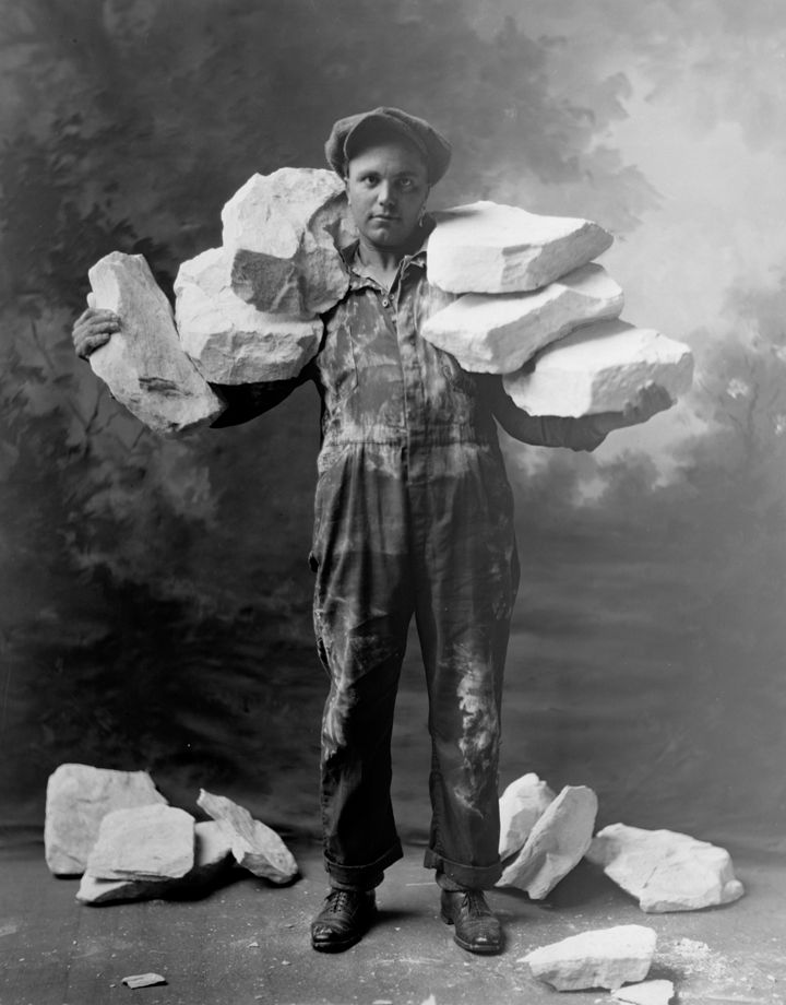
A worker showing why the mine was named Featherstone! The diatomite formed in the Miocene epoch approximately 7 million years ago.4
Image courtesy Covina Valley Historical Society c/o Powell Camera Shop.


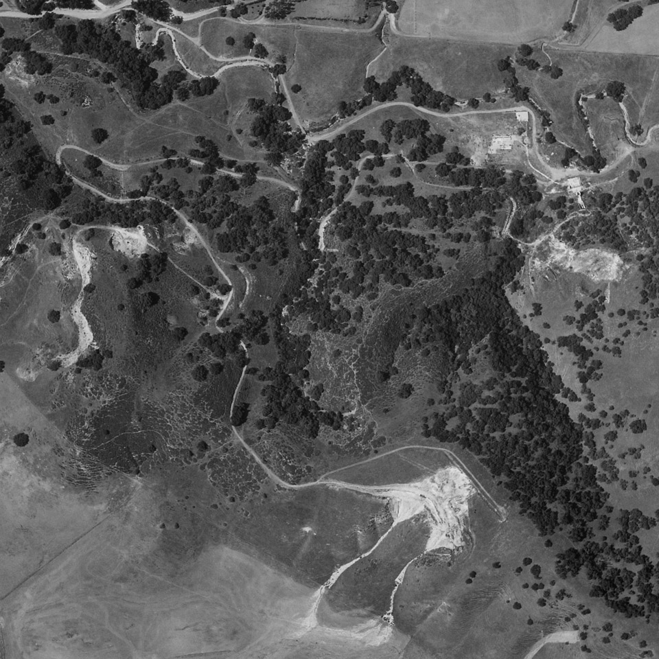
The main quarry (bottom) and its associated roads in 1934. The road at top approximately follows the alignment of today's Puente St.; the road over the hill from the quarry site, Jalapa Drive. Fair use courtesy U.C. Santa Barbara Digital Library, Special Research Collections.


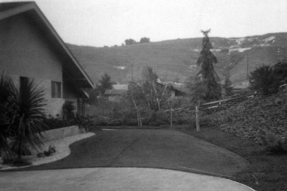
The "Chalk Mine" as seen from our house on Rancho El Encino, June, 1962. What we called the "Quartz Mine" can also be seen to the left of center. Inside that cleft was a thick outcropping of crystalline gypsum.


In 1965, all of the ancient hills north of our neighborhood were bulldozed to create the Covina Heights housing development.

Saturday, March 24, 2012

Oak Canyon Road

Probably not a lot people from Covina ever heard of Oak Canyon Road, but growing up in the hills east of town, I became aware of it at a very early age. Whenever we'd drive past Oak Canyon, its picturesque colonnade of old palm trees would catch my eye, and I'd wonder how they got there. Seven decades would pass before I finally found answers to all of the questions I had about this pioneer-era byway.


Detail of Joseph M. Bloom map showing Oak Canyon Road (green), Covina Hills Road (yellow) and surrounding streets in 1963.

First called Park Street, the now-secluded track southeast of Covina was laid out by the McCarthy Company in 1895: the same year as the westernmost mile of today's Covina Hills Road.1


Tract map from 1895 showing Park Street (green) and the new County Road (yellow) in the McCarthy subdivision of Block 1 of the Hollenbeck Ranch.
Courtesy Los Angeles Dept. of Public Works.

In 1902, Col. Frank Marion Chapman acquired 1,470 acres south of the Pomona-Covina Road,2 and Park Street became the palm-lined carriageway entrance to his Chapman Heights Ranch.

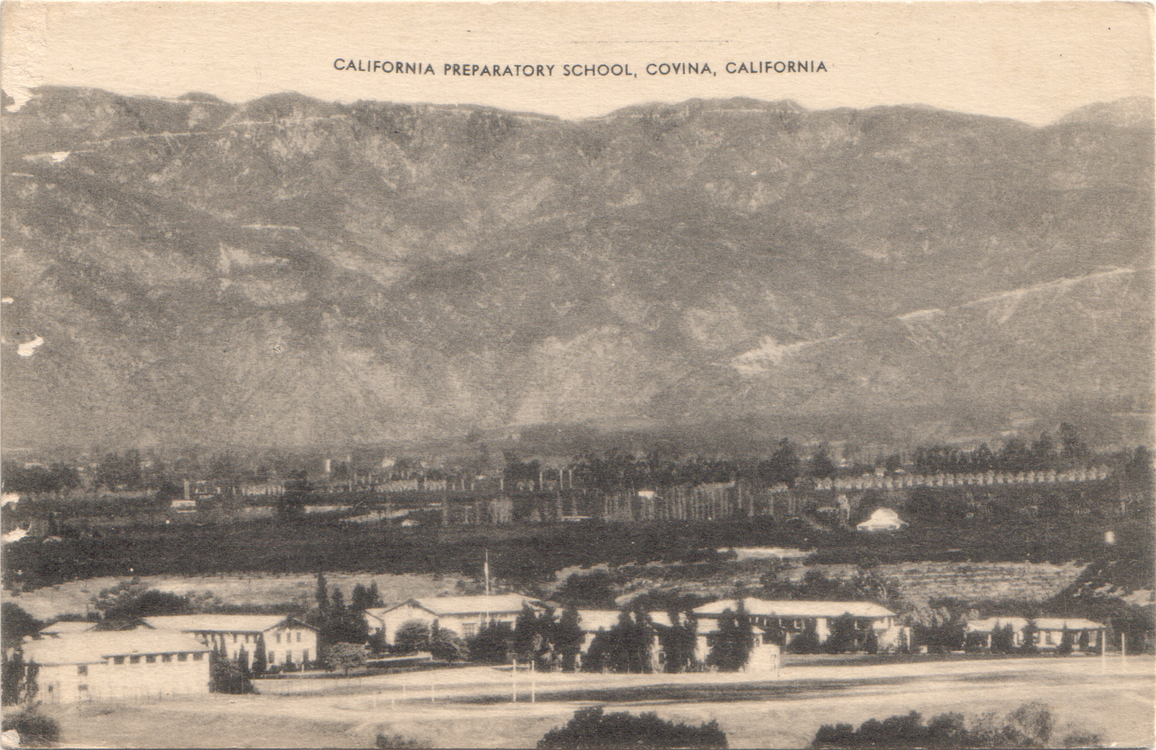
Following the Colonel's death in 1909, pioneer scion Harvey M. Houser bought the northernmost 100-acre portion of the former Chapman ranch.3 In March, 1925, Houser then sold the property to Mr. and Mrs. John H. Henry,4 and the following year, a renamed Palm Drive became the picturesque gateway to the Henrys' new California Preparatory School for Boys located atop the mesa overlooking Walnut Creek.


Aerial view of the new Cal Prep campus and what is now Oak Canyon Road at left, 1927. Courtesy U.C. Santa Barbara Geospatial Collection.

The palms lining the school's entrance road were evidently a kind of mascot to Cal Prep's academic community. Their emblem prominently featured the tropical tree, and they even named their yearbook "The Palm."


Frontispiece of the 1928 Cal Prep annual.5
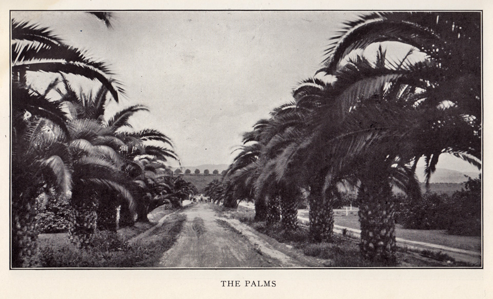

Looking south on Cal Prep's Palm Drive, 1928.5

After the California Preparatory School moved to Ojai in 1942, the campus was taken over by the Theosopical Society Point Loma,6 and it was in 1945 that the first mentions of Oak Canyon Road began appearing in the local newspaper.

The campus changed hands yet again in 1951, then becoming the new home of the California Baptist Theological Seminary.7 This was how I knew the place when our family moved to the Covina Hills in 1959, and I first saw the palms.

As curious as I was back then about Oak Canyon Road, I strictly avoided that area when I was younger, as it had a rather notorious local reputation. Invading swarms of "bad" teenagers took advantage of the secluded road to party and make out. The L. A. County Sheriffs patrolled that road constantly, and in my day it was mostly known as a really good place to go to get busted. The delinquency problem was solved once and for all, though, when Oak Canyon Road was finally closed to all vehicle traffic in the late 1970s when the seminary property was acquired by redevelopers.

The cars and juvies went away, but the palms endured as always—or at least some of them did. The trees used to extend in a uniform line all the way from the base of the bluff to the intersection with Covina Hills Road. I wish I had taken a picture of the palm drive as it looked before a suburban housing development destroyed the trees north of Walnut Creek in 1977 and obscured the view of those that remained. That vista that so inspired me in my childhood only survives in memory now, alas.

Fortunately, though, the southern half of the palms live on, and the old road itself today serves as the gateway to the 82.8-mile-long Schabarum-Skyline Equestrian Trail. I'm very pleased that at least one section of this pioneer-era relic will now be preserved for future generations.

This is my favorite picture from my visit last year to this quiet refugium. It was so amazing to finally walk among these palms and contemplate just how ancient they are. Planted 110 years ago, they are older than almost every man-made structure in the eastern San Gabriel Valley. Living history, hidden in plain sight, yet now no longer the mystery lost to the passage of time that they once were.


Photo ©2011 by J Scott Shannon.

(N.b., The foregoing is a complete rewrite of the original article which, over time, I discovered contained multiple factual errors. This revised version also includes a lot of new information and illustrations that were not available to me 14 years ago. I think you'll agree, this is a much more satisfactory and worthwhile read! —JSS, May 1, 2026.)

References:

1 Map of the McCarthy subdivision of Block 1 of the Hollenbeck Tract, surveyed August, 1895.
2 Covina Argus, May 31, 1902, p.1.
3 Covina Argus, May 14, 1910, p.2.
4 Covina Argus, March 6, 1925, p.1.
5 The Palm, 1928, Annual of the California Preparatory School for Boys, Covina, California, 84pp.
6 Los Angeles Times, May 22, 1942, p.30.
7 Covina Argus-Citizen, January 26, 1951, p.1.


The Baptist Seminary

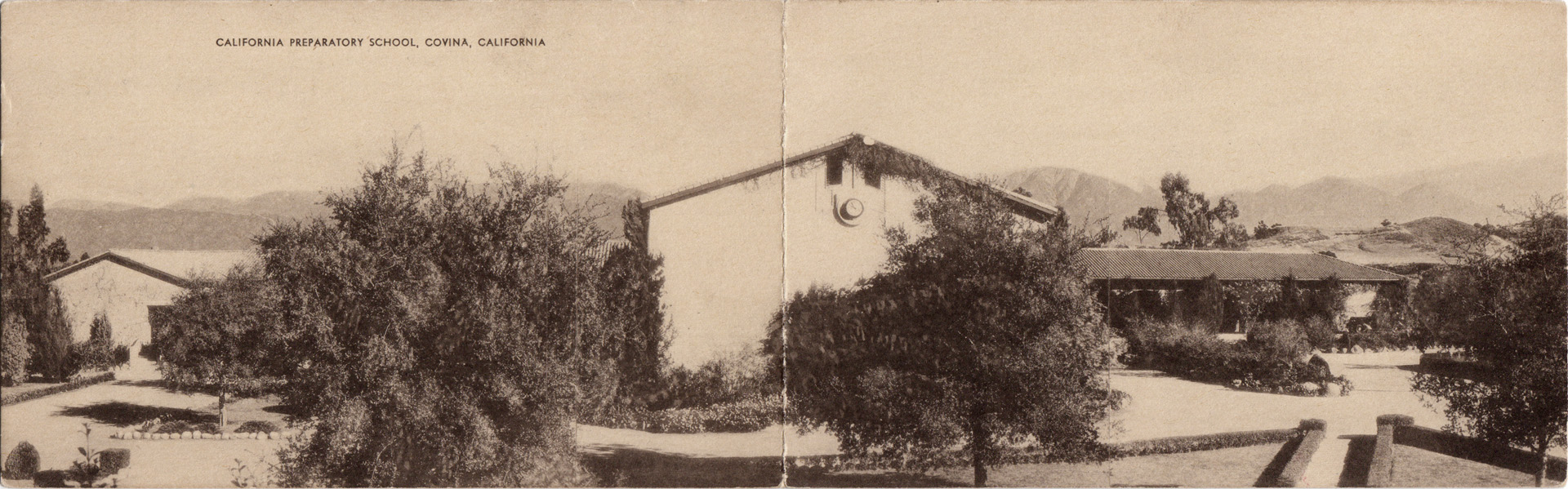
In 1926, the California Preparatory School for Boys (shown below c.1938) was built on the 100-acre H. M. Houser ranch on former Hollenbeck lands southeast of Covina.


Click any image on this page for an enlargement.

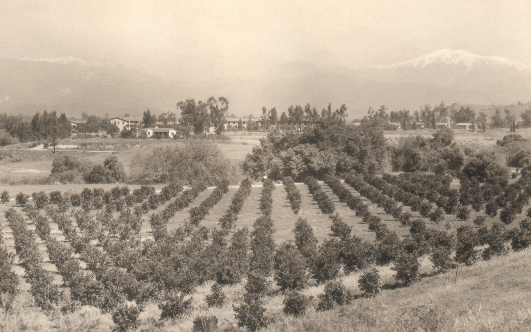
The prep school did well until the onset of WWII, when the ownership, fearing enemy attack (not joking!), moved the entire school to the mountains in Ojai. Consequently, in 1942, the Covina property was sold to the Theosophical Society Point Loma. The south-to-north view below shows the campus in the mid-Forties.


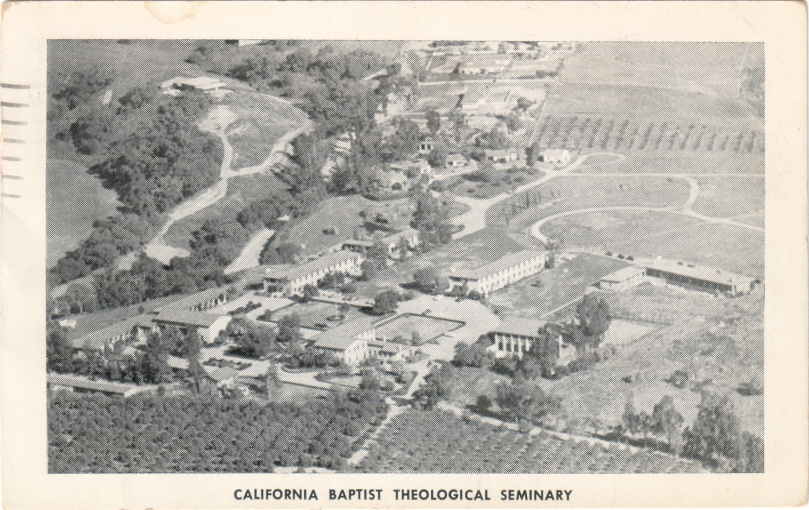
In 1951, the property changed hands again and became the California Baptist Theological Seminary. In this aerial view from c.1955 (below), we're looking generally eastward here; the road to the immediate left of the campus is Covina Hills Road.

Seminary classrooms (left) and one of the dormitories (right). In the early 1960s, that dormitory was also the headquarters of Wally Moon's Baseball Summer Camp. It was the first place I can ever remember sleeping overnight away from home.

The Baptist Seminary conferred its last ministry degrees at Covina in 1974 and moved its central campus to Berkeley. Starting in 1979, the grounds were redeveloped for housing and offices, and almost all of the old buildings were demolished. The gymnasium was initially spared and turned into a racquetball and workout facility, but it was finally torn down in 2005. Today, the only campus structure that remains is the Headmaster's house – Casa Mirasol.


Wednesday, January 5, 2011

Covina, 1940

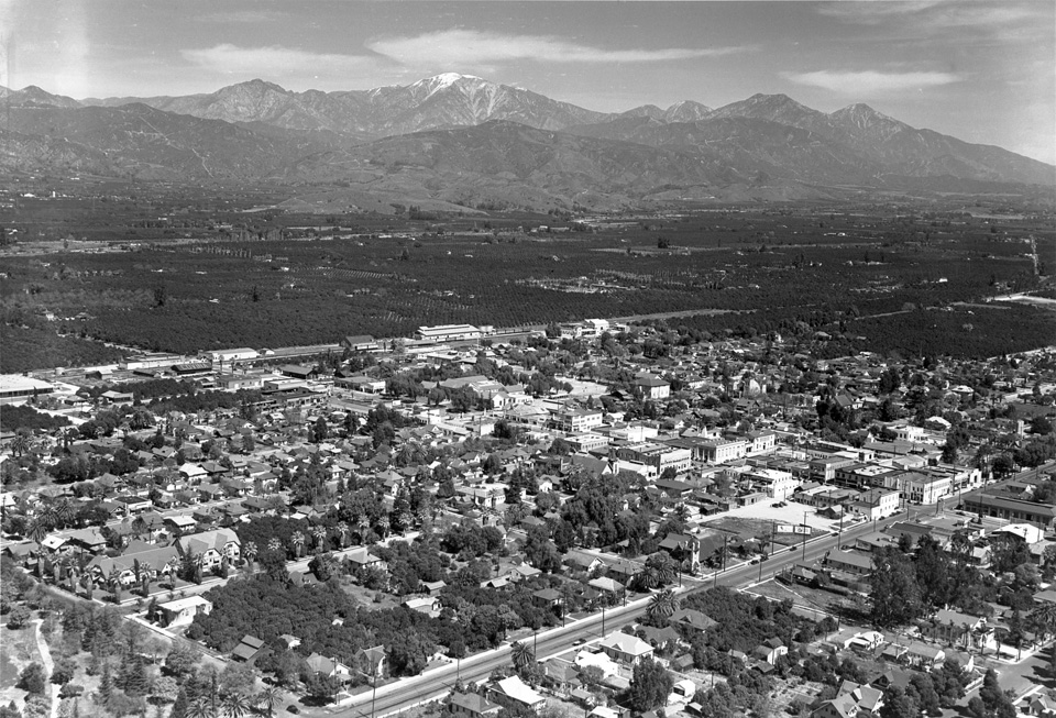
It's amazing the things you can find on the 'net, even when you're not really looking for them. Case in point: this 1940 aerial view of Covina–my home town–14 years before I was born there:


Originally uploaded by A Box of Pictures, and contributed by J. David Rogers. The full-res version of the photo is viewable here.

Let's go exploring!


Friday, November 9, 2007

My Hills, Then & Now

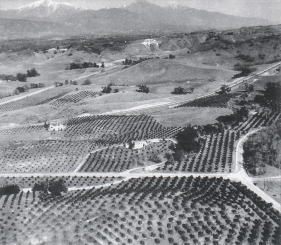
Last week, quite unexpectedly, a lifetime's dream of mine came true. I've finally been able to see what the Covina hills I lived in as a child originally looked like before they became part of Los Angeles's spreading metastasis.

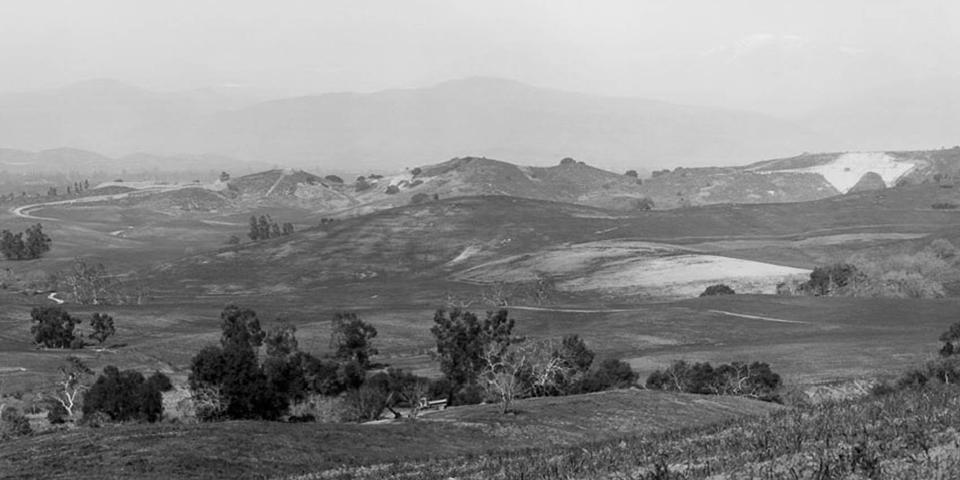
See that outcrop of white limestone on the hill in the background? That's what we kids called the "Chalk Mine." Down and to the right from the chalk mine can be seen a much smaller patch of white. In 1959, my family's house would be built just to the left of that. So these were my hills, circa 1935, about 20 years before I was born.

I'm just totally blown away by this image. The whole little valley I lived in–and everything around it–was entirely undeveloped, open rangeland. Nothing but wild grasses, chaparral, live oaks, walnuts and orange groves.

It is a vision of Heaven to me... a true Paradise Lost.

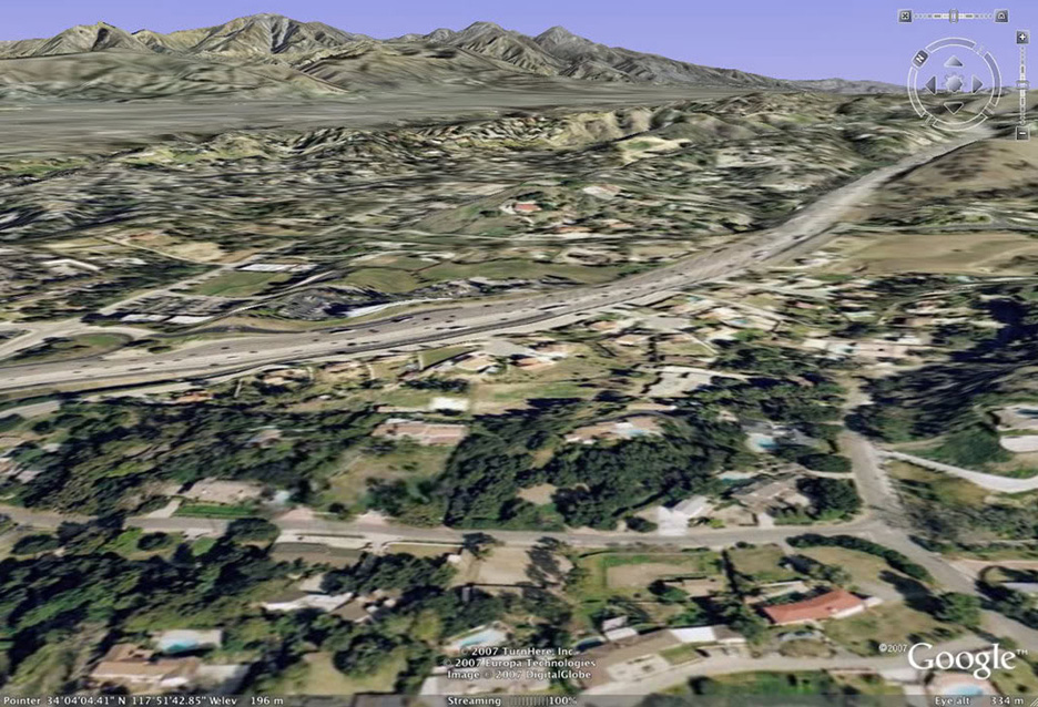
And here is the same scene today, courtesy of Google Earth. The then-newly-constructed Arroyo Avenue (U.S. Hwy. 99) in the old photo is now Interstate 10, and virtually all the formerly open spaces are now occupied by homes and businesses. It's become just another faceless L.A. suburb.

I'm grateful that I lived long enough to be able to see my hills the way they originally were. The chalk mine is long gone, but there's still a small refugium of undeveloped hills just past where my house was. Bulldozers may not have claimed it yet, but no coyotes howl, no jackrabbits scurry, no pheasants fly, no tarantulas crawl there anymore, like they did when I was little. It's all dead land now, fit only for humans.


Monday, October 22, 2007

Covina Bottle

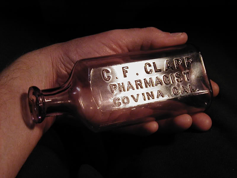
My old medicine bottle collection–which I started 25 years ago–is now complete. I finally have a Covina bottle. I found my Holy Grail at last. Now there's nothing more that I'm looking for. There's no way I could surpass this find, anyway.

So here is my treasure:

(Shows approximate actual size)

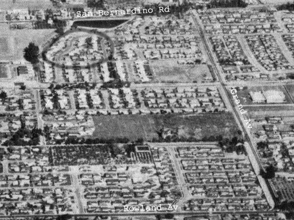
According to the seller, this bottle lay in a surface dump in Covina for about 50 years before I was born there, and 50 more years later, it is mine. The aerial photo below was taken in 1957. The charcoal-circled area near the top was the approximate location of the dump, behind the old city reservoir on San Bernardino Rd. That's where its original collector found it, right around the time I entered the world.


I got the bottle on eBay for only $66. After I won it, I asked the seller what its book value was. He said it had no book value because not enough examples of it are known to exist, so the price I paid is unbelievably cheap. I'm still amazed that there wasn't more interest in the auction (there's a highly-predatory cabal of Covina collectors on eBay, who obviously have a lot more money to throw around than I do). Anyway, a similar medicine from nearby Alhambra from the same seller went for $230, so I really was quite fortunate in this acquisition.