Thursday, November 14, 2019

Covina Souvenir Spoon

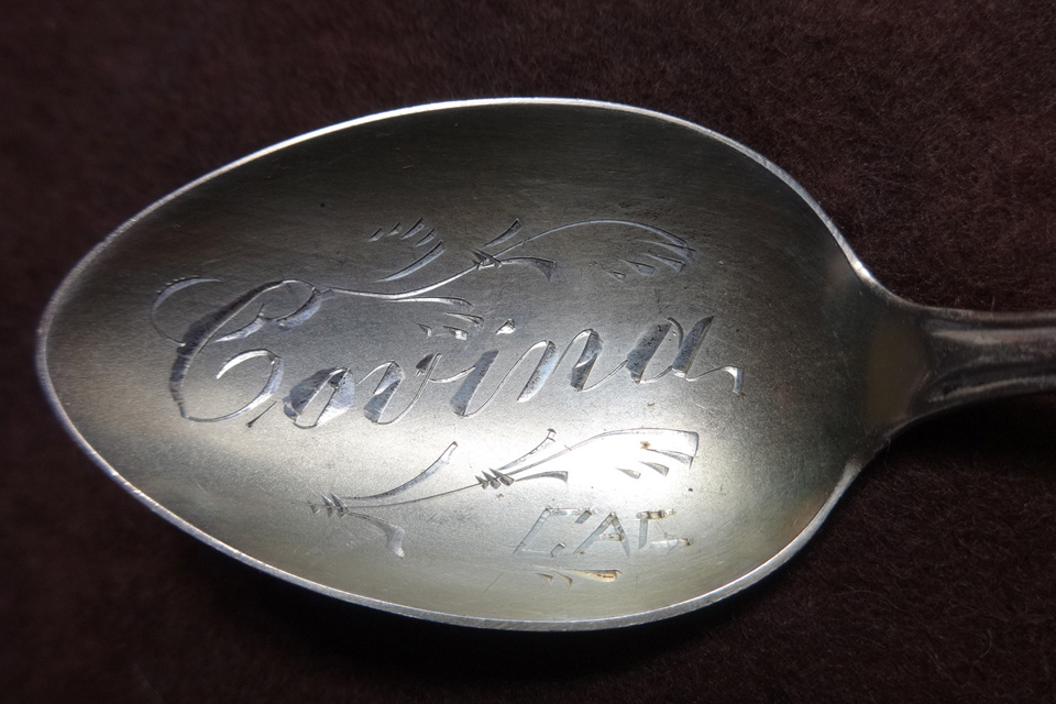
I recently acquired this Sterling silver souvenir spoon, hand-engraved with 'Covina CAL' on the bowl. I'm told it dates to the 1910s.


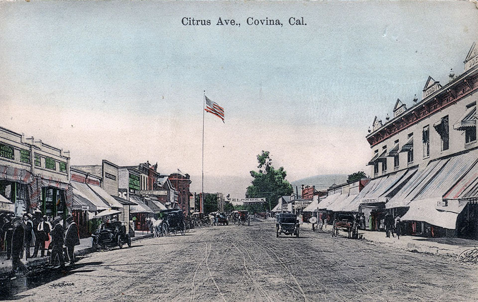
If it is from that period, it might very well have been bought at The Peoples Store on Citrus. This is exactly the kind of knickknack they sold. Clapp's Pharmacy is another possibility. Both carried souvenirs and curios in addition to their regular goods.


"The Peoples Store" can be seen over at the far left edge.

I was really happy to find the spoon. I saw one just like it 10+ years ago but failed to score it. I think my Covina antique collection is complete now. This was kind of the Holy Grail for me.


Tuesday, April 2, 2019

The San Bernardino Road

San Bernardino Road is one of Los Angeles County's oldest historical highways. An important transportation link in pioneer times, today's city of Covina would not have come into existence without it.

In 1810, when California was still part of the Spanish Empire, the friars of Mission San Gabriel built a chapel and supply station 45 miles to the east. The chapel was dedicated to San Bernardino de Siena, which, in the decades to come, would lend its name to a new city, and to the mission trail that originally connected the inland estancia to the mother church and to Los Angeles beyond.


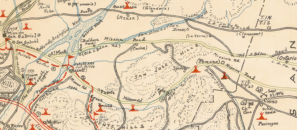
Detail from the Kirkman Map (1937) of historical sites in Los Angeles County, showing the future location of Covina (center) on the "Old S.Bdino. Rd."


It seems likely, however, that the trace which became known as the San Bernardino Road existed even before Mission San Gabriel was founded. The Gabrielinos which populated the valley prior to European settlement were said to have used it to transport logs from the San Bernardino Mountains to build the mission. The Anza expedition is known to have traversed the trail in 1774, as did Jedediah Smith and his party in 1826 and 1827.1

By 1842, when the San Bernardino Road was established as the northern boundary of Rancho La Puente,2 it was already the main east-west travel and freighting route between Los Angeles and what was then called the Azusa Valley.1 The old thoroughfare was upgraded to a county road in 1879,3 when it was widened and straightened to its current alignment.

In 1882, recognizing it as an ideal location for a townsite, Joseph S. Phillips bought 2,000 acres of land on the south side of the stage road and founded Covina there three years later.2,4

Many early "firsts" in the Covina area took place along the much-traveled track.2

  • The first general store: Goldsmith's "Four Corners" mercantile, just west of today's Orange Avenue, 1865.
  • The first community center and church: Grange Hall, on the south side, 500 feet west of today's Vincent Avenue, 1870s.
  • Covina's first schoolhouse, corner of Citrus Avenue, 1883.
  • First irrigation reservoir–foundational to Covina's citrus industry–west of Grand Avenue, 1886.
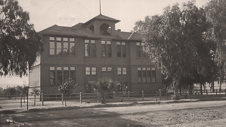
  • The city's first high school (pictured below): on San Bernardino Road behind the grammar school, 1903.


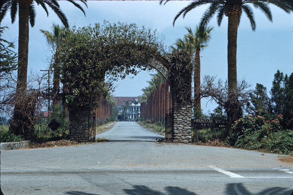
Some of the earliest houses in the lower Azusa Valley were built along San Bernardino Road. The most historically notable were the two homes built by the Badilla brothers in 1876,5 just west of today's Hollenbeck Avenue, and Thomas S. Ruddock's Mountain View (1891) at San Bernardino Road's intersection with Grand Avenue.4


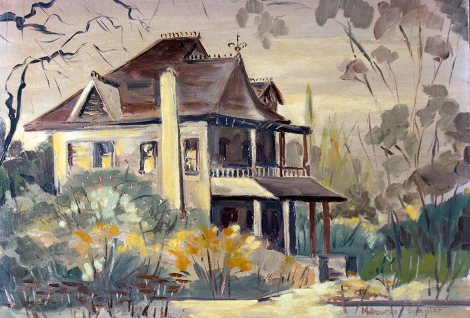
Covina's founder–J. S. Phillips–lived in this Queen Anne manse on the southwest corner of San Bernadino Road and Hollenbeck.
Painting by Melbourne Sumpter, image courtesy Glenn Reed/Covina Valley Historical Society.


The entrance to Mountain View at the eastern end of San Bernardino Road, 1952. This driveway is now the palm-lined stretch of Wingate Street in Charter Oak.
Photo by Bruce Ward Macy, courtesy Marilee Johnson.


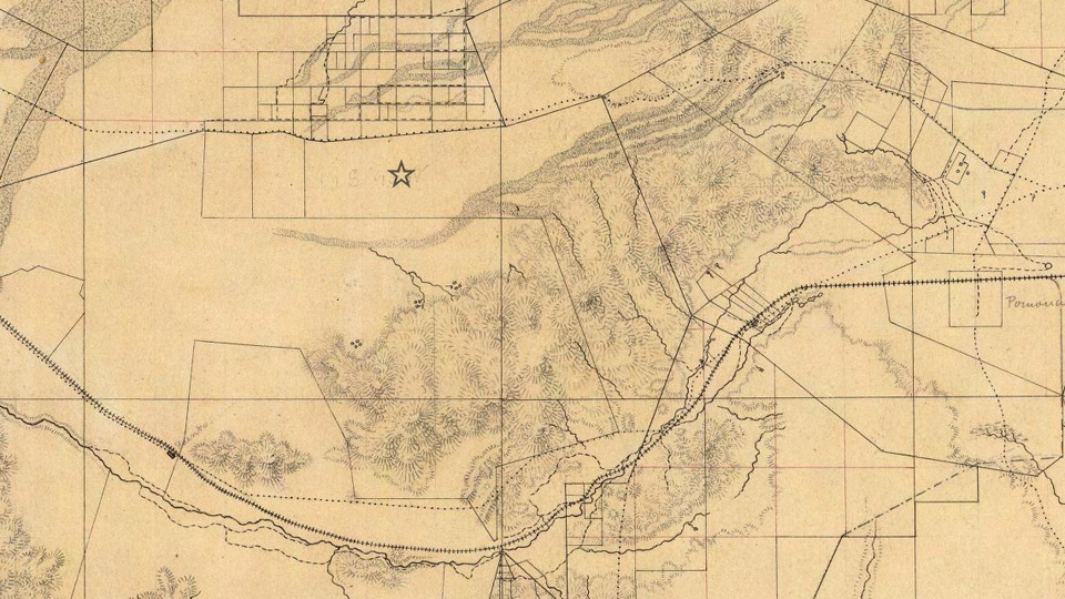
Before the establishment of Mountain View, the San Bernardino Road continued east in a meandering diagonal line up to Mud Springs south of San Dimas, then down past the Casa Primera de Rancho San José in Pomona on its way to its namesake destination.


This topographical map from 1880 shows the original track of old San Bernardino Road (upper dotted line). The star shows the future location of Covina.
The dotted line to the south is another mission road, later to become Valley Blvd. Source: David Rumsey Map Collection.


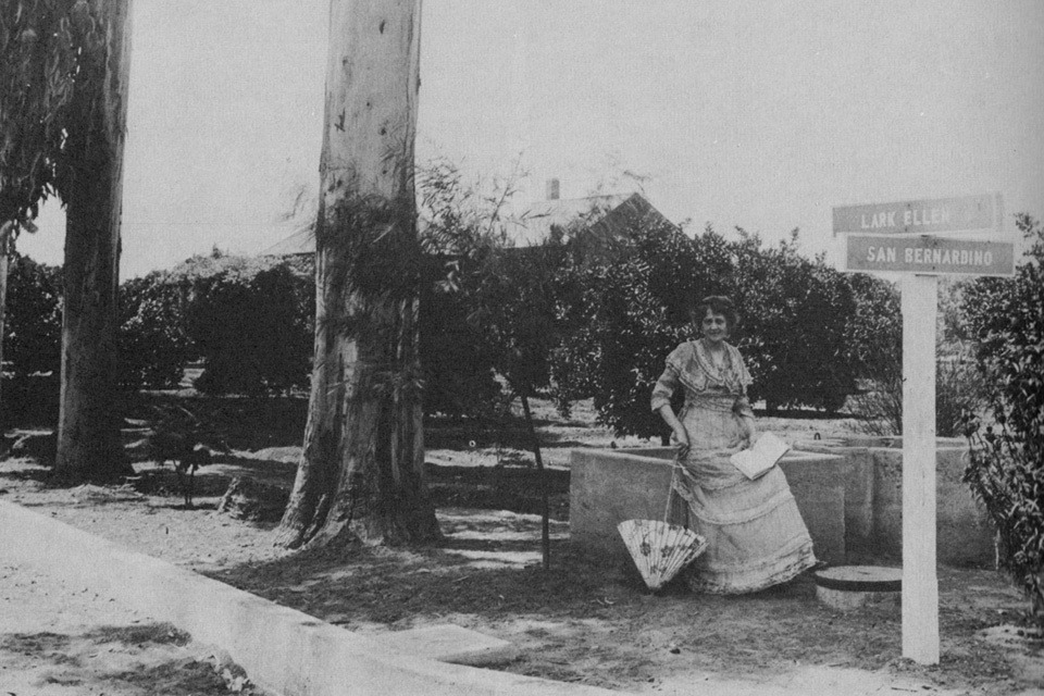
Opera singer "Lark Ellen" Beach Yaw also lived on San Bernardino Road, at the intersection of the street that still bears her name.
Image source: Covina, by Donald Pflueger, 1964.


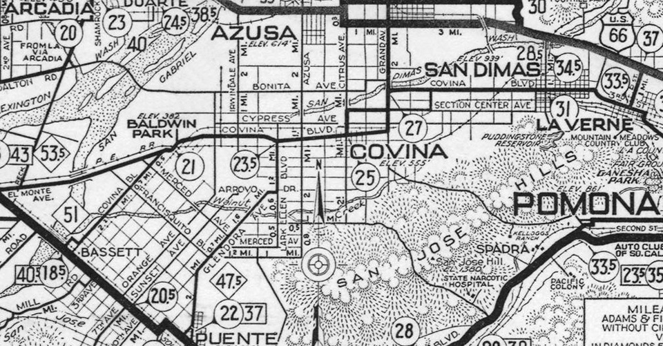
From 1911-1933, San Bernardino Road was part of a 14-mile-long thoroughfare called Covina Boulevard which ran from Bassett to San Dimas,
as shown on this AAA strip map from 1931. (Today's Covina Blvd. was called Section Center Ave. during this period.)


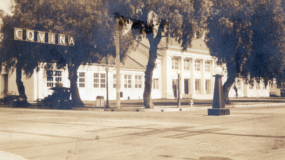
The Covina Grammar School at the southeast corner of San Bernardino Road (then named Covina Boulevard) and Citrus Avenue, mid-1920s. Tucker Studio photo.


Now well over 200 years old, almost all traces of the original San Bernardino Road have been erased, however the portion of it that passes through Covina today is one of the few remaining stretches that preserves the 1879 alignment of the historic Spanish mission trail.


The familiar odd angles of old San Bernardino Road are easily recognized in this detail of the first map of Covina, 1885.
Courtesy Glenn Reed/Covina Valley Historical Society.

References:

1 Head, Harriett R., San Bernardino Road Linked with Southern California History. Covina Argus, January 31, 1930, p.2.
2 Pflueger, D. H. 1964. Covina: Sunflowers, Citrus, Subdivisions. Castle Press, Pasadena, California, 372pp.
3 Los Angeles Herald, June 4, 1879.
4 Hall, B. A. 2007. Images of America – Covina. Arcadia Publishing, San Francisco, California, 127pp.
5 _______. 2012. Covina History Changes. The Citrus Peal, Covina Valley Historical Society, p.9.


Tuesday, November 20, 2018

Badillo – Badilla – or Eaton

...by guest author Glenn Reed
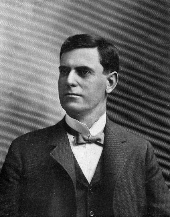

Frederick Eaton (1856-1934), surveyor of the Phillips Tract and the townsite of Covina.
Source: Wikimedia Commons.

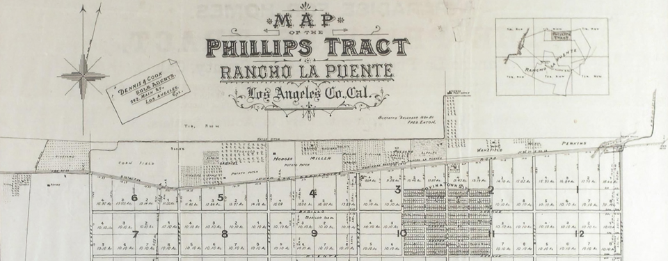
A couple of years ago we, of the Historical Society, were surprised and honored by a visit from some of the descendants of the Badilla brothers. As most of you know the Badilla brothers were Costa Rican coffee growers who came to California about 1875 and, with the intention of raising coffee, bought the land where Covina is now not knowing that this area was far too arid for the cultivation of that crop. In 1882, Joseph Swift Phillips purchased most of that land, decided to subdivide it, and established the town of Covina near its center. He hired Fred Eaton to survey the land and lay out the town site. This was completed, the site map was filed, and maps published in 1885. The map had street names written on it, including "Dexter," the name of Phillips's newborn son, and to honor the previous owners, "Badillo" street. But on the map the Costa Ricans' name was spelled Badillo, with a terminal "o" rather than "Badilla" the the last letter "a" as the brothers' name was spelled.
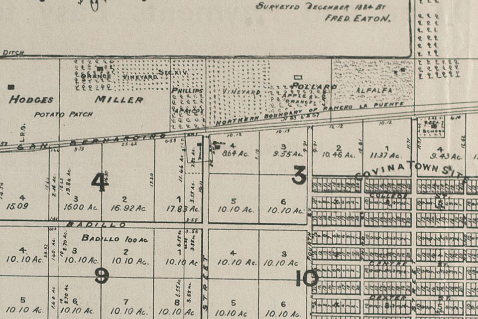

Detail of Eaton's map of the Phillips Tract, showing his spelling of "Badillo" Street alongside a label marking Antonio Badilla's 100-acre plot.
Courtesy Glenn Reed and the Covina Valley Historical Society.

The Badilla descendants pointed the error out, much to our chagrin. Some time later, I noticed an item on Facebook where one of the Badilla descendants suggested that the error was caused by the historical society. This was impossible, of course, as the error occurred in 1885 and the Society was not founded until 1969. But who was responsible for the misspelling? Mr. Phillips? Looking at his cash ledger from 1885-1886, I found more than twenty places where he entered the name Raphael or Vincent Badilla for work they performed on the water ditch from the San Gabriel River. Raphael and Vincent were two of the thirteen children of Antonio Badilla, one of the Costa Rican brothers. There entries were in Joseph Phillips's own hand and the name "Badilla" was written clearly with the "a" as the last letter. So apparently it was not Mr. Phillips as he used the proper spelling. It must have been Fred Eaton or someone in his office. In any event Fred Eaton must bear the responsibility.

Incidentally, Mr. Phillips's Cash Ledger for 1885-1886 is one of the prize treasures of our historical society's collection.

Mr. Fred Eaton made a couple of other mistakes in his lifetime and is remembered more for those than for his many accomplishments. He was born in 1855 in Los Angeles. He became superintendent of the Los Angeles Water Company when he was only 19 years old. Of course his uncle owned the company. Eaton hired William Mulholland as a zanjero and quickly moved him up in the company. Eaton opened his own engineering office in 1881 and did the survey of Covina in 1884-1885. He was appointed city surveyor and then elected city engineer of Los Angeles in 1887 (he was the only candidate).

Eaton designed 6th Street Park (now knwon as Pershing Square), Elysian Park, Westlake Park (now named MacArthur Park), Eastlake Park (now known as Lincoln Park), and the Plaza. His major achievement was the design of a new sewer system for the city of Los Angeles with an outfall to the ocean.

In 1898, he was elected mayor of Los Angeles for a two year term. While mayor he ensured strict enforcement of civil service laws in the city, desegregated the fire department (it was segregated again under the next mayor), created the Los Angeles Water Department, and announced his plan to appoint William Mulholland as superintendent. It was he who convinced William Mulholland that the need for water in Los Angeles could best be satisfied by an aqueduct from the Owens Valley to Los Angeles. For these accomplishments, and many more, he deserves much credit.

But later, acting on behalf of the City of Los Angeles, Eaton bought water rights from Owens Valley land owners while letting them believe that he was an agent for the federal government's reclamation program that was for the farmers' benefit. When it was discovered that he was acting for Los Angeles he was considered a villain and is still remembered for the deception.

Fred Eaton also bought, for his own account, an area called Round Valley near the Owens River. Some years later, after the aqueduct from Owens Valley to Los Angeles had been completed, William Mulholland felt it would be necessary to build a storage reservoir in Round Valley and asked Eaton to sell it to the city. Eaton asked for an amount that Mulholland felt was exorbitant. Their disagreement destroyed a close friendship of 35 years. Mulholland chose instead to build a reservoir on the Santa Clara River behind a new dam – the Saint Francis Dam.

References:
1885 Covina Townsite map
Joseph Swift Phillips's 1885-1886 Cash Ledger
"Fred Eaton, a Second Look," by Anna Sklar
"In Memoriam; Fredrick Eaton," Ramona Parlor
Fred Eaton, Wikipedia
Conversation with Barbara Ann Hall, Ph.D.

This article was originally published in the October, 2016 issue of "The Covina Citrus Peal," the official newsletter of the Covina Valley Historical Society, and is reproduced here with the permission of the author, Covina historian Glenn Reed.

Tuesday, October 23, 2018

Covina On the Rails

Long before Metrolink, rail transportation played a vital role in Covina's history. In 1876, the Southern Pacific Railroad became the first to connect Los Angeles to a transcontinental rail system, but the line passed through Spadra and Puente to the south. The Atchison, Topeka & Santa Fe Railway arrived in L.A. in 1887, but it, too, bypassed Covina: this time to the north, via Alosta, Glendora and Azusa. It wasn't until September, 1895, that the Southern Pacific opened a spur through Covina (today's Metrolink San Bernardino Line), offering service to Los Angeles and points beyond.

The S.P.'s primary purpose was transporting freight, however, so consequently, people who wished to travel by rail had very limited choices in terms of departure and arrival times. Conveniently-scheduled passenger service wouldn't be available to Covinans for another dozen years, when Henry Huntington's Pacific Electric Railway Company came to town.

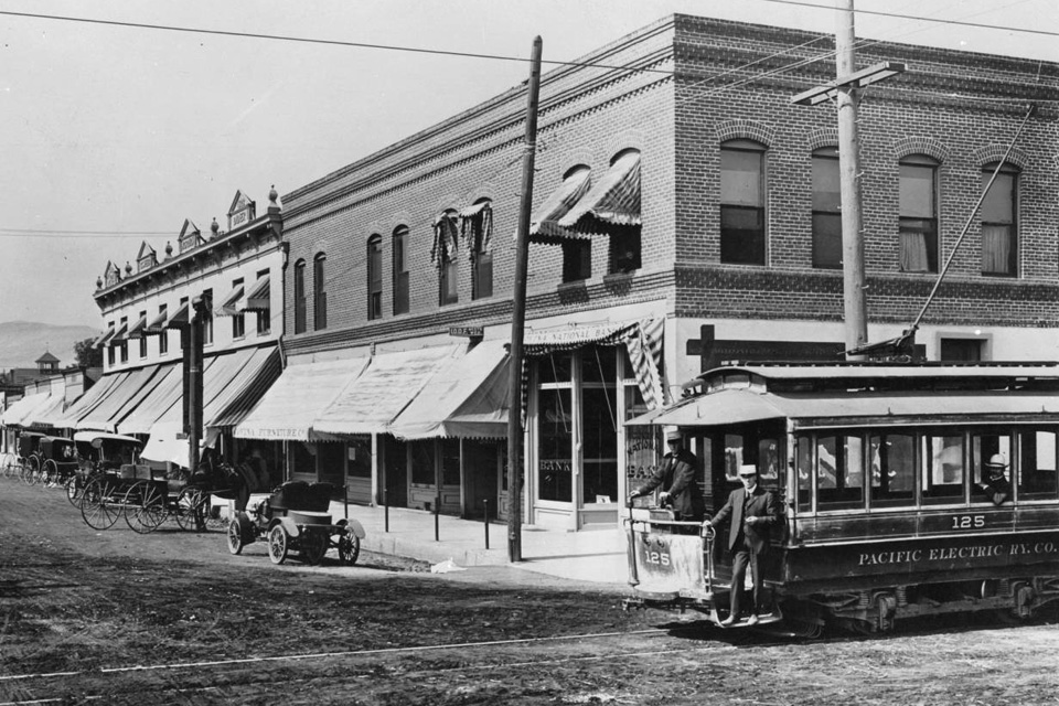
The first spike was driven for the P.E. tracks on Badillo Street on November 5, 1903, but the little trolley shown below only ran between Hollenbeck and Barranca Streets. The Covina segment was opened to the rest of the Pacific Electric system on June 5, 1907.


Intersection of Citrus and Badillo, circa 1905. Courtesy USC Digital Library.

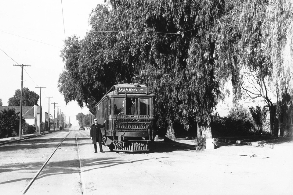
An early interurban Pacific Electric train bound for Covina (below), circa 1910. The original round-trip fare to Los Angeles was 90¢. (Sounds like a bargain, but that's about $25 in today's money.) Ticket in hand, then, a one-way trip to the big city took just under an hour.


Courtesy USC Digital Library.

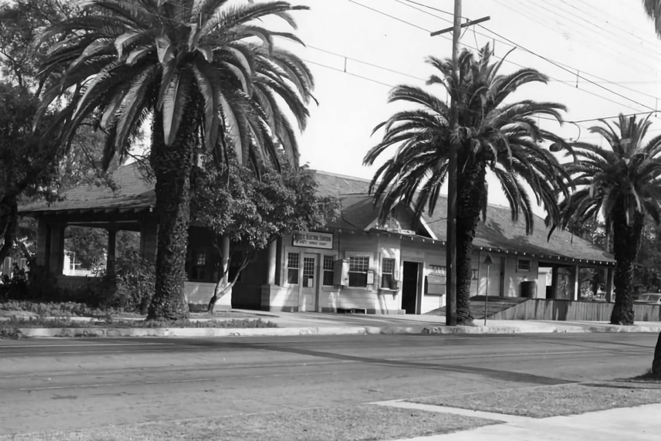
Pacific Electric's Covina station, circa 1937. It was located on the north side of East Badillo Street a short distance east of Second Avenue. It was Covina's commuter connection to the P.E. network from 1915 until 1945 when the line was rerouted to the Southern Pacific tracks north of downtown. All passenger rail service to Covina was discontinued in 1947.


Courtesy Los Angeles Public Library.

Saturday, September 29, 2018

Covina, 1895

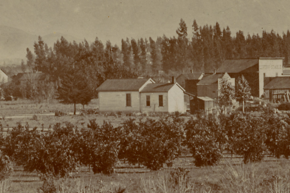
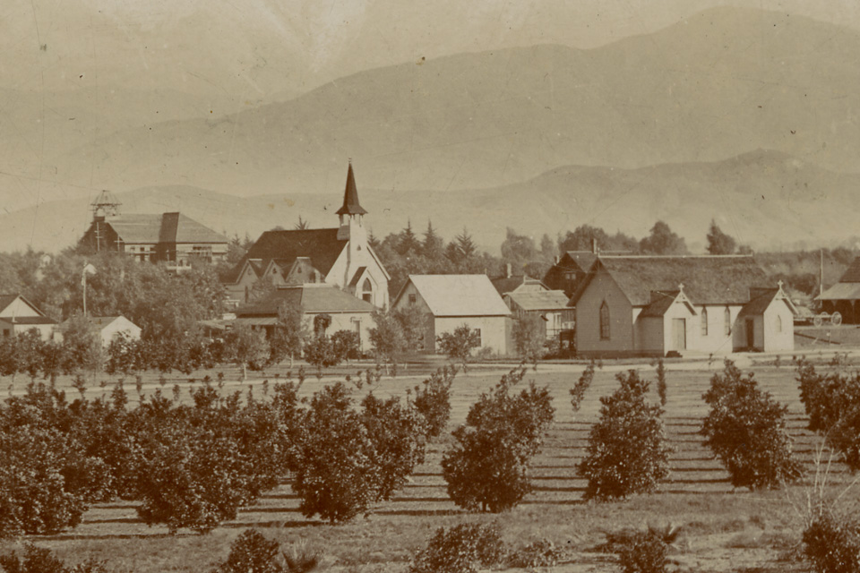
This is the oldest-known photograph of Covina. It was taken in winter, 1894, when the town was only 9 years old. The vantage point is the roof of the home of Mr. Lambert L. Ratekin at 237 South Fourth Avenue. The view is to the northeast, showing Fourth Avenue and the alley between Center and Dexter Streets in the foreground, and in the middle distance, Badillo Street passes from left to right just past the young orange groves.


Courtesy California State Library. Click on image for enlargement.

The photo is also noteworthy for depicting the very first house ever built in Covina.


The Samuel Allison residence (1885), at 160 West Badillo Street.

The image can be dated precisely because the school that we know was built in 1894 (at left, below) can be seen here currently under construction.


Historically-important buildings from l. to r.: the Covina Public School (1894), the Methodist Church (1888) on College Street, and the Episcopal Church (1893) at Badillo and Third.

What the school looked like upon completion:

Monday, September 24, 2018

Earliest Views of Citrus Avenue

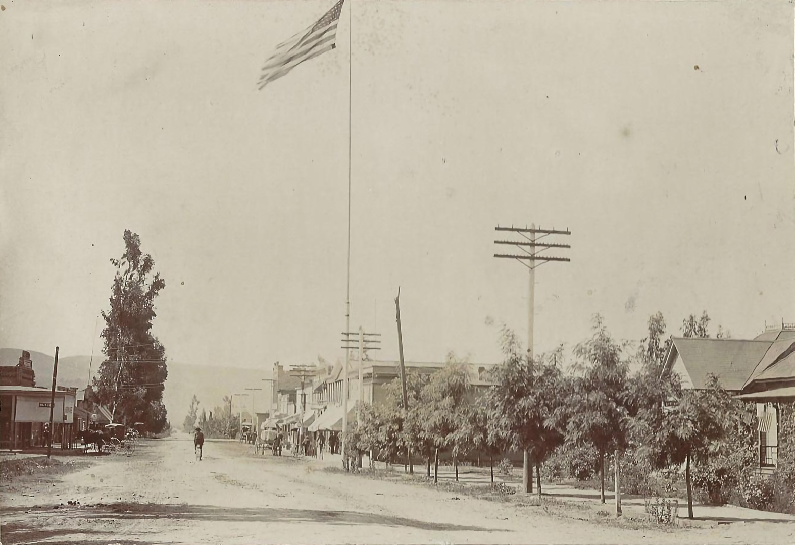
Some time ago, Covina historian Glenn Reed sent me this old photograph of Citrus Avenue, looking south from a vantage point near Italia Street.


Photo courtesy Glenn Reed. Click image for enlargement.

Although the photo bears no date, it can be said with certainty that it was taken in 1898. It can't be any later, because the First National Bank of Covina was built on the northwest corner of Citrus and College (where the flag pole stands) in 1899, but it can't be earlier because I can just barely see the T. E. Finch Block a few doors down, and that was erected in 1898.

Then, only a few days ago, reader Brian Solar sent me this illustrated newspaper article from 1897 that features an even earlier view of Citrus Avenue. Although a simple drawing in its details, I have confidence in its historical accuracy. Look at the eucalyptus tree at right. It's a close mirror image of the same tree in the 1898 photo above.


From the article "Azusa, Covina, Glendora" in the the Sunday, December 5, 1897 edition of the Los Angeles Herald. Source: Newspapers.com, courtesy Brian Solar. Click image for enlargement.

Interesting to note that the flag pole is not depicted in the 1897 illustration, so that must have gone up the following year, too. At left is the then-brand-new Chapman-Workmen Building (1897), still standing today at the northwest corner of Citrus and Badillo. Across the street, however, the lot appears vacant. The Reed Block (and what later generations would know as the Covina Theater) would be built on that site in 1900.


The complete newspaper page: