Monday, August 26, 2013

75 Years Ago Tonight

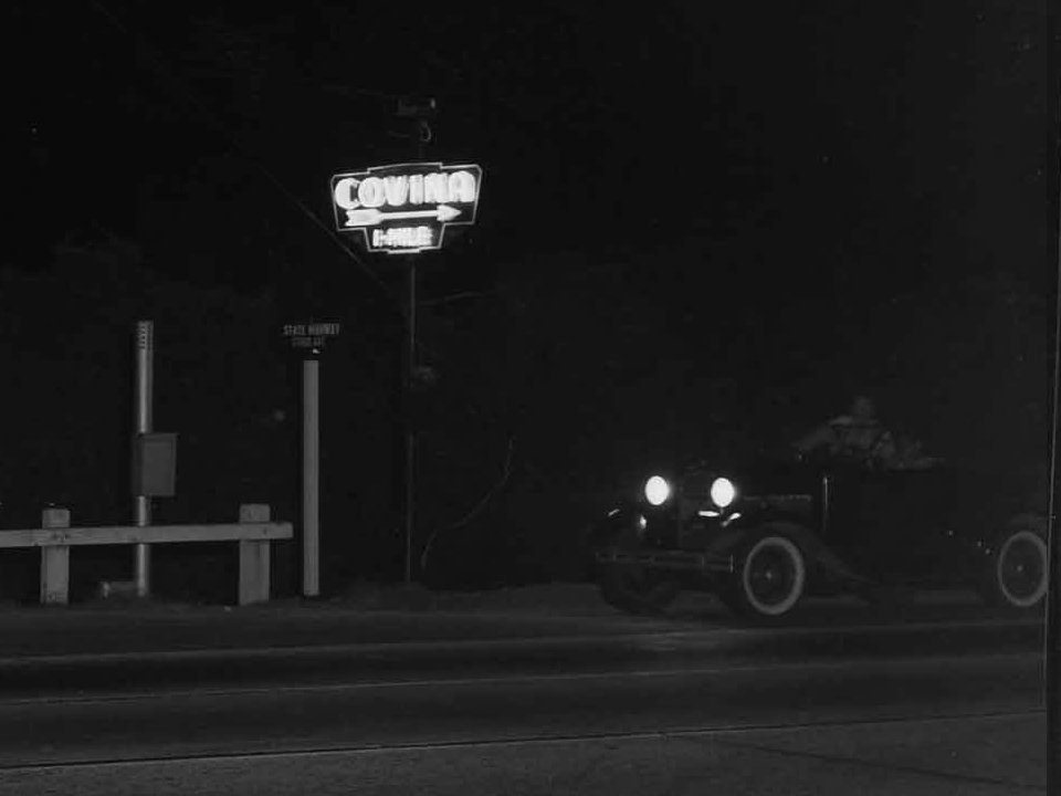
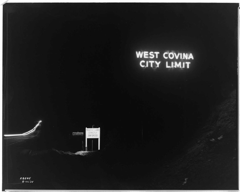
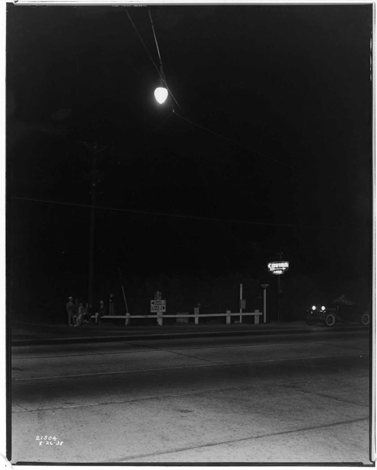
These photos were taken 75 years ago tonight along Garvey Boulevard (today's I-10) on the stretch that passed through the Covina area. They are from the archives of the Southern California Edison Company, and were evidently taken to document street lighting along the roadway.

The first one shows the signage at the eastern boundary of West Covina–the city limits of which, at that time, extended all the way east to Range Avenue (today's Grand Avenue). The slope of the pavement down the grade to the Walnut Creek arroyo is recognizable even today.

The neon sign fascinates me because I never knew it existed. The smaller sign illuminated by incandescent light warns motorists about the speed trap that West Covina had become notorious for since the opening of Garvey Boulevard. (My father used to tell tales about the WCPD cops and their famously predatory traffic law enforcement.) It's pretty obvious from this very prominent signage that they meant business. "You have been warned!"


G. Haven Bishop, photographer. From the Edison Archive. Courtesy of The Huntington Library, San Marino, CA. Link to full-size image.

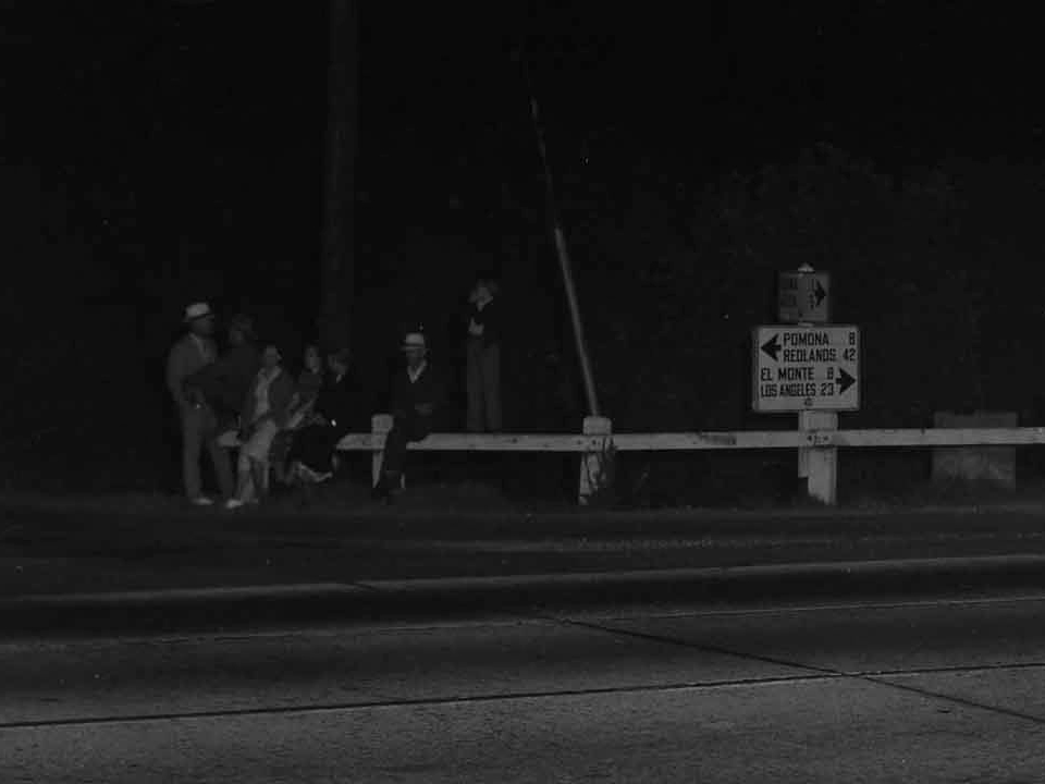
Here is another neon sign that I didn't know about before, either. It reads, "COVINA 1-MILE." Looking at the street signs in extreme closeup, I can see this is the intersection of "State Highway" and "Citrus Ave." The mileage sign points east to "Pomona 8" and "Redlands 42," and "El Monte 8" and "Los Angeles 23" to the west. The shaded mileage sign pointing north appears to say "Covina 1" and "Glendora [illegible]."


G. Haven Bishop, photographer. From the Edison Archive. Courtesy of The Huntington Library, San Marino, CA. Link to full-size image.


One might wonder what these people were doing hanging out down on the main drag through town at what must have been close to 10PM. Turns out they were assembling for a dedication ceremony for the new overhead street light (the neon "Covina" sign had been put in place three years previously).

Thursday, August 1, 2013

Driving Around the Groves

North Grand Avenue, late 1950s. Although this particular location is in Glendora, it is very much typical of the way Covina's streets looked during the transition from citrus to suburbs. After a block of new houses, the road narrows to its original two lanes as it passes an orange grove. To the left is a row of tall Washingtonia robusta fan palms and another housing development; this one with a separate feeder road running parallel to the arterial street. (Covina had a ton of those.) And, in the midst of all those modern homes stands an old two-story grove house: a lone survivor of rural times now past.

Even into the 1970s, there were still several roads in and around Covina that suddenly narrowed to two lanes like this. The last ones that I can remember were northbound Grand Avenue between Cypress and Covina Blvd., and Vincent Ave. just south of Arrow Highway. The former was widened to four lanes around 1971, and the latter as late as 1980.

This shows the postcard location in the present day. If you jump forward a little in the street view, you can see that the old grove house at left is still standing today.


Sunday, August 19, 2012

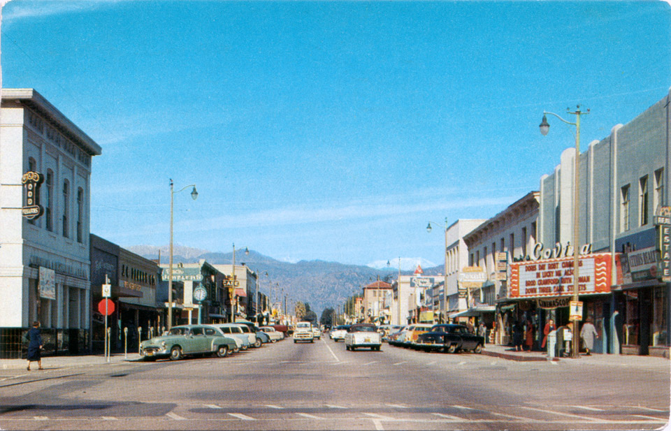
Fall, 1954

Postcard view of Citrus Avenue north from Badillo Street in Covina, California, in Fall, 1954. which just happens to be when I was born here. I can peg the date because both films on the Covina Theater's marquee are from 1954, and the later of the two—"Down Three Dark Streets"—was released on Sep. 2. It might be as late as early November, though, because of the snow in the mountains and the ladies wearing winter coats. It can't be after Thanksgiving, however, otherwise Citrus would be decked out in its traditional Christmas decorations!

Correction: According to an ad in the Covina Argus-Citizen, the twin bill of "Lucky Me" and "Down Three Dark Streets" played at the Covina Theatre only on January 16 and 17 of 1955—a Sunday and Monday respectively—and since none of the retail businesses on Citrus would have been open on a Sunday, the photo of this busy street scene must have been taken precisely on Monday, January 17, 1955. Q.E.D. :-)


Saturday, March 24, 2012

Oak Canyon Road

Probably not a lot people from Covina ever heard of Oak Canyon Road, but growing up in the hills east of town, I became aware of it at a very early age. Whenever we'd drive past Oak Canyon, its picturesque colonnade of old palm trees would catch my eye, and I'd wonder how they got there. Seven decades would pass before I finally found answers to all of the questions I had about this pioneer-era byway.


Detail of Joseph M. Bloom map showing Oak Canyon Road (green), Covina Hills Road (yellow) and surrounding streets in 1963.

First called Park Street, the now-secluded track southeast of Covina was laid out by the McCarthy Company in 1895: the same year as the westernmost mile of today's Covina Hills Road.1


Tract map from 1895 showing Park Street (green) and the new County Road (yellow) in the McCarthy subdivision of Block 1 of the Hollenbeck Ranch.
Courtesy Los Angeles Dept. of Public Works.

In 1902, Col. Frank Marion Chapman acquired 1,470 acres south of the Pomona-Covina Road,2 and Park Street became the palm-lined carriageway entrance to his Chapman Heights Ranch.

Following the Colonel's death in 1909, pioneer scion Harvey M. Houser bought the northernmost 100-acre portion of the former Chapman ranch.3 In March, 1925, Houser then sold the property to Mr. and Mrs. John H. Henry,4 and the following year, a renamed Palm Drive became the picturesque gateway to the Henrys' new California Preparatory School for Boys located atop the mesa overlooking Walnut Creek.


Aerial view of the new Cal Prep campus and what is now Oak Canyon Road at left, 1927. Courtesy U.C. Santa Barbara Geospatial Collection.

The palms lining the school's entrance road were evidently a kind of mascot to Cal Prep's academic community. Their emblem prominently featured the tropical tree, and they even named their yearbook "The Palm."


Frontispiece of the 1928 Cal Prep annual.5
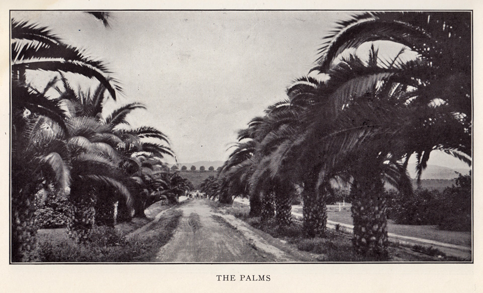

Looking south on Cal Prep's Palm Drive, 1928.5

After the California Preparatory School moved to Ojai in 1942, the campus was taken over by the Theosopical Society Point Loma,6 and it was in 1945 that the first mentions of Oak Canyon Road began appearing in the local newspaper.

The campus changed hands yet again in 1951, then becoming the new home of the California Baptist Theological Seminary.7 This was how I knew the place when our family moved to the Covina Hills in 1959, and I first saw the palms.

As curious as I was back then about Oak Canyon Road, I strictly avoided that area when I was younger, as it had a rather notorious local reputation. Invading swarms of "bad" teenagers took advantage of the secluded road to party and make out. The L. A. County Sheriffs patrolled that road constantly, and in my day it was mostly known as a really good place to go to get busted. The delinquency problem was solved once and for all, though, when Oak Canyon Road was finally closed to all vehicle traffic in the late 1970s when the seminary property was acquired by redevelopers.

The cars and juvies went away, but the palms endured as always—or at least some of them did. The trees used to extend in a uniform line all the way from the base of the bluff to the intersection with Covina Hills Road. I wish I had taken a picture of the palm drive as it looked before a suburban housing development destroyed the trees north of Walnut Creek in 1977 and obscured the view of those that remained. That vista that so inspired me in my childhood only survives in memory now, alas.

Fortunately, though, the southern half of the palms live on, and the old road itself today serves as the gateway to the 82.8-mile-long Schabarum-Skyline Equestrian Trail. I'm very pleased that at least one section of this pioneer-era relic will now be preserved for future generations.

This is my favorite picture from my visit last year to this quiet refugium. It was so amazing to finally walk among these palms and contemplate just how ancient they are. Planted 110 years ago, they are older than almost every man-made structure in the eastern San Gabriel Valley. Living history, hidden in plain sight, yet now no longer the mystery lost to the passage of time that they once were.


Photo ©2011 by J Scott Shannon.

(N.b., The foregoing is a complete rewrite of the original article which, over time, I discovered contained multiple factual errors. This revised version also includes a lot of new information and illustrations that were not available to me 14 years ago. I think you'll agree, this is a much more satisfactory and worthwhile read! —JSS, May 1, 2026.)

References:

1 Map of the McCarthy subdivision of Block 1 of the Hollenbeck Tract, surveyed August, 1895.
2 Covina Argus, May 31, 1902, p.1.
3 Covina Argus, May 14, 1910, p.2.
4 Covina Argus, March 6, 1925, p.1.
5 The Palm, 1928, Annual of the California Preparatory School for Boys, Covina, California, 84pp.
6 Los Angeles Times, May 22, 1942, p.30.
7 Covina Argus-Citizen, January 26, 1951, p.1.
 

The Baptist Seminary

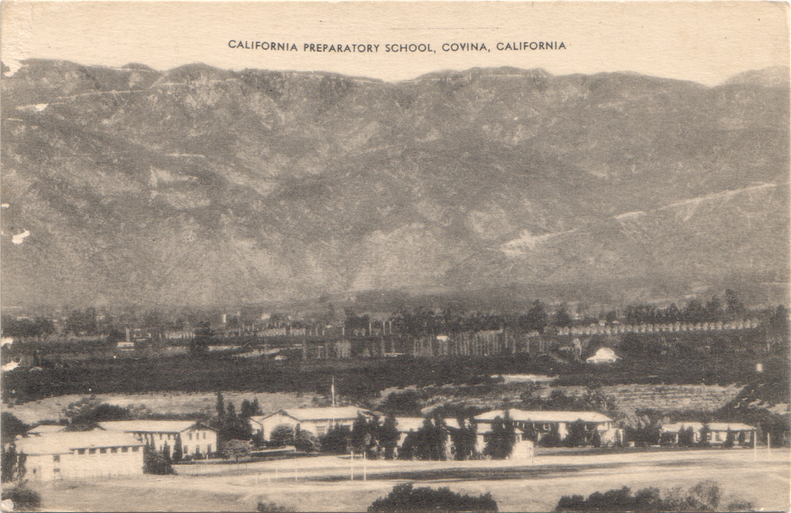
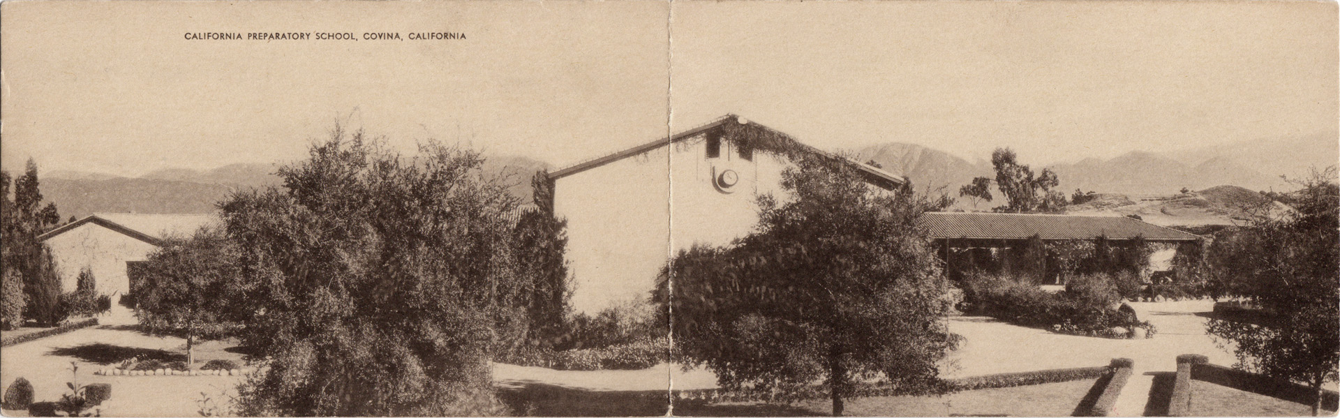
In 1926, the California Preparatory School for Boys (shown below c.1938) was built on the 100-acre H. M. Houser ranch on former Hollenbeck lands southeast of Covina.


Click any image on this page for an enlargement.

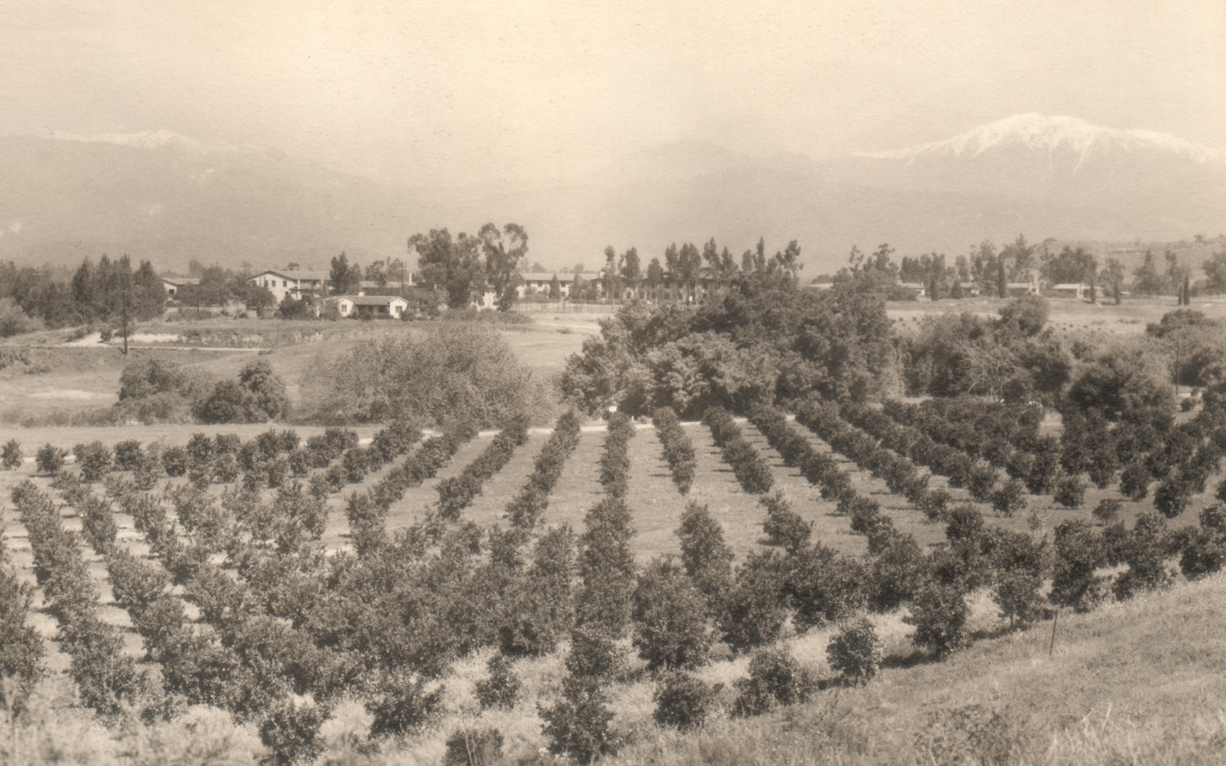
The prep school did well until the onset of WWII, when the ownership, fearing enemy attack (not joking!), moved the entire school to the mountains in Ojai. Consequently, in 1942, the Covina property was sold to the Theosophical Society Point Loma. The south-to-north view below shows the campus in the mid-Forties.


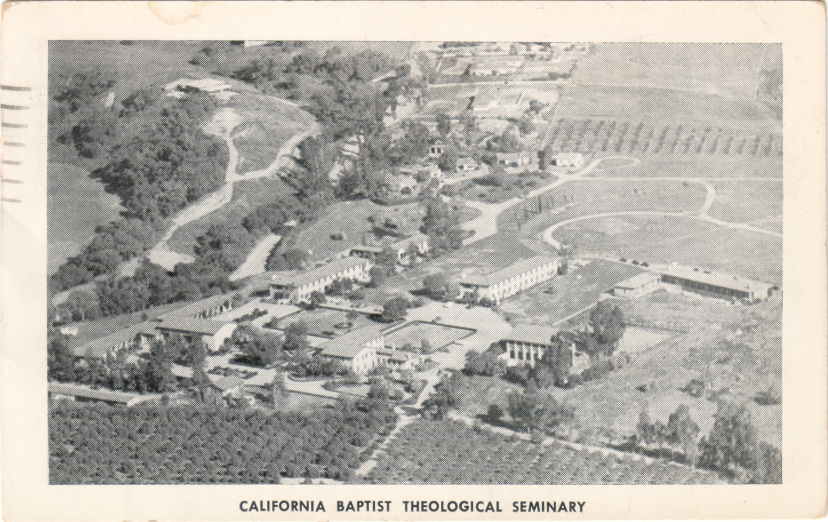
In 1951, the property changed hands again and became the California Baptist Theological Seminary. In this aerial view from c.1955 (below), we're looking generally eastward here; the road to the immediate left of the campus is Covina Hills Road.

Seminary classrooms (left) and one of the dormitories (right). In the early 1960s, that dormitory was also the headquarters of Wally Moon's Baseball Summer Camp. It was the first place I can ever remember sleeping overnight away from home.

The Baptist Seminary conferred its last ministry degrees at Covina in 1974 and moved its central campus to Berkeley. Starting in 1979, the grounds were redeveloped for housing and offices, and almost all of the old buildings were demolished. The gymnasium was initially spared and turned into a racquetball and workout facility, but it was finally torn down in 2005. Today, the only campus structure that remains is the Headmaster's house – Casa Mirasol.


Friday, October 21, 2011

Affordable Health Care!

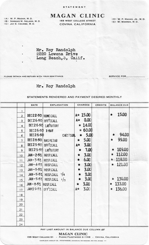
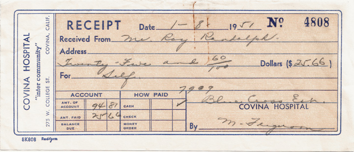
I found this ephemera on eBay recently. It's a receipt from the hospital I was born in (3 years later), and a statement from the medical clinic at which I was a patient essentially all my young life. (I actually remember the huge cash register-like machine in the clinic office that printed these very bills!)

I was also fascinated to see what doctors and hospitals were charging for their services 60 years ago.

The Magan Clinic bill pretty much tells the story. Mr. Randolph becomes ill the week before Christmas, 1950, and Dr. Magan (the founder of the clinic himself) pays a house call on him on Friday, Dec. 22. He evidently finds something wrong, and tells Mr. Randolph to come to his office the next business day, Tuesday, which amazingly enough is the day after Christmas. (No two-week Holiday vacations for doctors back then!) At the Boxing Day office visit (for which, you'll notice, the doctor did not charge his customary fee), Dr. Magan has his patient get a chest x-ray. Pt. comes back on Friday, and the doctor orders a blood test. Whatever Mr. Randolph has evidently gets much worse over the weekend, though, and he ends up in Covina Hospital. Every day for a week, the doctor visits him in the hospital; on the second day he even pays two visits. By the following Monday, whatever was wrong with Mr. Randolph has improved enough to allow him to leave the hospital, then, a couple weeks after release, Dr. Magan gives him a clean bill of health, for what I suspect was probably a bout of pneumonia.

The hospital bill for 7 days cost Mr. Randolph $94.81 out of pocket. He apparently had Blue Cross, so if we assume the standard 80/20 cost split, that means the full amount of the hospital bill was $475, roughly $70 per day. In 2011 dollars, that's $4,145; about $600 per day. (Dr. Magan's bill would be $1,186 today.)

So, in 2011 dollars, this course of treatment that spanned approximately one month ran up $5,331 worth of charges, with Mr. Randolph having to pay roughly $2,000 of that. Not cheap, but what would just the 7 days in the hospital cost today? I shudder to even think about it.